
There are Himalayan treks that take you to beautiful valleys, some that lead you across dramatic passes, and a few that bring you close enough to the great Himalayan peaks to make you feel almost insignificant beneath them. The Goechala Trek belongs firmly in that last category.
Among the most beautiful and diverse treks in India, Goechala is remarkable not simply because of the mountains you see at the end, but because of how dramatically the landscape changes throughout the journey. The trail begins in the dense evergreen forests of West Sikkim, where streams rush beneath hanging bridges and moss-covered trees create an almost storybook atmosphere. Over the following days, the forest gradually gives way to enormous alpine meadows, open mountain ridges and increasingly dramatic views of the high Himalayas.
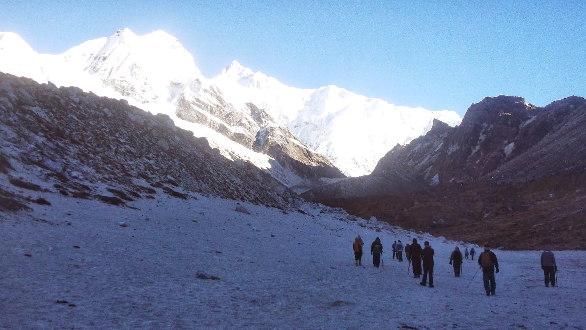

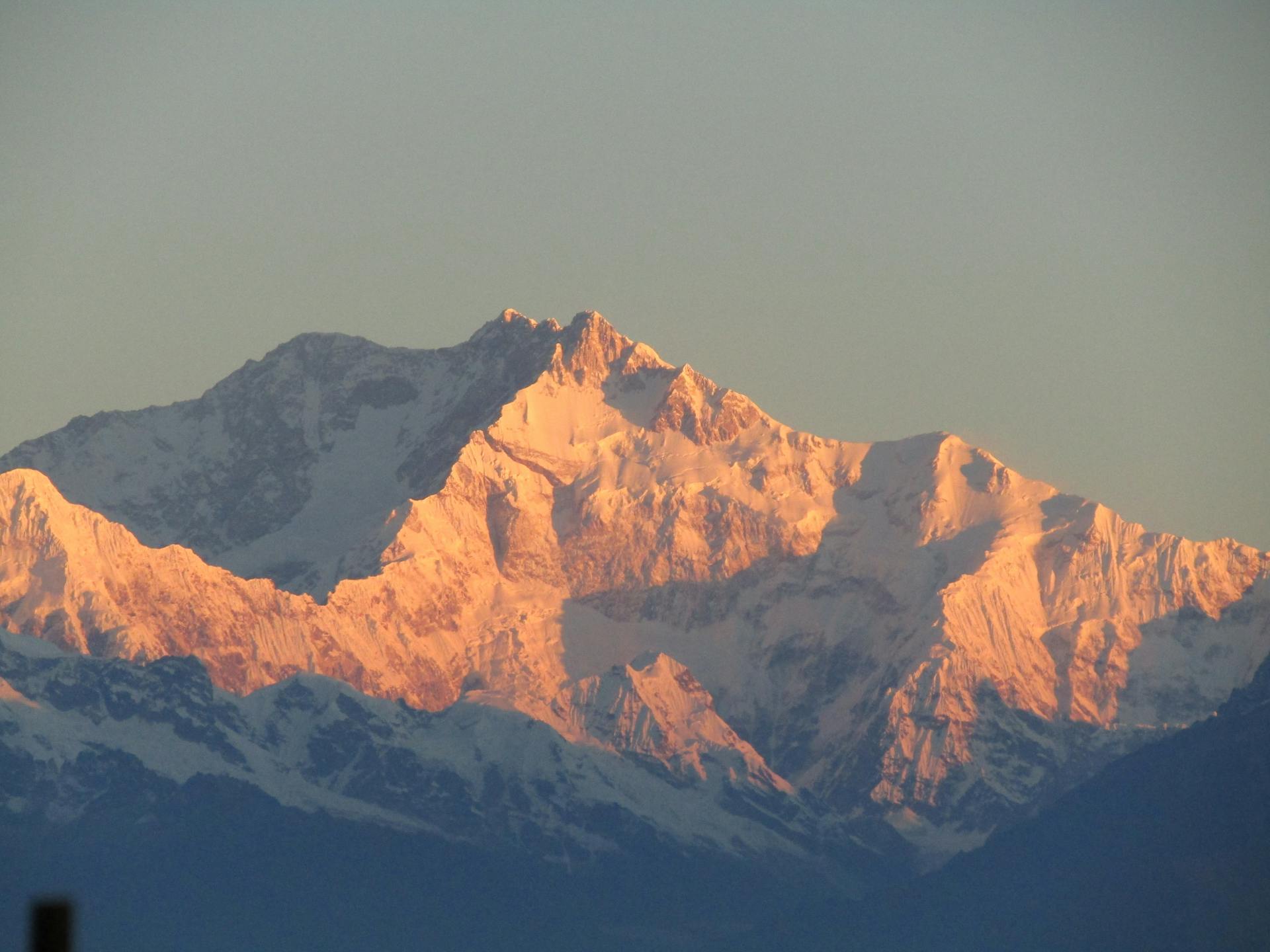
And then comes the landscape that makes Goechala unforgettable. The forests disappear, the vegetation becomes sparse, the trail turns rocky and glacial, and enormous snow-covered peaks begin to dominate the horizon. At the end of the permitted trekking route, Goechala Viewpoint 1 offers a spectacular perspective towards the southeastern face and surrounding ridges of Kanchenjunga, the world's third-highest mountain, along with massive neighbouring peaks such as Pandim, Kabru and Kumbhakarna.
Historically, the route beyond this region was connected with expeditions towards Kangchenjunga and the Goechala pass itself. Today, because of border sensitivities, conservation and safety regulations, trekkers are not permitted to continue all the way to the actual Goechala Pass. The modern trek therefore culminates at the permitted viewpoint from where the grandeur of the high Himalayan landscape can still be experienced at extraordinarily close range.
Yet the restricted access has not diminished the character of the trek. If anything, Goechala remains one of our favourite Himalayan journeys because of the extraordinary variety packed into a single route—dense forests, waterfalls, hanging bridges, rhododendron forests, huge alpine meadows, sacred lakes, glacial moraines, dramatic campsites and some of the finest high-mountain views in India.
The Goechala Trek in Sikkim is not simply a walk towards a viewpoint. It is a gradual transition from the world of forests into the world of the great Himalayas.
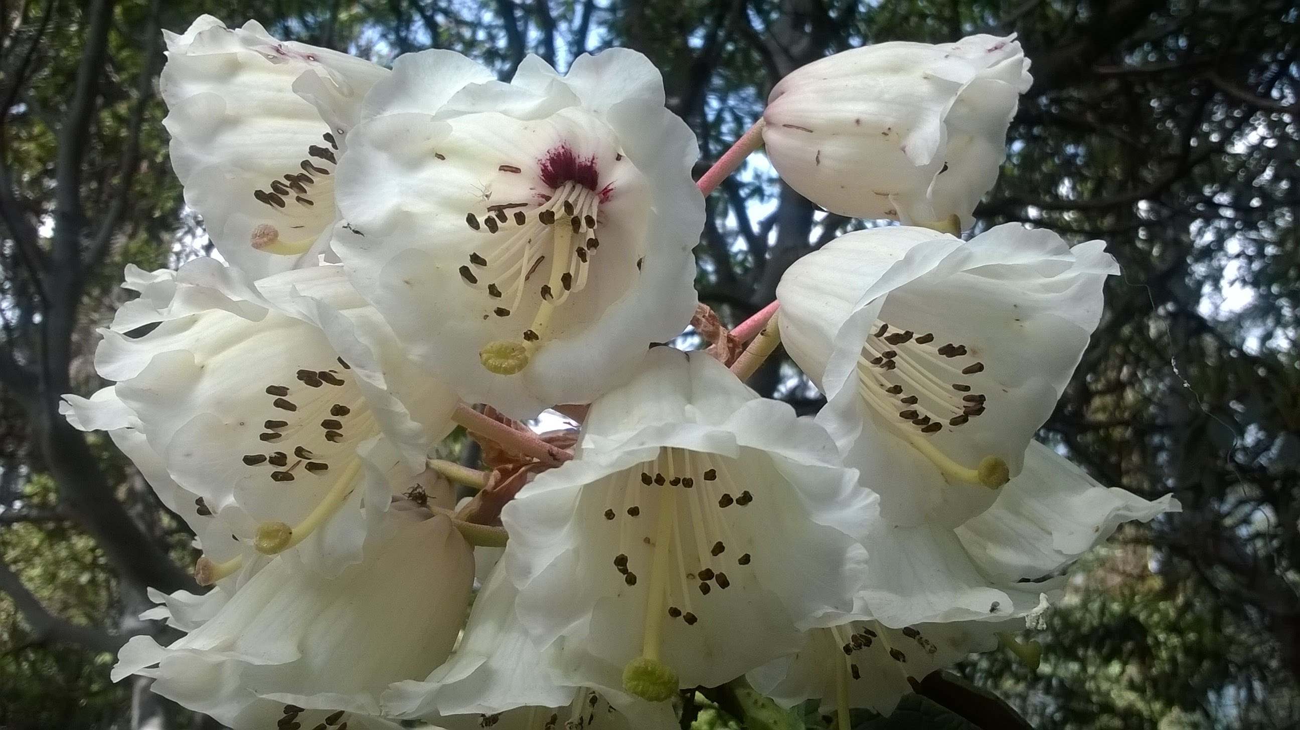
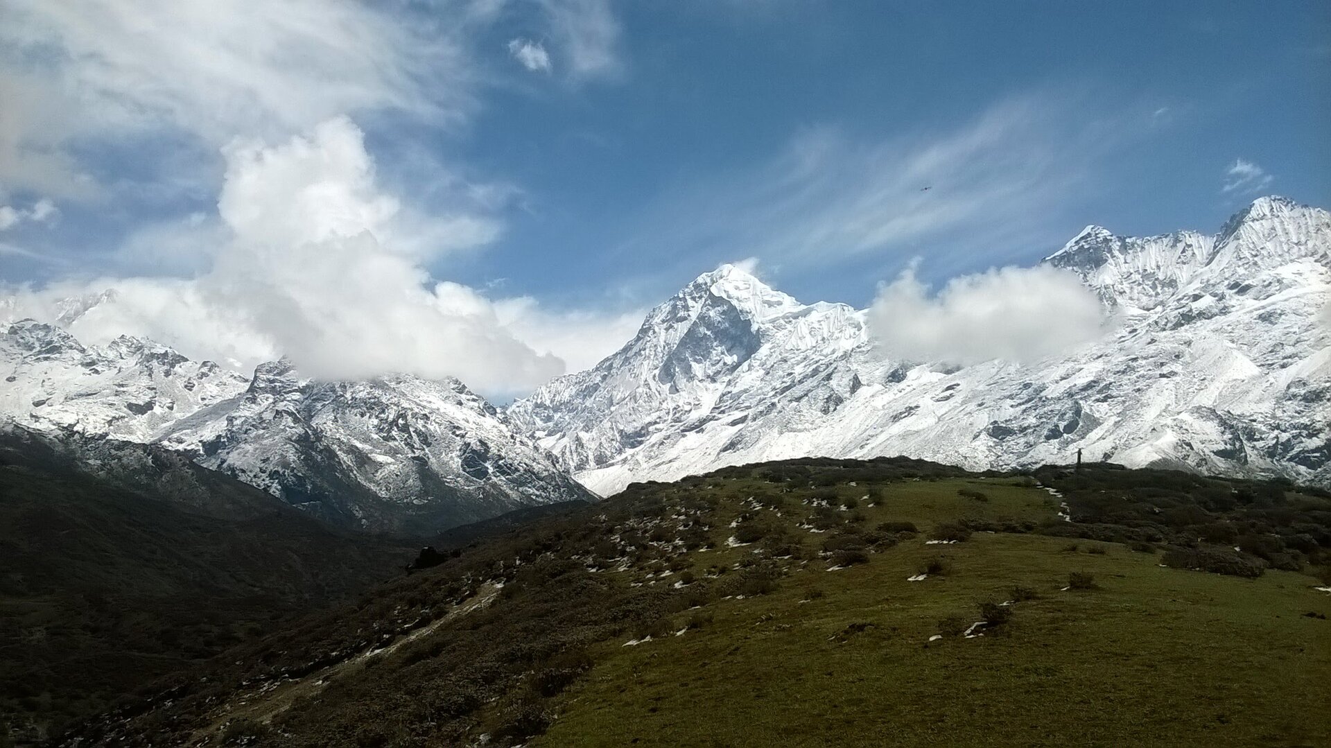
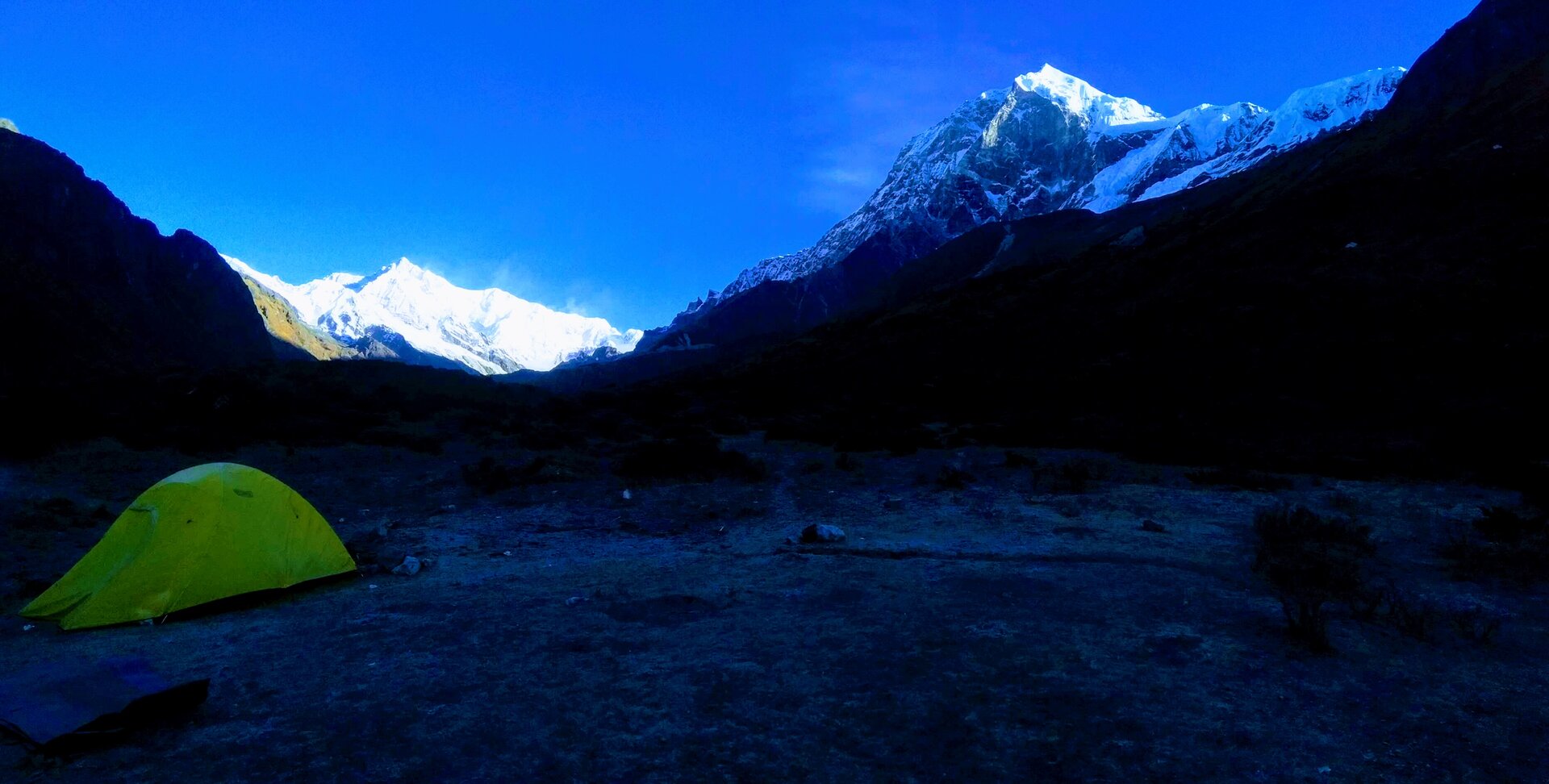
Table of Contents
- Why Goechala is One of India's Finest Himalayan Treks
- Understanding the Goechala Trek Route
- Yuksom – Gateway to the Goechala Trek
- Landscape, Mountains & Scenic Highlights
- Dzongri – The First Great Himalayan View
- Thansing & Lamuney – Into the High Himalayas
- Samiti Lake & Goechala Viewpoint 1
- Best Time to Visit Goechala
- Goechala Trek Difficulty, Fitness & AMS
- Flora, Fauna & Biodiversity
- Goechala Trek Weather Throughout the Year
- Camping Experience & Mountain Nights
- Photography Guide
- Permits, KNP Regulations & Access Restrictions
- Network, Electricity, ATM & Essential Facilities
- Preparing for the Goechala Trek
- Packing & Gear Recommendations
- Choosing Your Perfect Goechala Season
- Responsible Trekking in Khangchendzonga National Park
- The Planethimalayas Experience
- Explore the Complete Goechala Trek Itinerary
- Frequently Asked Questions
Why Goechala is One of India's Finest Himalayan Treks
Every great Himalayan trek has something that defines it. Some are famous for a single high pass. Others are remembered for a beautiful alpine lake, enormous meadows or a spectacular valley. The Goechala Trek is unusual because it combines almost all of these experiences into one long journey.
The trek begins at around the forested lower elevations of Yuksom and gradually climbs through several distinct ecological landscapes. You start among farmland and dense forests, cross streams and hanging bridges, walk beneath enormous rhododendron trees and eventually emerge into the open high-altitude landscape around Dzongri.
From there, the character of the trek changes again.
The forests become more sparse. Alpine meadows replace the trees. The mountains grow larger. The trail follows ridges and valleys where the Prek Chu River becomes a constant companion. Eventually the bushes disappear almost completely and the landscape turns into rock, boulders and glacial moraine.
Few Indian Himalayan treks offer such a pronounced transition in landscape over a single route.
Then there is the mountain itself. Kanchenjunga is not merely another peak appearing somewhere on the horizon. As you gain altitude, the mountain becomes an increasingly dominant presence. From Dzongri and later from Thansing and the higher trail, the surrounding peaks become so enormous that the scale of the landscape changes completely.
Goechala is also special because of its campsites. Places such as Thansing feel almost unreal—a small alpine meadow beside the Prek Chu with enormous mountains rising around it. Few trekkers forget their first evening there.
And finally comes the early-morning walk towards Goechala Viewpoint 1. Leaving camp in darkness, walking beside Samiti Lake and climbing over rocky terrain while the eastern sky slowly begins to brighten is an experience in itself. When the first sunlight touches the high Himalayan peaks, the long journey suddenly makes sense.
Explore our complete Goechala Trek itinerary, fixed departures, pricing, inclusions and availability on the Goechala Trek page →
Understanding the Goechala Trek Route
The traditional Goechala Trek route begins and ends at Yuksom in West Sikkim. From Yuksom the trail enters the forest and gradually climbs through a series of camps and high-altitude landscapes before reaching the Goechala Viewpoint region.
A typical route follows the broad sequence:
- Yuksom → Sachen through dense forest and streams.
- Sachen → Tshoka through Bakhim and steep forested sections.
- Tshoka → Dzongri through rhododendron forests, Phedang and Dzongrila.
- Dzongri → Thansing across alpine meadows and through Kockchurang.
- Thansing → Lamuney through the upper Prek Chu valley.
- Lamuney → Samiti Lake → Goechala Viewpoint 1 on the early-morning high-altitude push.
- Return towards Kockchurang and Yuksom through the permitted route.
The exact number of days can vary depending on the itinerary, acclimatisation strategy, weather and operational requirements. The route is long, and the combination of altitude gain, repeated ascents and descents and unpredictable high-altitude weather makes pacing particularly important.
One of the most important things to understand is that the name Goechala Trek can be slightly misleading to first-time trekkers. The modern trekking route does not mean walking all the way to the actual Goechala Pass. Access beyond the permitted viewpoint is restricted, and commercial trekking groups generally turn around from the viewpoint area.
Yuksom – Gateway to the Goechala Trek
The journey begins in Yuksom, the historic gateway to the Goechala Trek and one of West Sikkim's most interesting mountain settlements.
Yuksom feels very different from the better-known tourist centres of Sikkim. It has become more popular in recent years, particularly among trekkers, but it still retains a relatively peaceful character. Dense forest surrounds the settlement, while monasteries, lakes, homestays, small hotels and local eateries give the village everything a trekker needs before heading into the mountains.
The small marketplace is the last convenient place to make minor purchases, eat a local meal, arrange transport or simply spend a quiet evening before the trek begins. Shared taxis connect Yuksom with nearby towns and larger transport hubs, although departures can be early and schedules should be confirmed locally.
The forest checkpost and permit formalities are encountered before entering the trekking route. For organised groups, these permissions are normally coordinated as part of the trek operation.
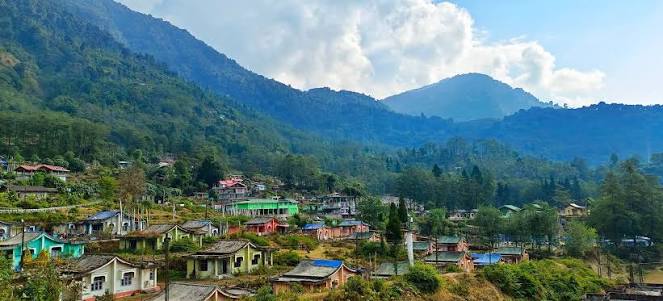
Yuksom generally has mobile connectivity, although signal strength can vary around the village. Once you leave Yuksom and enter the trekking route, connectivity becomes increasingly unreliable and eventually disappears for the majority of the trek.
One practical point is particularly important: do not depend on Yuksom for cash withdrawal. Current local information does not show a reliable ATM in Yuksom. Geyzing and Pelling are the more practical places to withdraw cash before reaching Yuksom.
Withdraw enough cash before entering the trekking region. Mountain connectivity and banking facilities are limited, and once the trek begins there is no reliable access to ATMs.
Landscape, Mountains & Scenic Highlights
The greatest strength of the Goechala Trek is the extraordinary variety of landscapes it passes through. It is almost as if the mountains deliberately reveal themselves one layer at a time.
Yuksom to Sachen – Into the Forest
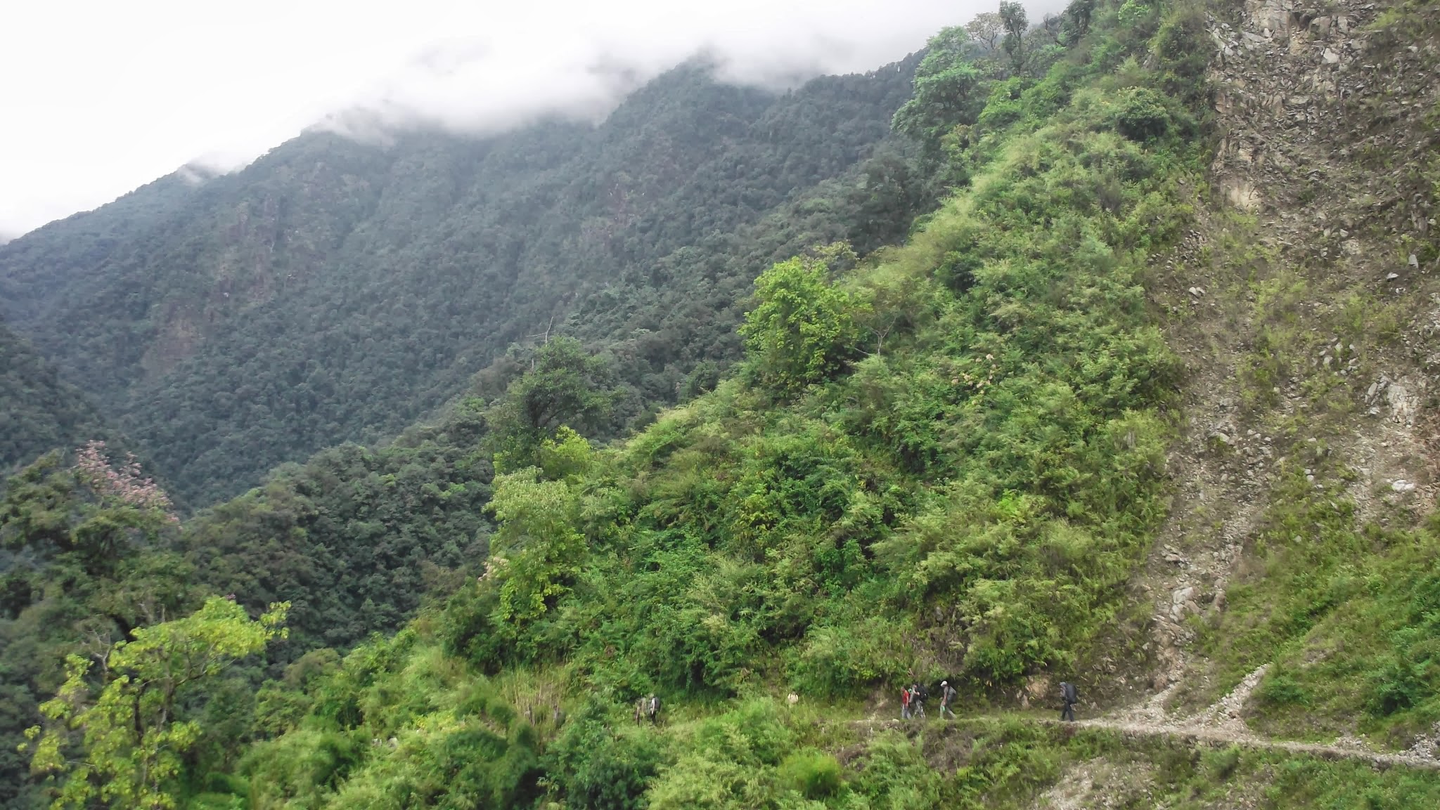
The first section takes you away from the last roads and settlements and into dense forest. Farmlands of cardamom and vegetables gradually disappear behind you as the trail enters a darker, greener world.
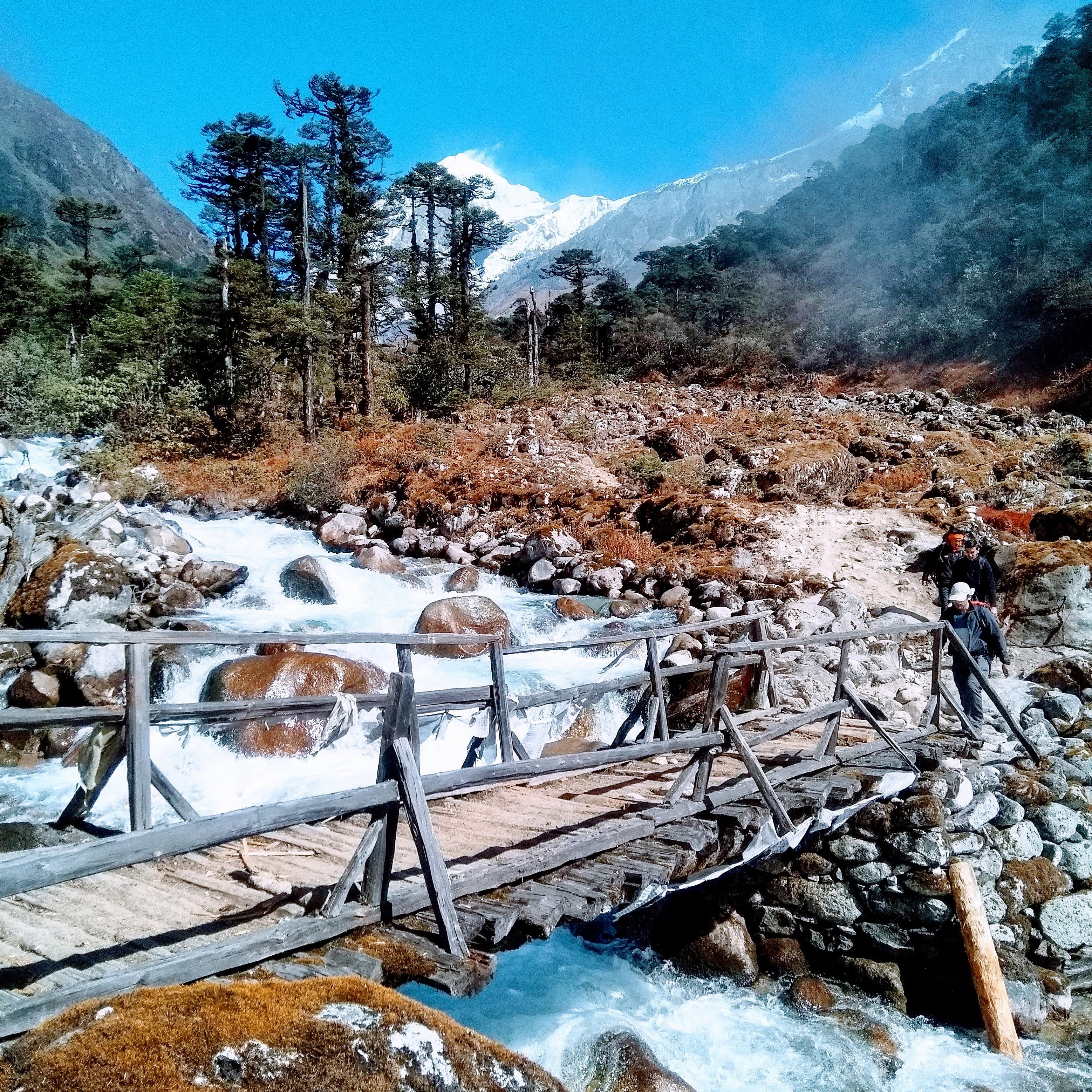
The trail is generally well defined, but it constantly rises and falls. Streams, waterfalls and wooden or hanging bridges create an adventurous character from the very beginning.
This is also the section where rain and leeches can become a significant part of the experience, particularly during wetter periods.
Sachen to Bakhim – Waterfalls & Steep Forest Trails
After Sachen, the trail continues through dense forest and crosses another long hanging bridge over the rushing water below. From here the route climbs through a series of steep switchbacks towards Bakhim.
Bakhim has traditionally served as a useful rest point, with a small eatery and wooden shelter. Trekkers moving at a strong pace can sometimes use it as an overnight stop, although many itineraries continue towards Tshoka.
Tshoka – The First Mountain Panorama
At around 9,000 feet, Tshoka feels dramatically different from the forest below. Wooden huts, camping grounds, prayer flags and the small monastery create a distinctive mountain settlement atmosphere.
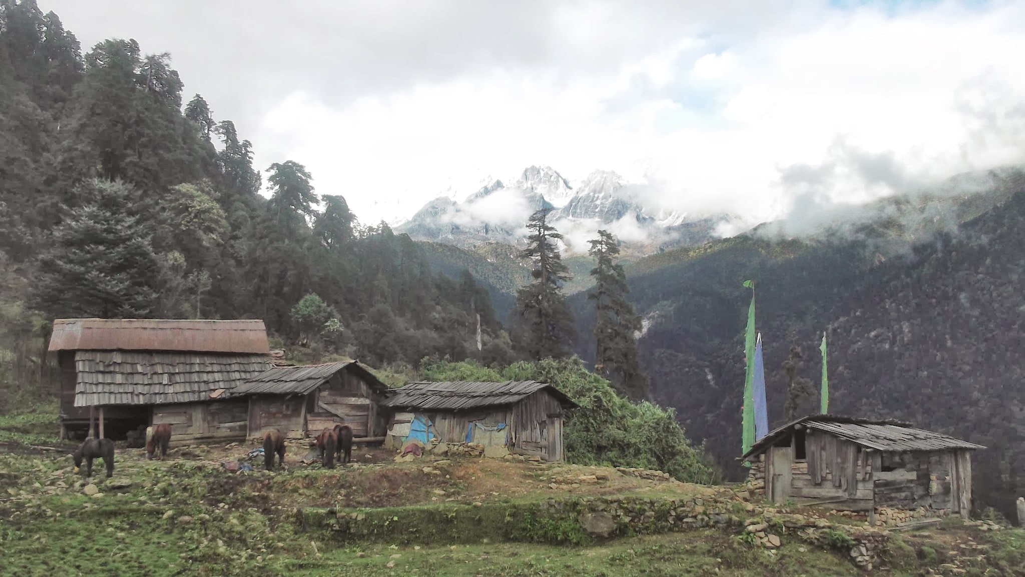
This is also where many trekkers get their first proper glimpse of Mount Pandim. The mountain appears dramatically above the surrounding ridges and gives you an early hint of the enormous Himalayan landscapes still ahead.
Tshoka is generally considered the last dependable mobile connectivity point on the trekking route, making it a sensible place to make your final calls and messages before entering the deeper high-altitude section.
Phedang and Dzongrila – Into the High Ridge
From Tshoka the trail becomes more demanding. You climb steadily through magnificent rhododendron forest along a high ridge, with long sections where there is no convenient water source directly beside the trail.
The wooden trail sections through the rhododendrons are particularly beautiful during spring, when the forest can be filled with flowers.
Eventually you reach Phedang, an open clearing marked by prayer flags and a wooden shelter. The shelter is particularly useful when the weather turns wet or windy.
Beyond Phedang the trail continues climbing towards Dzongrila, the high point of the day. From this ridge the views open dramatically, with the Kanchenjunga range, Pandim and the Singalila side of the mountains appearing across different directions.
From Dzongrila you descend towards the Dzongri campsite.
Dzongri – The First Great Himalayan View
Dzongri is one of the defining points of the Goechala Trek. After days of walking beneath forest canopies, you finally reach an enormous open alpine landscape where the mountains dominate almost every direction.
The Dzongri meadows are extensive and open, with wooden huts and a stream marking the lower part of the campsite. The name itself is associated with the presence of Dzo, the yak-cow hybrid traditionally used in the Himalayan region.
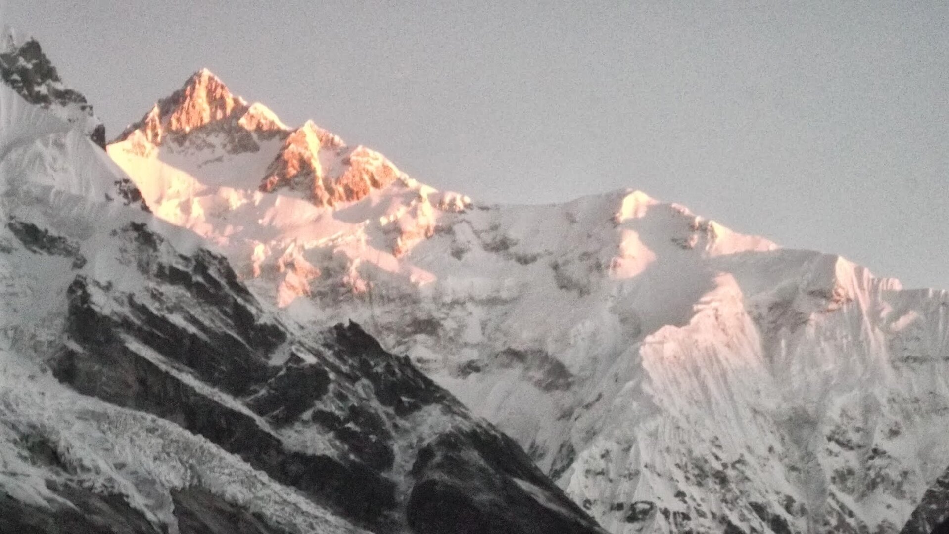
One of the most memorable experiences here is the short climb to a nearby viewpoint before sunrise. On a clear morning, the first rays of sunlight gradually illuminate the snow-covered peaks of the Kanchenjunga range.
This sunrise is often the first moment when trekkers truly understand the scale of the mountains they have been walking towards.
Dzongri is also an important acclimatisation point. The altitude is already substantial, and the trail becomes increasingly demanding from here. Rather than rushing through this section, a carefully planned itinerary allows the body time to adjust before moving higher.
Thansing & Lamuney – Into the High Himalayas
From Dzongri, the route gradually descends towards Kockchurang, where you encounter the Prek Chu River again. This is a fascinating part of the route because the same river that appeared much lower down near the earlier forest sections is now encountered at a much higher elevation.
After crossing the river, the trail climbs gradually through dense alpine forest before emerging into the extraordinary campsite of Thansing.
Thansing is one of those Himalayan campsites that photographs struggle to capture properly.
A broad alpine meadow sits beside the Prek Chu while huge mountains rise around the valley. Kanchenjunga dominates one side and Pandim rises dramatically on another. The river flows through the middle of the valley while the surrounding alpine vegetation adds shades of green, brown and gold to the landscape.
The campsite sits lower than Dzongri, but geographically it feels much closer to the greater Himalayas.
From Thansing the trail continues towards Lamuney. The distance is relatively short and the route initially remains within the alpine valley. The landscape becomes increasingly sparse as you move higher.
Lamuney also serves as the final camping area before the early-morning push towards Samiti Lake and Goechala Viewpoint 1. The surrounding mountains feel enormous here, and the cold becomes increasingly noticeable after sunset.
Samiti Lake & Goechala Viewpoint 1
This is the section for which most trekkers come to Goechala.
From Lamuney, the trail changes dramatically. The dense vegetation is gone and the route becomes dominated by rocks, boulders and loose moraine. The air feels thinner, the wind sharper and every climb noticeably more demanding.
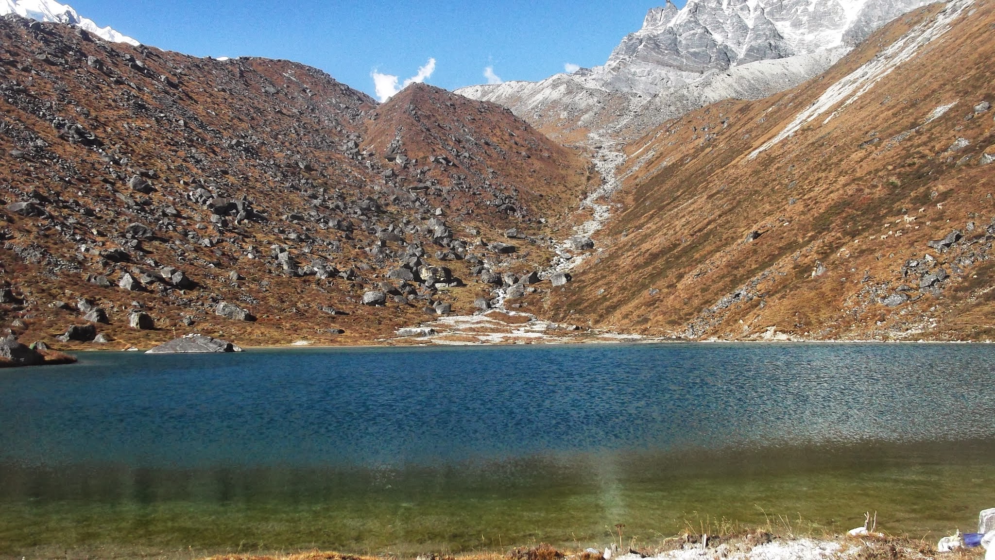
The trail soon reaches Samiti Lake, one of the most beautiful high-altitude features of the route. The lake is considered sacred, and camping at the lake itself is not permitted under current conservation practices.
The usual strategy is to leave the last campsite in darkness so that you reach the higher viewpoint around sunrise. The exact departure time depends on weather, trail conditions and the itinerary, but the principle remains the same: the earlier you reach the viewpoint, the better your chances of experiencing the mountains before clouds build up.
Beyond Samiti Lake the trail continues across rocky terrain towards Goechala Viewpoint 1. The climb itself is not technically difficult in the mountaineering sense, but altitude, cold, wind and the rocky surface make this one of the most physically demanding portions of the trek.
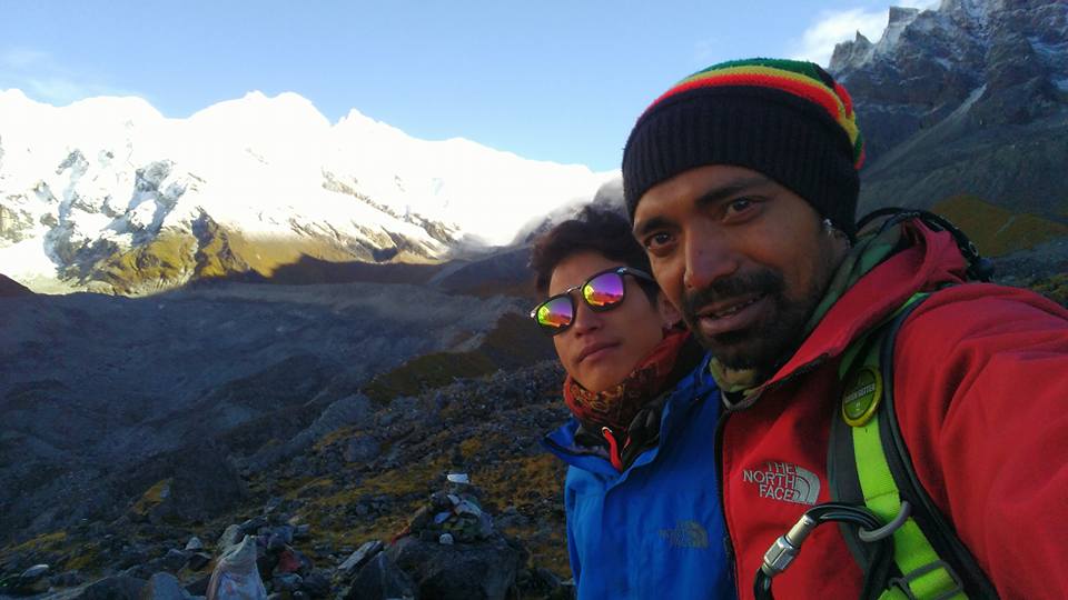
And then the landscape opens.
On a clear morning, the great Himalayan peaks rise directly ahead, illuminated by the first golden sunlight. The southeastern shoulder of Kanchenjunga dominates the view while surrounding peaks such as Pandim, Kabru and Kumbhakarna contribute to an enormous mountain panorama.
This is the moment that stays with most trekkers.
It is worth remembering that the actual Goechala Pass lies beyond the currently permitted trekking viewpoint. Modern trekking groups therefore turn around from the permitted viewpoint rather than crossing the restricted higher section.
The Goechala viewpoint experience is strongly dependent on visibility. Early morning generally provides the best chance of seeing the surrounding peaks before clouds develop, which is why the final ascent begins in darkness.
Best Time to Visit Goechala
The best time for the Goechala Trek is generally concentrated around two major trekking windows: spring and autumn. Each season offers a completely different experience.
Spring is about flowers, forests and the softer side of the Himalayas. Autumn is about sharp mountain silhouettes, dry trails and exceptional visibility.
Spring – Rhododendrons, Flowers & Living Forests
Spring transforms the lower and middle sections of the Goechala trail. Rhododendrons bloom across the forest, producing shades of red, pink, white and other colours depending on the variety.
Bird activity also increases around the flowering forests, making spring particularly attractive to photographers and nature lovers.
Higher up, snow can still remain around Dzongri and the upper trail depending on the year's conditions. This creates a beautiful contrast between colourful forests below and snow-covered high mountains above.
Autumn – Clear Skies & Big Mountain Views
For trekkers whose primary goal is seeing the great Himalayan peaks, autumn is arguably the finest season for Goechala.
The monsoon leaves behind clean, washed air and the atmosphere becomes progressively clearer. Mountain outlines become sharper and the probability of spectacular long-distance views increases.
The forests also change character. Greens gradually turn into golden, orange and earthy shades, creating a different visual experience from spring.
Current trekking guidance consistently identifies spring and post-monsoon autumn as the principal trekking windows, with autumn particularly favoured for clear Kanchenjunga views.
Monsoon – Beautiful but Problematic
The Goechala trail receives substantial rainfall during the monsoon. Forest sections become slippery, streams can swell, visibility deteriorates and leeches become particularly common.
Because the route involves numerous steep forest sections and bridges, monsoon conditions can make an already long trek considerably more demanding.
Winter – Extreme Conditions
As winter progresses, temperatures drop sharply and snow can make the higher sections much more difficult. The combination of heavy snow, frozen water sources, strong winds and limited operational access makes winter a very different proposition from the standard Goechala trekking season.
Choose a reliable spring or autumn trekking window, and remember that clear mornings are often more important than simply choosing a particular month. Mountain weather can change quickly.
Goechala Trek Difficulty, Fitness & AMS
The Goechala Trek is not a typical beginner's Himalayan trek.
The route is long—roughly 80–90 km depending on the exact itinerary and route variations—and includes substantial cumulative ascent and descent. More importantly, the trek spends multiple nights at high altitude and reaches the 15,000-foot region around the permitted high viewpoint.
The difficulty comes from the combination of several factors rather than one technically dangerous obstacle:
- Long walking days.
- Repeated steep ascents and descents.
- High altitude and reduced oxygen availability.
- Camping at high elevations.
- Cold and strong winds.
- Rapidly changing mountain weather.
- Rocky and moraine terrain near the upper sections.
- Potential exposure to Acute Mountain Sickness (AMS).
The trek is technically non-mountaineering for the standard permitted route, but that should not be confused with being easy.
A trekker should arrive with good cardiovascular fitness and experience with long walking days. More importantly, proper acclimatisation is essential. The body needs time to adapt to altitude, and attempting to rush the ascent simply because you are physically fit is not a safe strategy.
Anyone experiencing persistent headache, nausea, unusual fatigue, dizziness, breathlessness at rest or other symptoms suggestive of altitude illness should inform the trek leader immediately. Altitude-related problems should never be hidden from the team in an attempt to continue.
Read our preparation guides before your Goechala adventure:
Flora, Fauna & Biodiversity
One of the most fascinating aspects of Goechala is how visibly the vegetation changes as you gain altitude.
The lower trail passes through dense, humid forests where moss, ferns, trees and vines create a completely enclosed environment. As you climb higher, the forest changes into magnificent rhododendron zones and eventually gives way to alpine vegetation and open meadows.
Rhododendron Forests
Spring is the most dramatic time to experience the rhododendron forests. Different species and colours appear across the route, transforming sections of the trail into a natural garden.
Alpine Vegetation
Above the tree line, vegetation becomes shorter and more adapted to the harsh environment. Alpine herbs, grasses and shrubs survive the short growing season and extreme winter conditions.
Wildlife
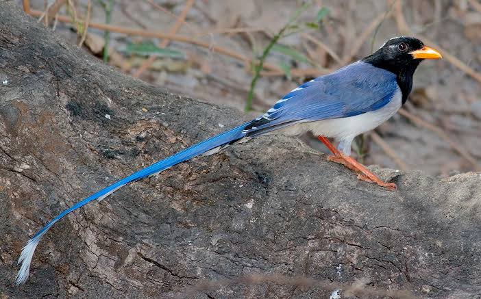
The larger protected landscape of Khangchendzonga National Park supports a remarkable range of Himalayan wildlife. Sightings are never guaranteed, and trekkers should never approach or disturb animals, but the possibility of encountering birds and mountain wildlife adds another dimension to the journey.
The region is particularly significant for Himalayan biodiversity, with forests and high-altitude habitats supporting numerous plant and animal species.
Goechala Trek Weather Throughout the Year
Weather is one of the most important variables on the Goechala Trek. The lower forest sections and the high-altitude viewpoint can feel like completely different climates on the same day.
| Season | Typical Conditions | Trail Character | Highlights |
|---|---|---|---|
| Spring | Cold mornings, mild days, occasional showers | Flowers, forest trails, possible snow higher up | Rhododendrons and mountain views |
| Summer / Pre-monsoon | Increasing humidity and rainfall | Wet forest sections | Green landscapes |
| Monsoon | Heavy rain, cloud, high humidity | Slippery, muddy and leech-prone | Lush forests but poor visibility |
| Autumn | Cold, dry and generally clearer | Excellent trekking conditions | Sharp Kanchenjunga views |
| Late Autumn / Winter | Very cold, possible snow | Harder high-altitude conditions | Fewer trekkers and dramatic winter landscapes |
Temperature varies significantly with altitude, season and weather. Rather than relying on a single temperature number, trekkers should prepare for cold nights, strong wind and sudden changes in conditions.
A clear weather forecast does not mean clear skies at the viewpoint. Mountain clouds can form rapidly, particularly later in the day. This is why the final Goechala viewpoint push begins early.
Camping Experience & Mountain Nights
Camping is one of the reasons the Goechala Trek feels so different from an ordinary Himalayan hike.
The campsites themselves change dramatically as you gain altitude. Sachen is a small forest clearing. Tshoka has wooden huts and prayer flags. Dzongri opens into a vast alpine meadow. Kockchurang sits beside the Prek Chu. And Thansing feels like a mountain amphitheatre surrounded by some of Sikkim's greatest peaks.
At Thansing in particular, the combination of the meadow, river and surrounding peaks creates one of the most memorable camping environments on the route.
Higher camps are much colder. At Lamuney, the landscape feels increasingly barren and the cold becomes a constant presence. The evening is usually quiet because the next morning begins very early.
Then comes the night before the viewpoint push. Trekkers sleep knowing that the alarm will ring long before sunrise. The quiet darkness, headlamps moving across the trail and anticipation of the mountains ahead become part of the experience.
On clear nights, the absence of city lights also creates excellent opportunities for stargazing and night-sky photography.
Photography Guide
The Goechala Trek is one of the finest Himalayan routes in India for landscape photography because the scenery keeps changing throughout the journey.
Don't miss these locations:
- Yuksom's traditional mountain surroundings.
- The dense forest trails between Yuksom and Sachen.
- Hanging bridges and waterfalls.
- Prayer flags and wooden huts at Tshoka.
- Rhododendron forests around Tshoka and Phedang.
- Sunrise from Dzongri.
- The huge alpine landscape around Dzongri.
- Kockchurang and the Prek Chu River.
- Thansing with Pandim in the background.
- Lamuney's high-altitude landscape.
- Reflections and surrounding mountains at Samiti Lake.
- Sunrise at Goechala Viewpoint 1.
Cold temperatures can reduce camera and phone battery performance. Carry spare batteries or a reliable power bank, keep electronics protected from moisture and avoid repeatedly exposing them to condensation.
Permits, KNP Regulations & Access Restrictions
The Goechala route passes through the Khangchendzonga National Park, a protected Himalayan landscape. Trekking therefore involves forest and park permissions in addition to the other formalities applicable to travel in Sikkim.
Foreign trekkers may also have additional entry requirements for Sikkim, including the applicable Inner Line Permit / Protected Area-related formalities depending on nationality and current regulations. Current requirements should always be checked before travel because regulations can change.
For organised treks, the trekking operator generally coordinates the required park permissions, route formalities and local documentation before the group enters the trail.
Why Can't You Actually Cross Goechala?
This is one of the most common questions about the trek.
Historically, the Goechala route was associated with access towards the high mountain region beneath Kanchenjunga. Today, trekkers are restricted to the permitted viewpoint area. The actual pass lies farther ahead across terrain that is no longer accessible to standard commercial trekking groups.
The restriction is connected with the region's sensitive border location, safety considerations and conservation requirements. Current trekking guidance confirms that the standard route turns around at Viewpoint 1 rather than continuing to the actual pass.
Do not assume that a trek advertised as “Goechala Trek” means crossing the actual Goechala Pass. The modern permitted trekking experience culminates at the designated viewpoint.
Network, Electricity, ATM & Essential Facilities
Goechala is a remote high-altitude trek, so it is important to use Yuksom as your final preparation point rather than expecting facilities along the trail.
- Mobile Network: Generally available in Yuksom, but coverage becomes unreliable once you leave the village and disappears for most of the trek.
- Electricity: Available in Yuksom hotels and homestays before the trek.
- Charging: Do not depend on charging facilities once you are deep into the trek. Carry a properly charged power bank.
- ATM: Do not rely on an ATM in Yuksom. Withdraw cash at Geyzing, Pelling or another reliable town before reaching Yuksom.
- Medical Facilities: Basic medical support is available around the larger settlements, but there are no regular medical facilities once the high-altitude trek begins.
- Food & Supplies: Yuksom is the final practical place for last-minute purchases and supplies.
Yuksom has mobile connectivity, but coverage should not be treated as guaranteed. Current local trekking information indicates that connectivity becomes unavailable after entering the trekking route, with Tshoka commonly described as the last useful connectivity point.
Charge your phone, camera, headlamp and power bank, withdraw sufficient cash, make your important calls and inform family or colleagues that you may be unreachable for several days.
Preparing for the Goechala Trek
The Goechala Trek rewards preparation more than almost anything else.
This is a long high-altitude journey rather than a short weekend hike. You should be comfortable walking for several consecutive hours, climbing continuously and recovering adequately before the next day's walk.
Your preparation should focus on four areas:
- Cardiovascular fitness: Build the ability to walk continuously for several hours.
- Leg strength: Train your quads, calves and glutes for repeated uphill and downhill sections.
- Endurance: Practice longer walks rather than relying only on short gym workouts.
- Altitude awareness: Understand AMS and respect acclimatisation rather than trying to overpower altitude through fitness.
You should also practise walking with the footwear and backpack you intend to use on the trek. A pair of comfortable trekking shoes that are already broken in is much more valuable than an expensive new pair worn for the first time on the mountain.
Reading these guides before departure will help you arrive better prepared for the long walking days, cold temperatures and high-altitude environment of Goechala.
Packing & Gear Recommendations
Goechala's changing climate means your packing needs to account for both wet forest conditions and freezing high-altitude conditions.
Your essential gear should include:
- Good-quality trekking shoes with reliable grip.
- Waterproof rain protection.
- Warm thermal layers.
- Fleece or insulating mid-layer.
- Warm down or synthetic insulated jacket.
- Windproof outer layer.
- Warm gloves and woollen socks.
- Sun hat and warm cap.
- Sunglasses with adequate UV protection.
- Headlamp with spare batteries.
- Water bottles or hydration system.
- Personal medicines and first-aid essentials.
- Power bank.
- Small personal backpack.
- Waterproof protection for electronics and documents.
Do not overpack. The Goechala Trek is long, and unnecessary weight becomes increasingly noticeable once you reach the high-altitude sections.
Which Goechala Season Should You Choose?
The best season depends on what you want to experience.
| If you want... | Choose |
|---|---|
| Rhododendron forests and spring flowers | Spring |
| Birdlife and colourful forests | Spring |
| Sharpest Kanchenjunga views | Autumn |
| Best landscape photography | Autumn |
| Dryer trails and crisp mountain air | Autumn |
| Quieter trekking conditions | Early/late shoulder periods, subject to current access and weather |
| Heavy snow and extreme winter conditions | Winter — only for appropriately equipped and experienced teams |
For most trekkers, spring and autumn are the sensible choices. Spring gives the forests their greatest colour, while autumn generally provides the clearest high-mountain visibility.
If your primary goal is to photograph Kanchenjunga, Pandim and the surrounding peaks, autumn deserves particularly serious consideration.
Responsible Trekking in Khangchendzonga National Park
Goechala passes through an exceptionally sensitive Himalayan environment. The higher you climb, the more obvious it becomes how slowly nature can recover from human impact.
- Carry all non-biodegradable waste back.
- Never throw plastic, food packaging or other waste on the trail.
- Stay on established trails wherever possible.
- Do not pick rhododendrons, alpine flowers or medicinal plants.
- Respect sacred places such as Samiti Lake.
- Never disturb wildlife.
- Keep noise levels low, particularly around campsites and forest sections.
- Use designated camping areas and follow park regulations.
- Respect local communities, guides, porters and other trekkers.
Responsible trekking is particularly important in a protected landscape like Khangchendzonga National Park. The beauty of Goechala exists because the mountain environment has remained relatively wild; protecting that character is part of the responsibility of everyone who travels here.
The Planethimalayas Way
At Planethimalayas, we believe a Himalayan trek should never be reduced to walking from one campsite to another.
A route like Goechala deserves to be understood. The forests, rivers, mountain communities, changing vegetation, high-altitude ecology, sacred landscapes and enormous peaks are all part of the experience.
Our approach is therefore centred around carefully planned itineraries, experienced mountain leaders, appropriate acclimatisation and small-group experiences. We would rather give trekkers enough time to experience the mountain properly than rush through a demanding route simply to fit an arbitrary schedule.
Goechala is particularly unforgiving of rushed trekking. The difference between an enjoyable high-altitude expedition and an exhausting struggle can come down to pacing, acclimatisation, weather decisions and how well the team responds to changing mountain conditions.
Our goal is simple: to take you into the Himalayas responsibly, safely and thoughtfully—and bring you back with memories that last much longer than the photographs.
View our complete trek itinerary, fixed departures, pricing, inclusions, FAQs and booking information on the official trek page.
Explore the Complete Goechala Trek Itinerary
The Goechala Trek involves careful planning because the route combines long distances, high altitude and rapidly changing weather. The detailed itinerary should therefore be read alongside the preparation information in this guide.
Our complete trek page contains the current itinerary, departure dates, pricing, inclusions, exclusions and booking information.
View the complete Goechala Trek itinerary, dates and booking information →
Frequently Asked Questions
Is the Goechala Trek suitable for beginners?
Goechala is better suited to trekkers with good fitness and some experience of long Himalayan trekking. It is not technically a mountaineering expedition on the permitted route, but the distance, altitude, repeated ascents and high-altitude camping make it considerably more demanding than a typical beginner trek.
How difficult is the Goechala Trek?
The Goechala Trek is generally considered a moderate-to-difficult high-altitude trek. The biggest challenges are the long walking days, substantial elevation gain and loss, high camps, cold weather and the final rocky climb towards Goechala Viewpoint 1.
What is the maximum altitude of the Goechala Trek?
The permitted trekking route reaches the Goechala Viewpoint region at roughly 15,000 feet, depending on the exact route and viewpoint reference used. The actual Goechala Pass lies higher, but the pass itself is currently beyond the permitted commercial trekking route.
Can you actually reach Goechala Pass?
Not on the standard modern commercial trekking route. Current access restrictions mean trekkers turn around at the permitted viewpoint rather than crossing the restricted section towards the actual pass.
What is the best time for the Goechala Trek?
Spring and autumn are the principal trekking seasons. Spring is particularly beautiful for rhododendrons and forest landscapes, while autumn is generally preferred for crisp skies and clearer views of Kanchenjunga and the surrounding peaks.
Is Goechala Trek possible during monsoon?
Monsoon is generally an unsuitable period for the standard Goechala trekking experience because Sikkim receives heavy rainfall. Forest trails can become slippery, streams may swell, leeches are common and mountain visibility can deteriorate considerably.
How long is the Goechala Trek?
The total trekking distance is approximately 80–90 km depending on the itinerary and route variations. Because of the distance and altitude profile, the trek normally requires several days rather than being a short high-altitude excursion.
Is there mobile network on the Goechala Trek?
Mobile connectivity is available in Yuksom but becomes unreliable once you enter the trekking route. Tshoka is commonly considered the last useful connectivity point, after which trekkers should expect to be largely offline for the remainder of the route.
Is there an ATM in Yuksom?
You should not depend on an ATM in Yuksom. Current local information indicates that reliable ATM access is available in places such as Geyzing and Pelling before reaching Yuksom. Carry sufficient cash with you before starting the trek.
What peaks can you see from Goechala?
The major attraction is the enormous Kanchenjunga massif. Depending on visibility and exact viewpoint, trekkers can also see prominent neighbouring peaks including Pandim, Kabru and Kumbhakarna.
Is Goechala the same as Goecha La?
Yes. Goechala, Goecha La and Goecha La Trek are commonly used variations of the name. For search purposes, “Goechala Trek” is the most useful primary term, while “Goecha La Trek” is an important related keyword.
Why do trekkers start the final day so early?
The final ascent is timed to reach Goechala Viewpoint 1 around sunrise. Early morning generally offers the best chance of clear mountain views before clouds develop, and the golden first light on Kanchenjunga is one of the defining experiences of the trek.
Final Thoughts
Some Himalayan treks are remembered for a summit. Others for a pass, a lake or a spectacular valley. Goechala is remembered for the journey from one world into another.
You begin beneath a dense forest canopy in Yuksom, crossing streams and hanging bridges while surrounded by an almost impossibly green landscape. Days later you are standing in enormous alpine meadows beneath snow-covered peaks. Then the vegetation disappears altogether and the trail becomes rock, moraine and wind.
And finally, after leaving camp in darkness and climbing towards the high Himalayas, the first sunlight reaches the mountains.
Kanchenjunga appears.
For a few moments, everything else becomes secondary.
That is the magic of the Goechala Trek. It isn't simply about reaching a viewpoint. It is about experiencing one of the most dramatic transitions in the Indian Himalayas—from forest to meadow, meadow to alpine wilderness, and finally into the enormous world of the high mountains.
And that is why, despite the long days, the altitude and the demanding terrain, Goechala remains one of our favourite Himalayan treks.
