Trekking in the Himalayas is a true adventure experience — a journey into high-altitude wilderness where nature exists in its most raw and powerful form. Every trek comes with physical challenges, unpredictable weather, and varying terrain. Choosing the right trek grade is essential not just for a great experience, but also for safety and proper acclimatization.
To help you make the right choice, treks are categorized into three levels based on altitude, terrain, duration, and overall difficulty:
Easy (Beginner-Friendly Treks):
Ideal for first-time trekkers or those looking for an easy trek in the Himalayas. These treks usually last up to a week, with shorter hiking days, gradual altitude gain, and a maximum altitude of around 14,000 ft. The terrain remains well-defined, often within or near the tree line, with civilization relatively accessible. Weather conditions are more predictable, making these treks safer and easier to manage, with quicker rescue access if required.
Moderate Treks:
Designed for trekkers with some prior experience or good fitness levels. These treks may extend beyond a week and include a mix of short and long trekking days, with altitudes reaching up to 16,000 ft. You move above the tree line into more rugged landscapes — including alpine meadows, moraines, and high-altitude terrain. Weather becomes more unpredictable, and conditions can change suddenly. While still manageable, these treks require better preparation, endurance, and mental strength.
Difficult (Expedition-Level Treks):
These are high-altitude expeditions meant for experienced trekkers. Routes often exceed 17,000 ft and pass through glaciers, snowfields, steep ascents, river crossings, and technical terrain. Treks can last up to two weeks, taking you far from civilization into extreme Himalayan conditions. Weather can shift rapidly, and sections may require technical equipment like ropes or ice axes. Rescue in such regions is complex, making experience, self-sufficiency, and strong mental resilience absolutely essential.
Understanding these categories helps you choose a trek that matches your fitness, experience, and expectations — ensuring a safe, enjoyable, and truly memorable Himalayan adventure.
×
PriceNote – Listed Price & Customisation Rules:
The listed trek price applies to our fixed departures for the specified itinerary. Trek fees including any add-ons for customized groups may vary based on your preferences, ensuring every adventure is tailored to your needs.
Group Booking Offer:
For groups of 8 or more booking together, the trek fee for 1 participant will be waived as a token to encourage shared adventures.
Scholarship for Kids:
Children under 15 years receive a 30% discount on the trek price, making it easier for families to explore the Himalayas together.
×
Transport Price Note:
The transport price mentioned is only an current indicative estimate per person, assuming a Non-AC vehicle like Bolero shared by at least 4 participants. Fewer participants → cost rises; More participants → cost decreases.
Transport Selection During Booking:
Selecting transport during booking informs us of your preference. No payment is collected at booking.
Final Cost & Payment:
Final transport cost will be communicated before departure and to be paid directly to the cab driver.
×
Itinerary Note:
This itinerary represents the most updated plan, but minor adjustments may occur due to operational needs or mountain conditions.
×
Terms & Conditions
Trekking is an adventurous activity that inherently involves a variety of risks and uncertainties. By choosing to trek with Planethimalayas, I acknowledge and accept the following potential hazards:
Natural Threats:
Unpredictable Weather: I understand there is always a possibility of facing sudden rain, cloudbursts, flash floods, or Glacial Lake Outburst Floods (GLOFs), either during the trek or at the campsite. Harsh weather conditions such as hailstorms, thunderstorms, lightning, high-altitude winds, and abrupt temperature drops can not only affect comfort but may also lead to the cancellation of the trek without prior notice.
Wildlife Encounters: Trekking trails may intersect with habitats of wild animals including bears, snakes, and a range of insects or arthropods. These encounters pose serious risks.
Flora Exposure: Some plant species in the trekking regions may be toxic or harmful upon contact or ingestion. I understand that interacting with such vegetation could result in serious consequences.
Natural Calamities: Mountainous terrains are prone to landslides, avalanches, earthquakes, and whiteouts — all of which could significantly endanger life and disrupt the trek.
Altitude and Injury Risks:
High-altitude conditions can lead to Acute Mountain Sickness (AMS), High Altitude Pulmonary Edema (HAPE), or High Altitude Cerebral Edema (HACE).
I understand that trekking surfaces are uneven and potentially slippery. This increases the chance of falls, slips, or injuries — including accidental drowning.
Misuse or malfunctioning of trekking gear (e.g., trekking poles, safety equipment) may also result in accidents.
Accidents during the trek could cause emotional or physical trauma, temporary or permanent disabilities, or even paralysis.
Injuries caused by fellow trekkers or locals are also possible.
I acknowledge that sun exposure, extreme cold, or environmental factors may cause health issues such as sunburn, frostbite, hypothermia, dehydration, heatstroke, chilblains, or hypoxia.
Medical Emergencies:
Trekking routes often lack access to nearby hospitals or clinics. I understand that medical attention may be delayed or unavailable.
I am aware that evacuation due to an emergency may be logistically difficult and time-consuming.
Additional Concerns:
Civil or Political Disturbance: Unrest due to protests, strikes, conflicts, or terrorism may impact trek safety.
Equipment Failures: I accept that gear failure could lead to difficulties or injuries.
Transportation Disruptions: Travel to or from the basecamp may be delayed or disrupted due to vehicle failure, cancellations, or roadblocks.
Disease Exposure: Trekking in unfamiliar regions may expose me to infectious diseases or health risks.
By agreeing to this document, I confirm:
I am fully aware of the above-mentioned risks.
I am voluntarily participating in the trek.
I agree to follow all safety protocols and guidance provided by Planethimalayas staff.
I will take full responsibility for any gear or equipment used during the trek.
I acknowledge that while Planethimalayas’ staff are trained and experienced, they are human and cannot foresee or prevent every risk.
My safety and well-being ultimately remain my responsibility.
I take full ownership of my physical readiness for the trek, based on the eligibility and fitness standards set by Planethimalayas.
Health Statement:
I certify that I am physically and mentally fit.
I have no known medical conditions that could restrict me from undertaking the trek.
No medical professional has advised me against participating in this activity.
Legal Liability:
I confirm that I am solely accountable for my safety throughout the trek.
I voluntarily assume all known and unknown risks involved.
Planethimalayas is not liable for any injuries, illnesses, or losses sustained during or after the trek.
I understand that Planethimalayas will not cover any medical costs I may incur.
Should my actions cause harm or inconvenience to another person or damage to property — whether intentionally or by accident — I agree to compensate Planethimalayas for any resulting expenses. This includes costs related to repairs, medical treatments, or legal actions.
I am aware that high-altitude trekking may cause symptoms related to oxygen deprivation and altitude sickness. If the trek leader believes it is unsafe for me to continue, I accept their decision to descend me to a safer altitude.
I understand that health checks (oxygen level, pulse, blood pressure) will be conducted regularly at various camps. Based on these assessments, Planethimalayas reserves the right to disallow me from proceeding further if my health metrics fall below acceptable standards. These standards are available with trek leaders.
I am aware that the terrain will involve challenging and unpredictable conditions including steep slopes, snow-covered paths, and rocky trails.
If the trek leader concludes that I am physically unable to complete the trek without constant support, I understand that I may be turned around.
Alcohol, tobacco, and any recreational drugs are strictly banned throughout the trek. Consumption of such substances may result in immediate removal from the trek and basecamp.
I have read and fully understood all the terms stated in this agreement. I consent to the conditions knowing the legal impact it may have. Even if any clause here is declared unenforceable, the remainder shall remain valid.
I acknowledge that the trek cost was calculated assuming my full consent to these terms. Without this agreement, Planethimalayas would not be able to offer the trek services.
I agree that my electronic or digital acceptance of this agreement shall hold the same validity as a signed physical document.
It is solely my duty to carry all necessary documents related to this trek (passport, ID, permits, visa, etc.). Planethimalayas will not be held responsible if I fail to present these documents when required.
Planethimalayas also disclaims liability in case of loss, theft, or damage to any personal identification or travel documents.
I voluntarily consent to provide my Aadhaar number for use by Planethimalayas in matters related strictly to identity verification, trek permit processing, and administrative formalities. This data will be used solely for these purposes in accordance with Indian law. I understand I may withdraw this consent prior to its usage by submitting written notice.
I agree to abide by the cancellation policy of Planethimalayas as outlined in the official document.
🩺 Basic Medical Support – On-trek first aid and support for minor medical issues
👥 Support Staff – Team includes experienced trek leaders, local guides, cooks, and helpers
🎯 Qualified Leadership – Professional trek leader overseeing safety and coordination
❌ Exclusions
🚑 Insurance – Travel or medical insurance is not included
🚨 Emergency Costs – Expenses for evacuation, rescue, or medical treatment are not covered
🎒 Backpack Offloading – Available as an optional add-on at an extra charge
🚗 Travel to/from Base Camp – Transport to the trek base or return is not part of the package unless opted separately
🛍️ Personal Purchases – Items bought on the way (snacks, gifts, souvenirs, etc.) are not included
👕 Personal Trek Gear – Jackets, shoes, walking sticks, or toiletries are not part of the package (can be rented separately)
❗ Anything Not Listed Above – If it’s not mentioned under inclusions, it is not covered by Planethimalayas
×
Cancellation & Refunds
At Planethimalayas, we strive to make your trekking experience smooth and transparent. Please read our cancellation policies carefully:
1. Trek Cancellation by Participant
Within 30 days prior to departure: Full refund of trek fees.
Between 30 to 15 days prior to departure: 20% of trek fee will be retained; the remaining amount will be refunded.
Less than 15 days prior to departure or no-show: No refund.
2. Trek Cancellation by Planethimalayas
In the unlikely event that Planethimalayas cancels a trek due to weather, natural disasters, political unrest, or any unforeseen circumstance, we will provide you with the option to join another trek of the same value or issue a full refund.
3. Refund Policy
Refund Method: All approved refunds are issued as vouchers tied to the specific participant's account and can be used for future treks. Direct cash or online refunds are not provided.
4. Rescheduling & Changing Treks
Rescheduling a trek to a different date is free of charge.
Changing to a different trek must be requested at least 30 days prior to departure.
If the selected trek is of higher price, the extra amount must be paid.
If the selected trek is of lower price, the remaining amount will be refunded within 10 days after trek completion.
Requests made within 15 days of departure are handled on a case-by-case basis.
5. Transport & Offloading Bag Add-on Cancellation
Cancellation more than 72 hours prior to departure: Full refund.
Cancellation within 72 hours or post that period: No refund possible.
Important Note: In case of emergencies or rescue operations, any transportation used during such processes will not be considered part of the Transport add-on, and trekkers must bear all costs incurred. It is strongly recommended to purchase proper trek insurance to claim such costs as per your insurance policy.
6. Cancellation Requests
All cancellations must be processed through email only. No other form of communication will be considered official. Our official email address:
info@planethimalayas.com
Borasu Pass Trek
A Remote Himalayan Traverse from Harkidun to Baspa Valley
Transportation – INR 6,000 (* Dehradun to Sankri & Chitkul to Shimla)?
Offloading Bags – INR 7,200 (* Maximum weight 9kg/bag)
Need a different date?
We can arrange a custom departure if 3+ trekkers align.
Walking The Trail
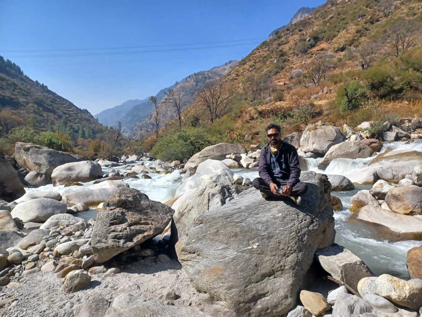
The Borasu Pass Trek is not a journey that reveals itself all at once. It unfolds gradually, almost patiently, beginning in the quiet mountain settlement of Sankri — a place where wooden homes cling to the slopes and life moves to the rhythm of seasons rather than time. The early days feel deceptively gentle as the trail slips into the Har Ki Dun valley, following the restless flow of the river through forests of walnut, chestnut, and deodar. Villages like Gangad and Osla appear along the way, their architecture and traditions rooted deeply in the past, offering a glimpse into a Himalayan life that has remained largely unchanged for centuries.
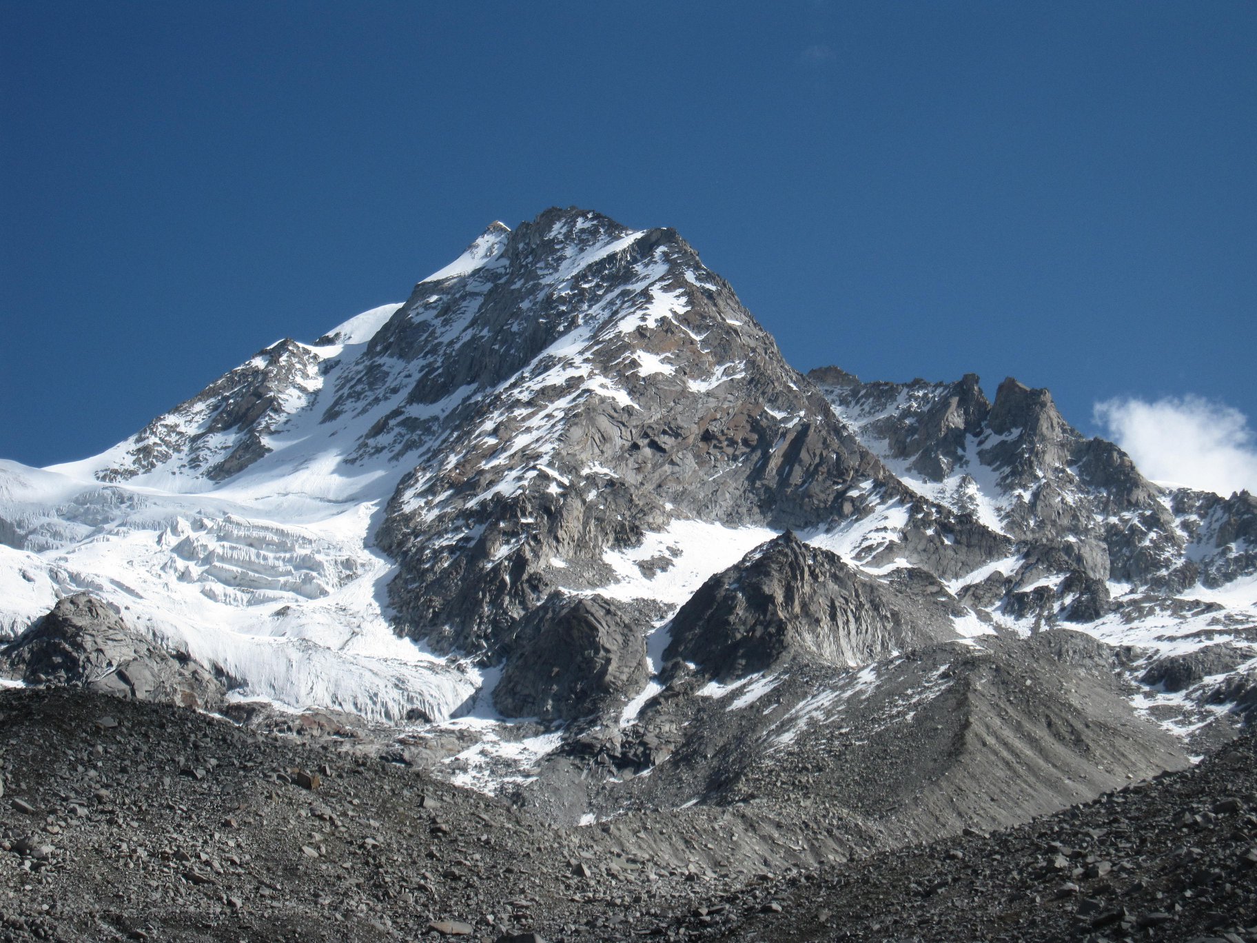
As you move deeper into the valley, the trail opens into vast grasslands framed by towering peaks. Har Ki Dun, often called the ‘Valley of Gods,’ stretches wide and serene, with the Swargarohini massif rising dramatically at its head. There is a sense of calm here — a rare stillness — broken only by the sound of wind brushing through the valley and the distant rush of glacial streams. For many, this is where the trek feels complete. But Borasu begins where Har Ki Dun ends.
Beyond this point, the landscape shifts almost abruptly. The forests disappear, the valley narrows, and the terrain becomes rugged and untamed. The trail moves toward Maninda Tal, a high-altitude glacial lake that appears almost unexpectedly amid moraine and boulder fields. The water reflects the surrounding peaks with an eerie clarity, and the silence here feels deeper, heavier. Campsites become more exposed, winds stronger, and the altitude more noticeable.
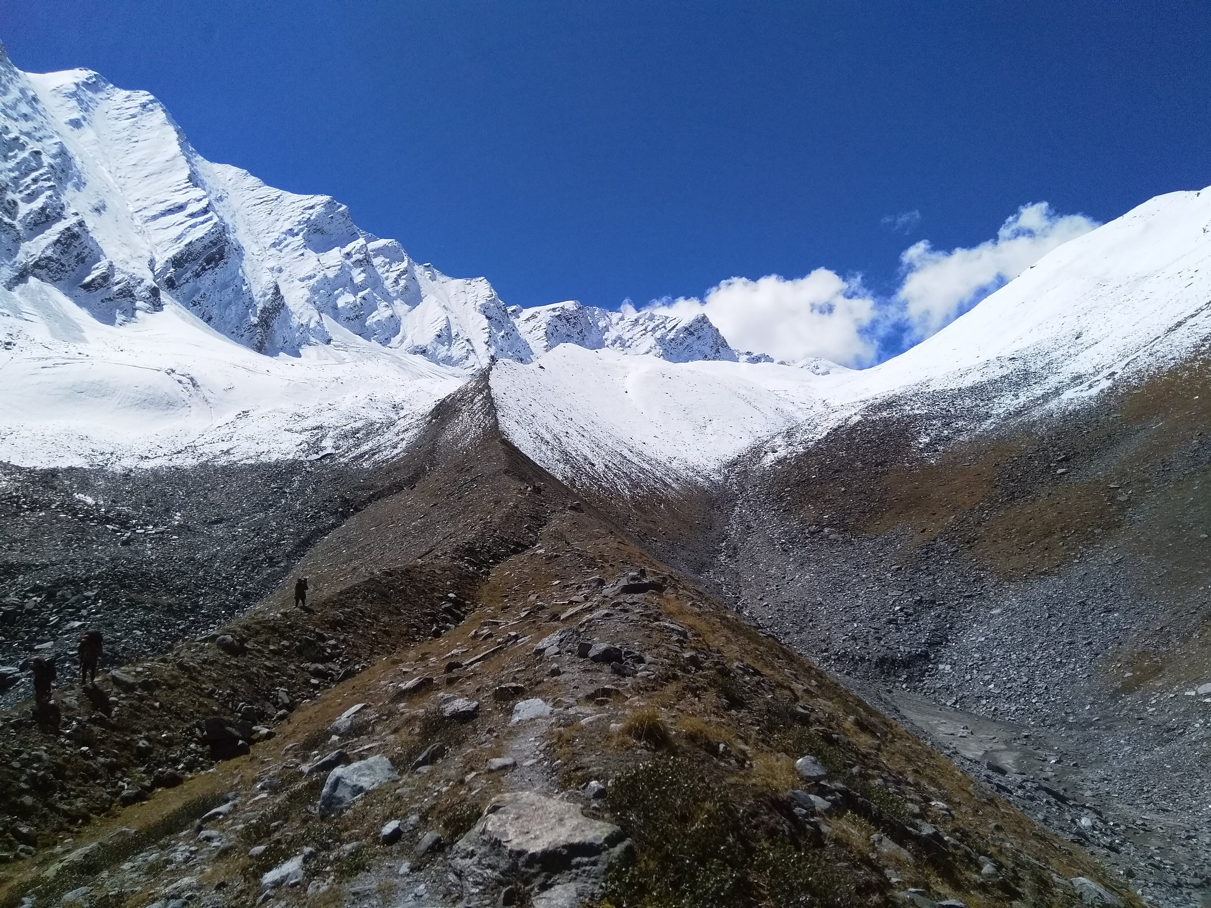
From Maninda, the approach to the pass turns increasingly demanding. The terrain is a mix of loose rocks, glacier moraine, and snow patches that test both balance and endurance. The trail is no longer forgiving — it requires focus, patience, and a steady rhythm. As you climb higher, the world begins to strip itself down to its rawest form — no trees, no shelter, only rock, snow, and sky.
The final push to Borasu Pass is steep and relentless. Each step feels deliberate as the altitude presses against your lungs and the wind cuts through the silence. But when you finally reach the top, the effort dissolves into something far greater. On one side lies the valley you’ve climbed through — green, layered, alive. On the other side opens an entirely different world — stark, vast, and glacial, stretching endlessly toward Kinnaur.
The descent is just as intense. Steep snow slopes often require careful footing or controlled glissades, followed by long traverses across moraine and glacier-fed streams. Slowly, almost imperceptibly, the harsh alpine terrain begins to soften. Green returns to the landscape, streams widen, and the trail leads you toward the Baspa Valley.
By the time you reach Chitkul, the last inhabited village near the Indo-Tibet border, the contrast feels surreal. From dense forests and mythological valleys to glaciers and barren passes, and finally back to green meadows and human settlements — Borasu is not just a trek, it is a complete Himalayan transition.
With Planethimalayas, this journey is approached as an expedition rather than a trek — slow, immersive, and deeply connected to the terrain. It is meant for those who seek not just altitude, but experience — the kind that stays long after the mountains are behind you.
Read More
Highlights
✅ A rare high-altitude crossover connecting Har Ki Dun valley to Baspa (Kinnaur)
✅ Stunning views of Swargarohini, Bandarpoonch, and Kala Nag (Black Peak)
✅ Journey through ancient Himalayan villages and the culturally rich Har Ki Dun valley
✅ Scenic passage via the glacial Maninda Tal and remote high-altitude meadow camps
✅ Traverse from lush forests to stark glacial terrain of moraine, scree, and snow
✅ Technical crossing of Borasu Pass (17,880 ft) with steep snow slopes and exposed sections
✅ Dramatic transition from raw alpine wilderness to the vibrant Baspa Valley
✅ Finish at Chitkul — the last inhabited village near the Indo-Tibet border
Itinerary
?
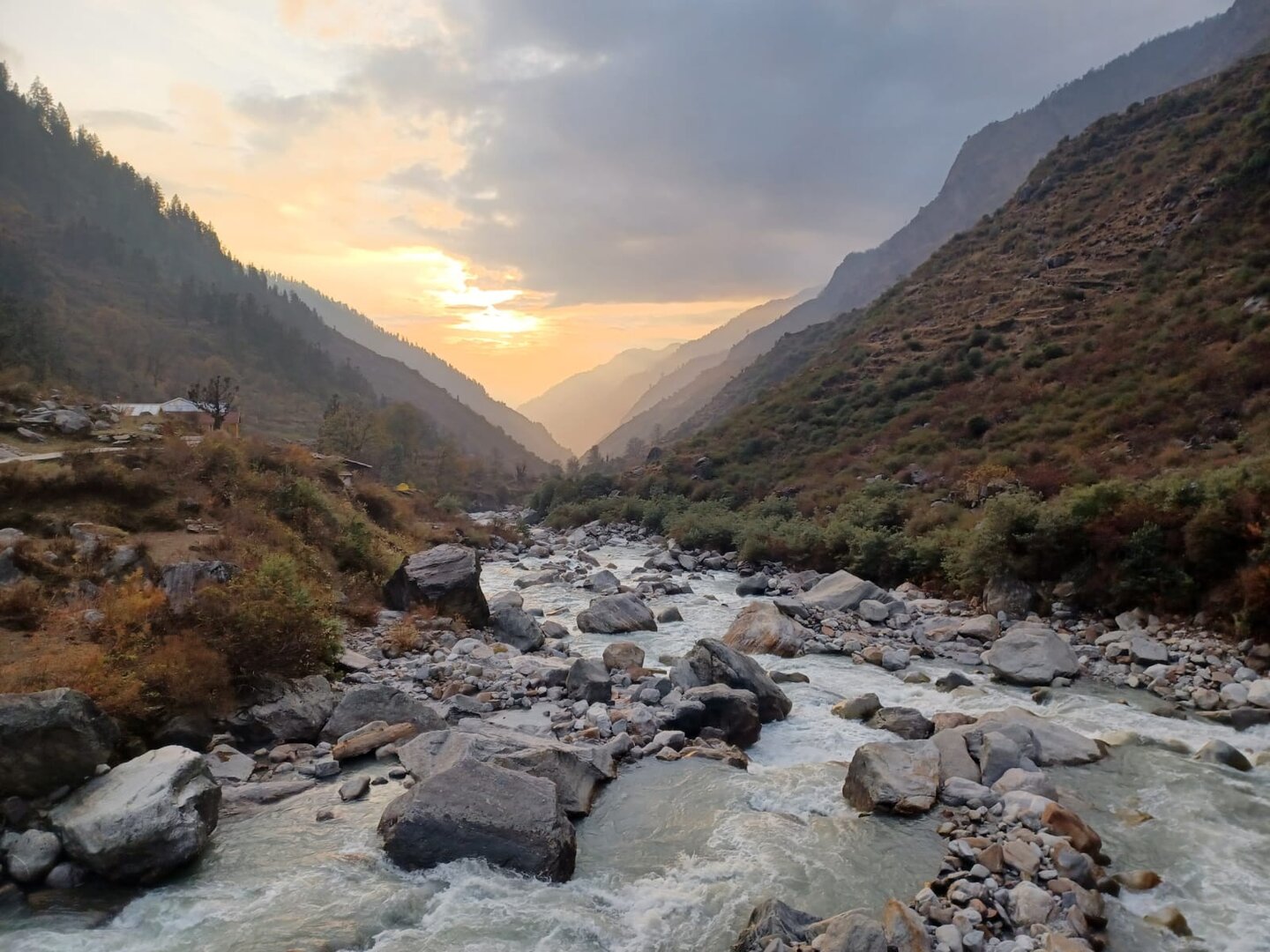
Your journey begins with a long yet stunning drive from Dehradun to Sankri, passing through Mussoorie, Purola, and Mori. The road winds through thick pine and deodar forests, opening occasionally into deep valleys where the Tons River glimmers below. As the altitude rises, the air becomes cooler and the landscape noticeably quieter. When you finally arrive in Sankri—an isolated Himalayan village inside Govind Pashu Vihar National Park—you’ll immediately feel the shift into mountain life. The village serves as the base for many legendary Garhwal treks. You settle into a cozy guesthouse or homestay, resting as the sun sets behind the ridges.
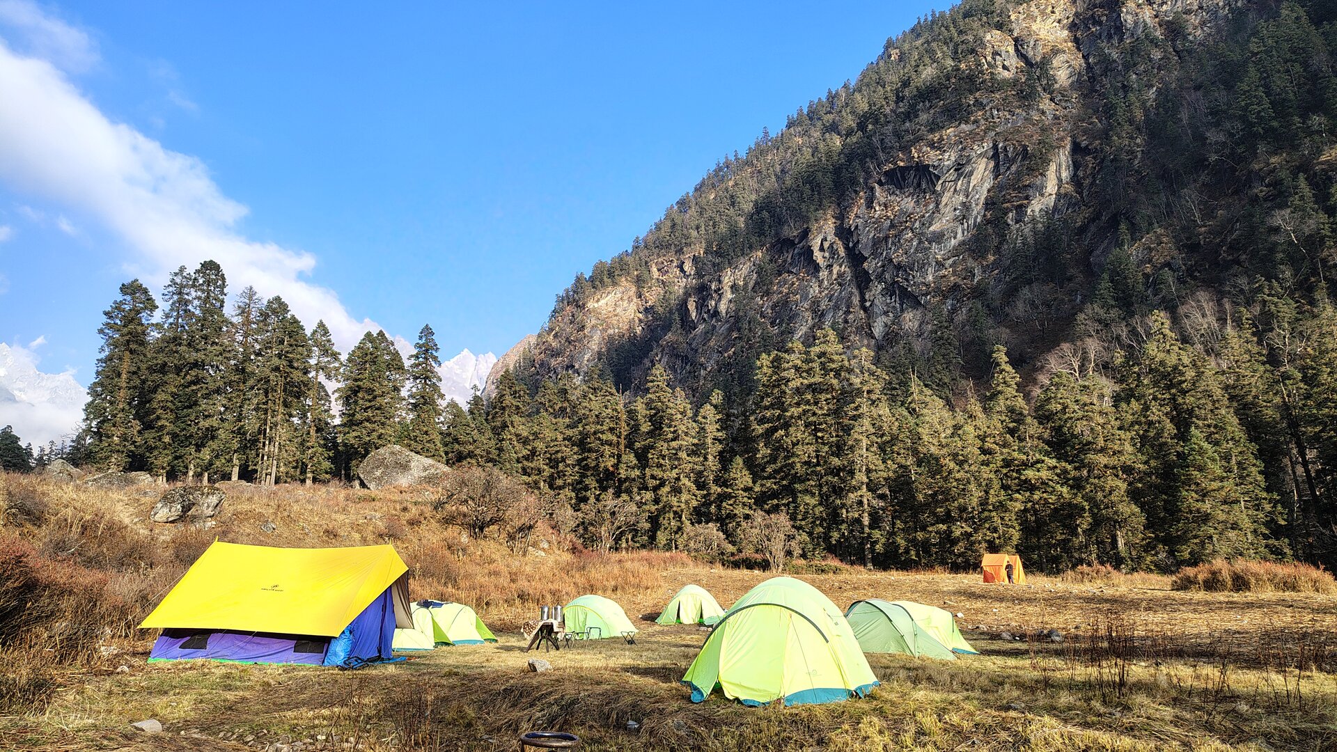
The day begins with a short but beautiful drive to Dhatmeer, the starting point of the trek. Soon after stepping onto the trail, you find yourself walking beside the Supin River, its constant flow echoing through forests of walnut, chestnut, and deodar. The path takes you across wooden bridges and through small mountain villages like Gangaar, where life moves slowly and peacefully. With every turn, the valley opens wider, offering clearer glimpses of the snow-covered Swargarohini peaks. By late afternoon, you reach Seema—a serene riverside campsite surrounded by forests and meadows. The sound of the river becomes your lullaby for the night.
Today is where the valley truly begins to open itself to you. With a steady altitude gain ahead, we start early — the kind of morning where the air feels crisp and the forest still holds onto the last traces of night. The trail continues much like the previous day, winding through damp, stone-laid paths that demand careful footing, especially with the constant presence of water trickling across the route. Within minutes of starting, we pass a small settlement — a quiet reminder of how deeply life is rooted in these remote valleys.
The Supin river remains your silent companion below, sometimes hidden behind thick vegetation, sometimes revealing itself in flashes through the trees. As the trail progresses, wooden bridges and small stream crossings become frequent, each one adding a rhythm to your walk. About an hour into the trek, a suspension bridge pulls you across to the other side of the valley, followed immediately by a steep climb that tests your breathing. But as always in the mountains, effort is quickly rewarded.
With height, the landscape begins to shift. The dense forests slowly loosen their grip, making way for wider clearings and longer sightlines. The towering trees thin out, replaced by shorter shrubs and open slopes that let the light pour in. It is here, almost unexpectedly, that the mountains begin to reveal themselves. The first distant glimpses of the great Garhwal peaks appear — vast, silent, and unmoving — slowly rising above the valley walls.
The trail doesn’t give in easily though. After a brief stretch of relatively flat ground, the ascent resumes — steady, continuous, and at times relentless. There are sections where you lose altitude briefly, only to regain it again, reminding you that progress in the mountains is rarely linear. But with every turn, the valley grows grander, the scale deeper, and the sense of isolation stronger.
As the day moves forward, the forest transforms once again. What began as tall, enclosing woods now opens into a vibrant mix of vegetation — wild plants, scattered flowers, and patches of green that feel almost untouched. The valley floor below carries the river in full force, but from up here, it feels distant — like a quiet hum beneath the vastness around you.
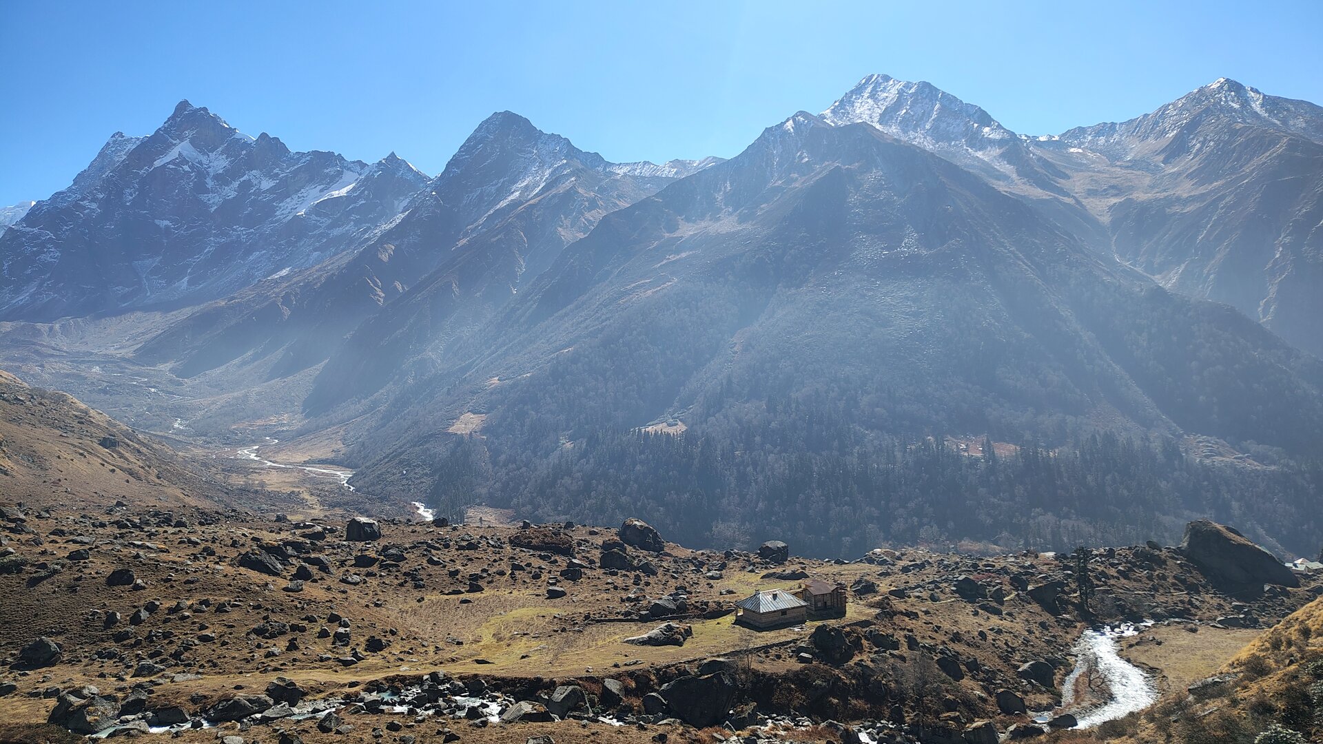
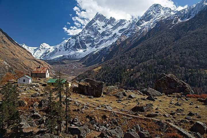
A couple of hours before Har Ki Dun, we break away and move toward our campsite at Boslo — a beautiful open meadow set away from the restricted zones of the valley. The moment you step into this space, it feels earned. Surrounded by dense forests on one side and towering peaks on the other, the campsite opens wide to the sky, offering a rare sense of freedom after a day of enclosed trails.
Right in front stands Hata Peak, calm yet commanding, while far below, the river continues its endless journey through the valley. As evening sets in, the light softens across the meadow, and the mountains begin to glow in shades of gold and grey. Sitting here with a hot cup in hand, watching the last light fade behind the ridgelines, you realise — this is the kind of place you don’t just reach, you arrive at.
The night settles in quietly. The wind moves gently through the meadow, the forest stands still, and somewhere far below, the river continues to flow — constant, unseen, and reassuring. Boslo is not just a stop before Har Ki Dun. It is a place that holds its own silence, its own space, and its own story in the journey ahead.
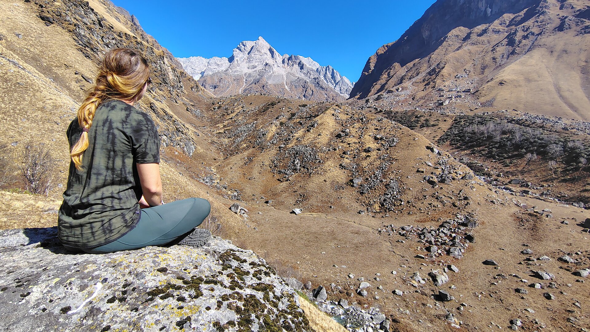
Today feels different right from the start. There’s a quiet sense of anticipation in the air — the kind that comes when you know you’re about to leave the familiar behind. This is the day we move beyond Har Ki Dun, stepping off the well-walked trail and into terrain that feels far more raw, far more untouched.
The morning begins unhurried. From Boslo, the trail gently leads us into the vast expanse of Har Ki Dun valley. The landscape opens wide here — a sweeping basin of green with the river flowing lazily through it, and the great Swargarohini massif standing tall at the head of the valley. With fewer crowds this early in the day, the valley feels almost personal, as if it has slowed down just for you. There’s time to pause, to look around, to take in the scale of it all before moving ahead.
Soon, we leave the main trail behind. Almost instantly, the difference is noticeable. The footsteps thin out, the silence deepens, and the valley begins to feel wilder. The trail now climbs gradually along the river, moving into a space that very few trekkers venture into. The mountains seem closer here, more involved — clouds brushing against their ridges, sunlight slipping in and out, constantly changing the mood of the landscape.
The first stretch is a steady, comfortable ascent. After about an hour, the terrain flattens briefly and leads us to Maninda Tal — a quiet glacial lake resting in the middle of this vast valley. The contrast is striking. Around it, the wind moves freely, grass sways endlessly, and rocks lie scattered without order. And yet, the lake remains perfectly still, holding a deep turquoise calm that feels almost unreal in this rugged setting. Nearby, you’ll notice old stone shelters — remnants of shepherd life that once passed through these high lands.
Beyond the lake, the valley changes character once again. The lush greens begin to fade, giving way to drier, golden hues. Vegetation becomes sparse, shrubs disappear, and the landscape opens into wide, rolling meadows broken occasionally by boulder sections. The trail is not demanding, but it constantly reminds you that you are gaining height — slowly, steadily, without urgency.
There are moments here where the trail feels almost secondary. You find yourself stopping without reason — lying back on the grass, watching clouds drift lazily across the sky, dissolving into the vastness above the peaks. Time stretches in these moments. The mountains don’t rush you, and for once, you don’t feel the need to rush either.
A short boulder patch interrupts the softness of the meadows, demanding focus for a while, before the trail returns to gentle inclines again. The altitude begins to make its presence felt, but the openness of the valley keeps the journey light.
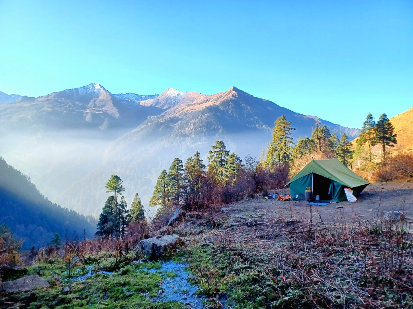
By early afternoon, we arrive at Ratta Tho — a campsite marked by its striking red boulder, standing out against the muted tones of the surrounding landscape. The campsite sits in a wide alpine clearing, exposed, quiet, and completely removed from everything below. There are no forests here, no tall trees — only open sky, scattered rocks, and distant snow slopes beginning to appear higher up.
As you settle into camp, the shift becomes clear. The comfort of the lower valleys is behind you now. Ahead lies the harsher, colder, more demanding world of high altitude. But for now, the stillness of Ratta Tho, the slow-moving clouds, and the vast emptiness around you offer a rare kind of peace — one that only exists when you step beyond the known. On a clear day, you get the first glimpse of the mighty Borasu Pass from here.
The mountains begin to feel different from today.
Gone are the soft meadows and forgiving trails of the lower valleys. What lies ahead now is a landscape that feels colder, quieter, and far more indifferent to your presence. Ratta Tho, with its open expanse and striking red boulder, serves as the last gentle pause before the terrain starts to harden.
We start early, as the wind here tends to rise sharply as the day progresses. The first stretch moves gradually over rolling alpine ground, but the softness underfoot doesn’t last long. Very soon, the trail begins to weave through scattered boulders and loose moraine, demanding a more careful rhythm. Each step now needs attention — not because the trail is extremely technical yet, but because the mountains are slowly introducing you to what lies ahead.
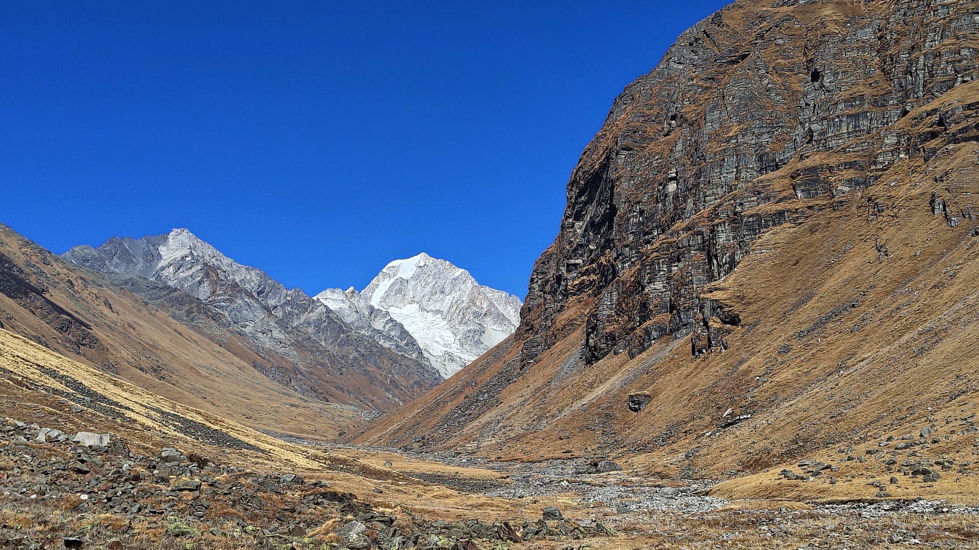
The valley tightens as we move forward. What was once wide and open now begins to narrow, guiding us toward the upper reaches of the Borasu basin. Streams born from melting snow crisscross the trail, sometimes gentle, sometimes forcing you to pause and choose your steps wisely. The sound of flowing water follows you constantly, echoing through the emptiness.
As we gain altitude, the landscape starts losing its colour. The greens fade into pale yellows, then into a raw mix of grey rock and dusty earth. Vegetation becomes almost nonexistent. The only life you occasionally spot are a few resilient alpine flowers clinging stubbornly to the cold ground — small reminders of the world you’ve left behind.
There is a certain silence here that feels heavier than before. No birds, no distant village sounds, no movement except the wind and your own breath. It’s the kind of silence that makes you aware of your own presence in the mountains — and how small it really is.
The climb today is steady and continuous, gaining close to 1,500 feet without any dramatic steep sections, but the altitude ensures that it is felt. Breaks become more frequent, not out of exhaustion alone, but because your body is beginning to adjust to thinner air. The pace slows naturally, and the group starts spreading out, each person finding their own rhythm.
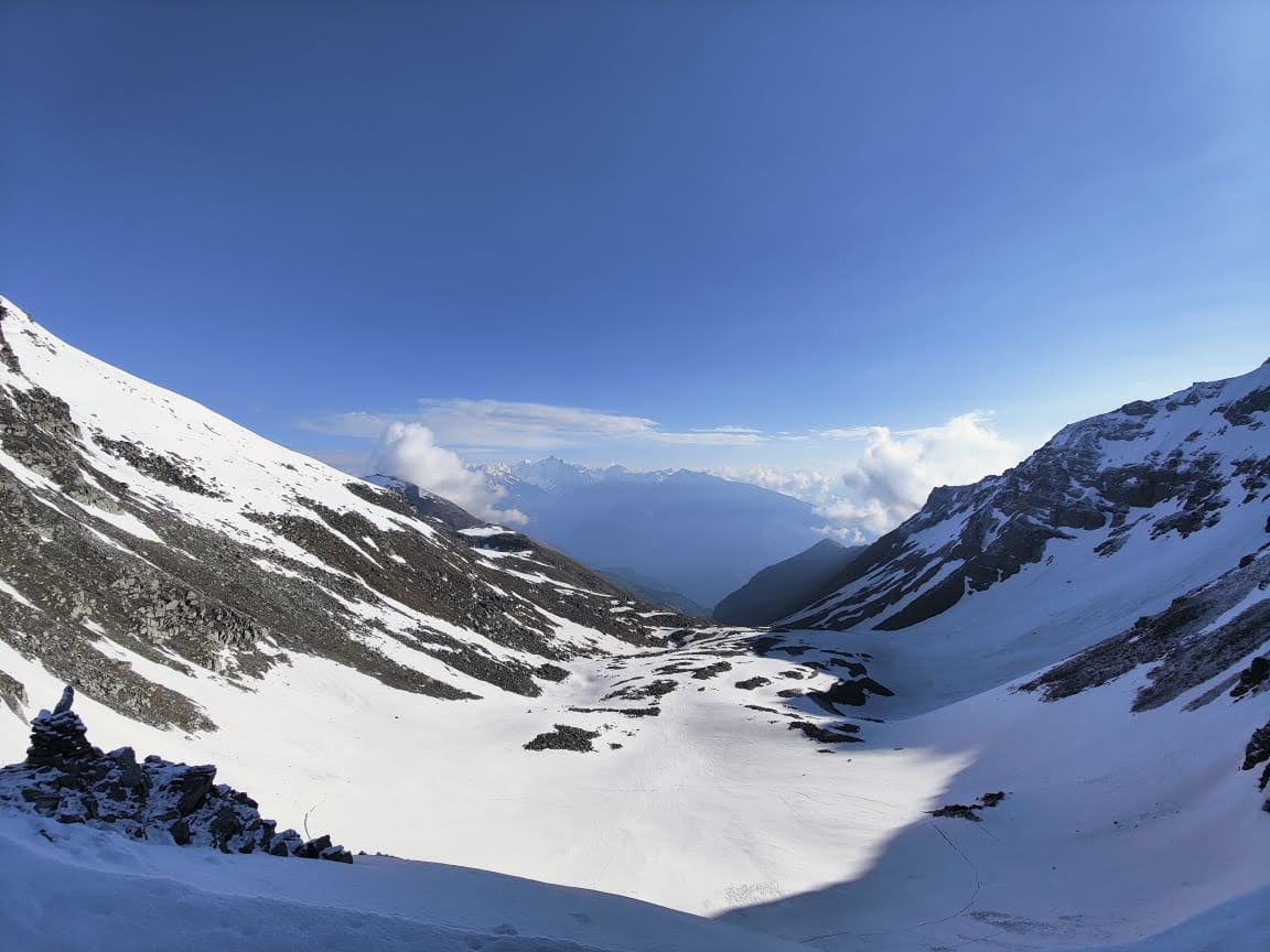
As we approach Sonbhera, the terrain opens slightly into a vast high-altitude meadow, unlike anything we’ve seen so far. The ground here feels damp, almost sponge-like in places, with multiple small streams weaving through it, forming a delicate web of water channels. In early season, patches of snow often remain scattered across the campsite, adding to its raw beauty.
Sonbhera is not a place of comfort — it is a place of transition. Surrounded by towering ridgelines and distant snow slopes, it feels exposed, almost vulnerable. But it is also incredibly powerful. Standing here, you can see the route ahead beginning to reveal itself — the higher ridges, the snowfields, and somewhere beyond them, the unseen line of Borasu Pass.
By the time we settle into camp, the temperature begins to drop quickly. The wind picks up, sweeping across the open ground without obstruction. Layers go on, conversations grow quieter, and the mountains slowly take over the evening.
Today is not about reaching a destination. It is about stepping deeper into the high Himalayas — where the terrain strips away comfort, and replaces it with something far more real.
Today is deceptive.
On paper, it is the shortest day of the entire journey — a quick push to the base camp of the pass. But the mountains have their own way of redefining what ‘short’ really means. This is where the terrain begins to prepare you, quietly but firmly, for what lies ahead.
We don’t rush the morning. The cold here lingers longer, and the sun takes its time to touch the valley floor. Once it does, we begin — not with urgency, but with awareness.
The moment we leave Sonbhera, the softness disappears. Within minutes, the trail transforms into a field of boulders — endless, scattered, uneven. There is no defined path anymore, only a direction. Each step becomes deliberate. Your feet search for stability, your balance adjusts constantly, and your pace slows into something more measured.
Crossing the campsite takes barely a few minutes before the real climb begins. The route rises sharply along a narrow ridge, threading its way upward through loose rock and broken terrain. About an hour into the climb, we reach the top of the first ridge — and it is here that the mountain quietly rewards you.
Below, Sonbhera stretches out like a living map. Streams carve their way through the meadow, dividing the land into intricate patterns — almost geometric, almost unreal. From above, the campsite looks like a mosaic of green and gold, stitched together by threads of water. It’s one of those views that holds you in place longer than you expect.
The trail eases briefly after this, allowing a few minutes of level walking — a rare luxury at this altitude. But it doesn’t last. The second ridge rises ahead, steeper and more rugged. The climb is shorter, sharper — about half an hour of steady effort that leads you higher into a world that feels increasingly distant from everything below.
And then, almost suddenly, you arrive.
Upper Lamjung.
The base camp of Borasu Pass.
Locally, ‘Lamjung’ translates to ‘Long Moustache’ — a name inspired by the sweeping ridgelines below that, from a distance, resemble the curve of a long moustache. Standing here, you understand why. The terrain folds and curves in ways that feel almost deliberate, almost sculpted.
The campsite itself is unlike anything you’ve experienced so far. It is small, uneven, and filled with loose rock — a place where pitching tents feels more like negotiation than routine. Comfort takes a backseat here. This is not a campsite meant for ease; it is a place meant for purpose.
All around you, the mountains rise in stark contrast. To one side, softer slopes roll away into muted colours, almost calm in their appearance. To the other, sharp ridges and jagged rock faces dominate the skyline — raw, aggressive, constantly shedding loose stones that echo through the valley. Every few minutes, you hear it — the distant rumble of rockfall, reminding you of the fragile nature of this terrain.
The pass itself remains hidden, tucked away behind layers of glacier and ridge. You know it is close, but the mountain doesn’t reveal it yet.
If the sky is clear, the reward is immense. From this vantage point, you can spot distant glacial lakes resting quietly in the folds of the mountains — untouched, unmoving, almost frozen in time. Clouds drift slowly, forming and dissolving without warning, casting shadows that change the entire landscape within moments.
The ground beneath your feet feels ancient — like the remains of something that once stood tall and has now collapsed into itself. Rocks scattered in every direction, as if pushed down by time.
Water is scarce here. You can hear it — faintly, somewhere beneath the ice or between rocks — but finding it takes effort. Everything here demands a little more from you.
As evening sets in, the temperature drops quickly. The wind carries a sharp bite, and the silence deepens, broken only by the occasional crack and rumble of shifting rock.
Tomorrow is the pass.
And tonight, the mountains make sure you understand what that truly means.
Today is the day the mountains test everything you’ve carried within you.
We begin long before the sun even considers rising. In the darkness, under a sky still heavy with stars, there is a quiet urgency in the air. Headlamps flicker on, boots crunch over frozen ground, and without much conversation, we start moving. The peaks around us are still silhouettes — dark, silent, watching.
The climb begins immediately.
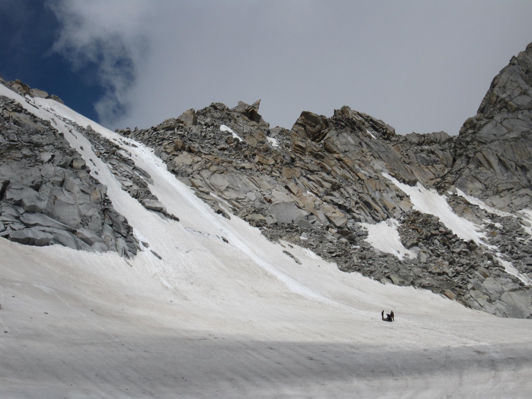
The first stretch is steep and relentless, weaving through boulders and broken rock. Within an hour, we reach the base of the glacier — the point where the terrain shifts once again. Here, we pause. Crampons or microspikes go on. Ice axes are readied. The mountain demands more from us now.
The initial slope feels manageable, almost welcoming. But it doesn’t stay that way for long.
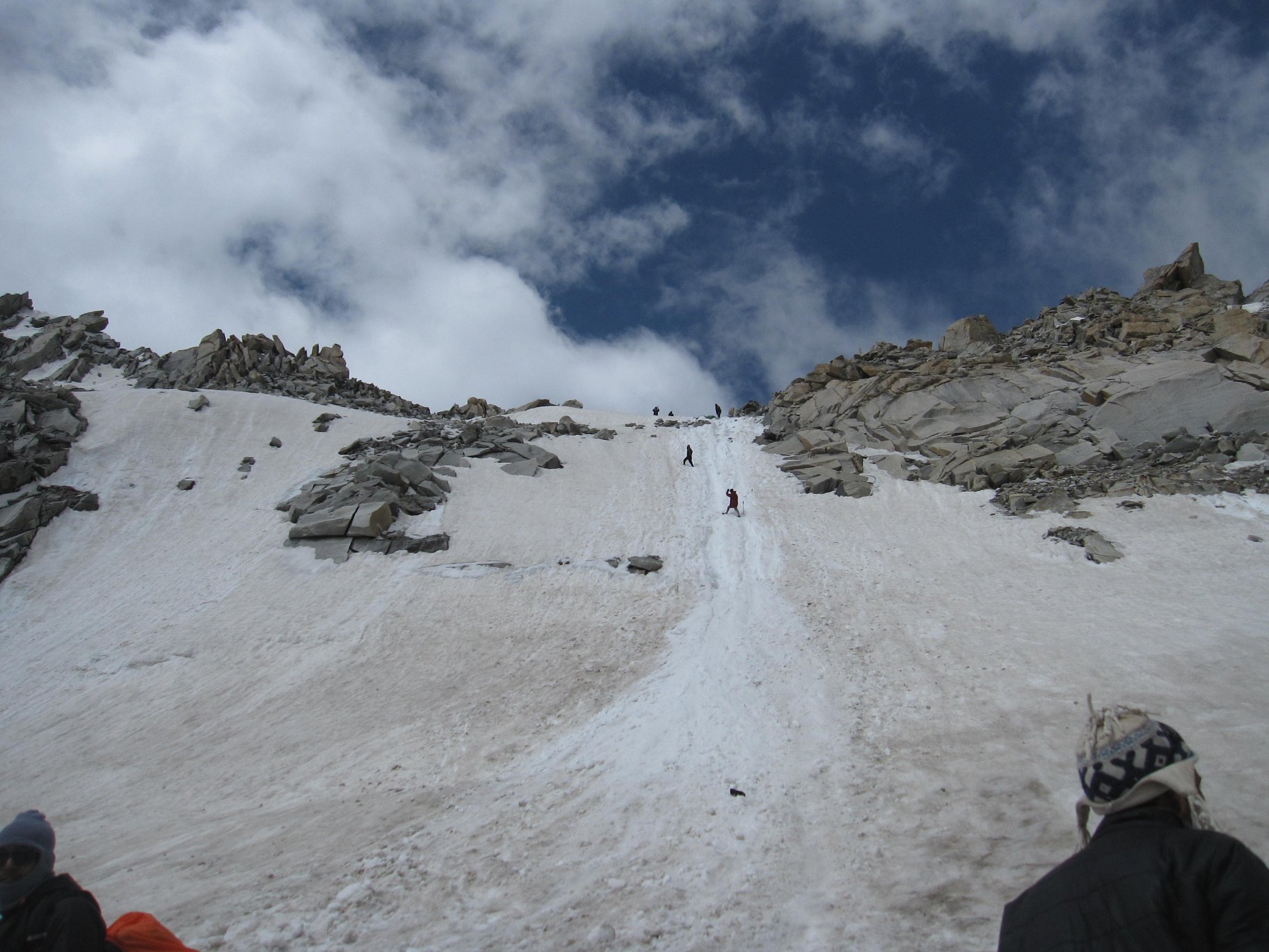
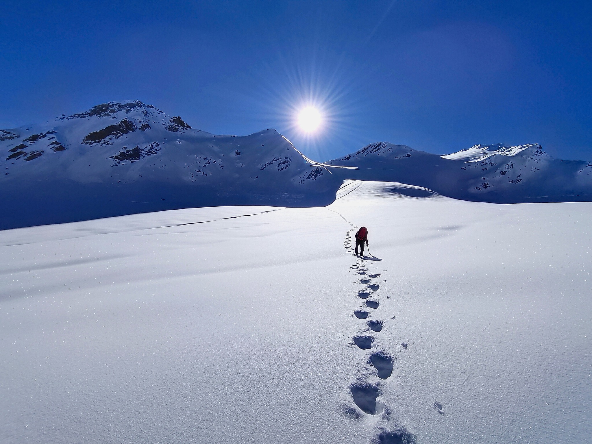
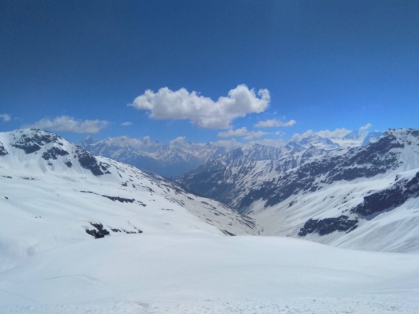
As we move higher, the gradient sharpens quickly. Snow and rock alternate unpredictably underfoot. The slope steepens — 30 degrees, then 50, then pushing toward 70. Breathing becomes heavier, steps slower, more deliberate. The final approach to the pass is the kind that forces silence — steep, exposed, and mentally demanding. Every step feels earned.
And then, almost suddenly, there is nowhere higher to climb.
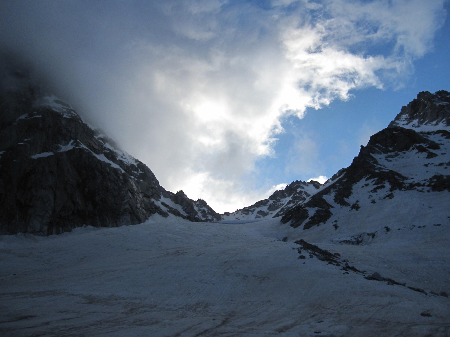
Borasu Pass.
At nearly 17,880 feet, you stand in a world that feels completely stripped down to its rawest form. There is no softness here — only wind, snow, rock, and the vast openness of the high Himalayas. Peaks stretch endlessly in every direction, their faces painted in shifting patterns of white snow and dark rock. The air is thin, the cold sharp, and yet there is a stillness that holds you in place.
We don’t stay long.
Because what comes next is where the real challenge begins.
The descent.
Right from the pass, the mountain drops away sharply — almost intimidating in its directness. The first section is steep enough to require fixed ropes in certain conditions. Each step downward needs focus. Loose snow, hard ice, and exposure combine to demand complete attention. This initial descent alone takes time, patience, and control.
Once off the steep face, we enter a long stretch of snowfields. At first glance, it feels easier — almost forgiving. But this terrain has its own dangers. Hidden crevasses lie beneath the surface, and sections of the slope fall away sharply on one side. The group moves carefully, maintaining distance, placing each step with intent. Over the next hour, we steadily lose altitude, the pass slowly rising behind us.
And then, the mountains change again.
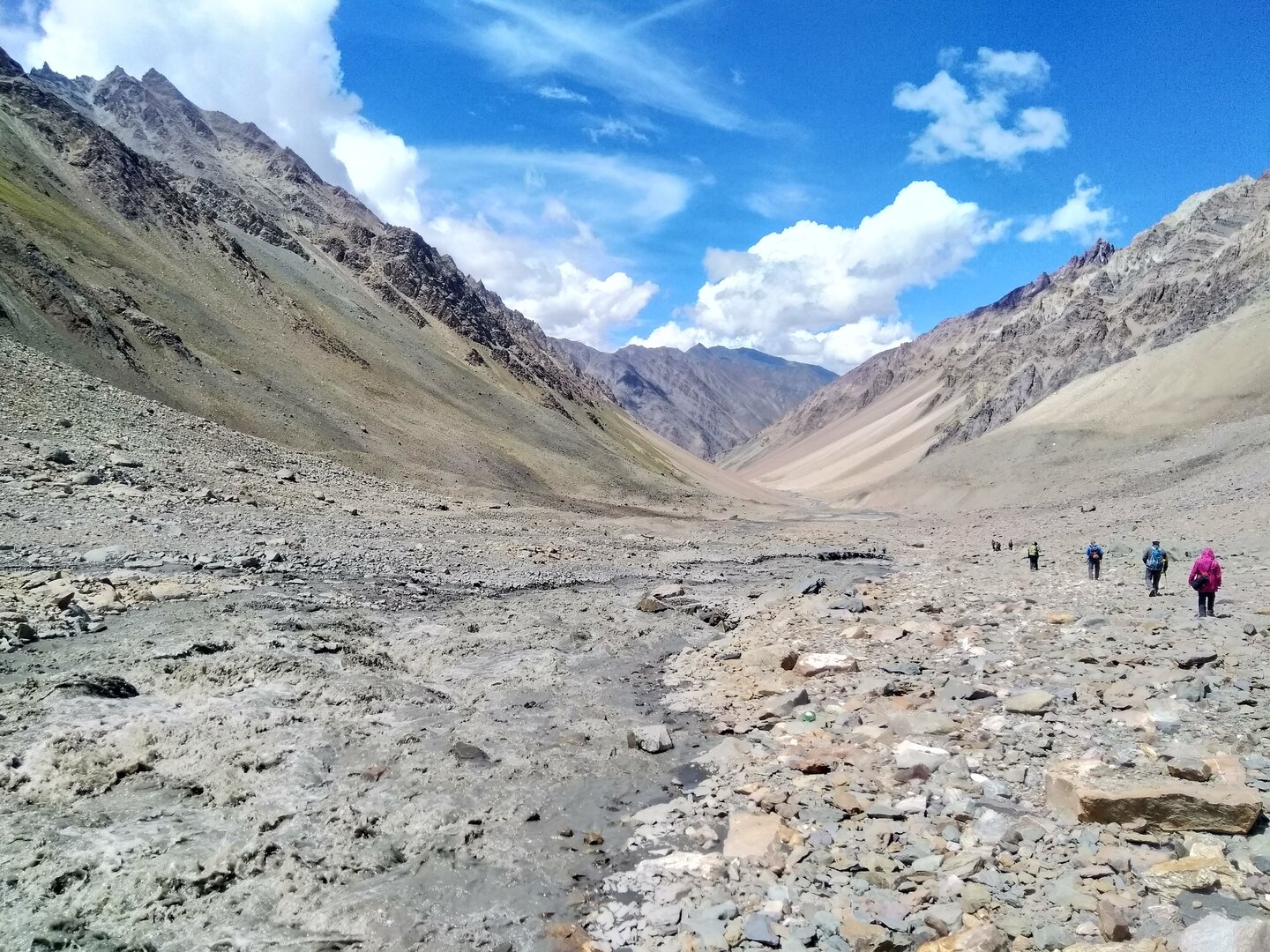
Snow gives way to rock.
What follows is a long, exhausting traverse across massive boulder fields — unstable, uneven, and mentally draining. There is no defined trail here. You choose your line, step by step, navigating gaps, balancing over shifting rock, constantly adjusting. Progress feels slow, far slower than it looks on paper. Every movement demands attention, and fatigue begins to build.
After what feels like an endless stretch of rock, the terrain eases briefly as we cross a wide glacial basin. The ground here is harsh but manageable, giving you just enough relief before the next challenge rises ahead.
To continue, we must gain a ridge visible in the distance.
The climb to it is short, but brutal — a steep slope of loose scree and sliding rock that shifts under every step. It’s the kind of section that tests willpower more than strength. Each step forward feels like half a step back. But once you push through and gain the ridge, something changes.
The walk ahead becomes more defined.
Narrow, yes. Still loose, yes. But finally, a direction you can follow without constant calculation.
As we move along the ridge, the stark whites and greys begin to soften. Colour slowly returns to the landscape. Snow peaks move into the background. Streams begin to appear — not just heard, but seen. The mountains feel a little less hostile, a little more alive.
Gradually, the trail descends toward greener ground. Patches of grass emerge. Small flowers begin to appear, breaking through the cold earth. It feels like stepping back into a world that supports life again.
By early evening, we reach Bonga — a campsite that feels almost comforting after the harshness of the day. A stream flows nearby, the ground is softer, and the valley opens out around us. But the cold remains, a reminder of where we’ve just come from.
Today is not just another day on the trek.
It is the crossing.
The moment where you leave one world behind and step into another — carrying with you the quiet satisfaction of having stood on one of the rawest, most demanding mountain passes in the Himalayas.
The body feels it today.
After yesterday’s crossing, the fatigue sits deeper — not just in the legs, but somewhere quieter. And yet, the journey isn’t done. What lies ahead is long, demanding, and in many ways, just as testing.
We begin after a slightly relaxed morning, stepping out of Bonga around 9 AM. The air feels calmer here, but the terrain quickly reminds you that the mountains are not done with you yet.
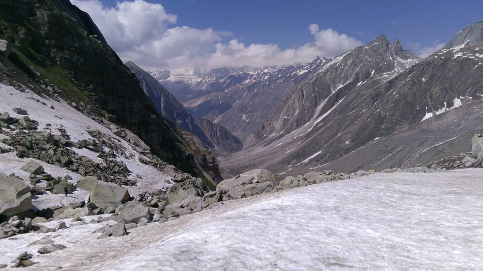
The first section of the trail is relentless — a series of steep ascents and descents across massive boulders spread along an exposed mountainside. There is no clear trail to follow. You move by instinct, choosing your steps carefully, navigating through gaps, balancing over unstable rock while the valley drops sharply below. It demands constant focus. One careless step here is not an option.
Water is scarce in this stretch, and the dryness adds to the effort. For nearly two to three hours, it’s just you, the rock, and the silence of the mountains. Progress feels slow, measured not in distance but in effort.
And then, almost quietly, the mountains begin to soften.
The endless boulder field gives way to patches of firmer ground. Small signs of life begin to appear — first in the form of scattered shrubs, then slowly, more defined vegetation. The harsh greys start blending into muted greens.
Another hour or so, and the transformation becomes complete.
The tree line appears.
And with it, a feeling that’s hard to describe.
You step into forests of Bhojpatra — their pale bark and golden leaves catching the light, rustling gently in the wind. After days spent in stark, high-altitude wilderness, this feels almost surreal. The sound of dry leaves under your feet, the subtle warmth in the air, the presence of trees all around — it feels like returning to a forgotten world.
The trail now flows more naturally, winding through these forests before opening up into rolling grasslands. The terrain undulates gently, small humps rising and falling, but compared to what you’ve crossed, it feels almost effortless. Streams begin to appear more frequently, and the valley feels alive again.
Gradually, the descent leads us toward the riverbed. There’s one final stretch of rocky terrain — a last reminder of the mountains we’ve just left behind — before the landscape eases out completely.
By late afternoon, we reach a small wooden bridge.
Crossing it feels symbolic.
On one side lies the raw, untamed world of Borasu — silent, harsh, and unforgettable. On the other, a defined path, smoother ground, and the slow return to civilisation.
From here, the trail merges into a proper track leading toward Chitkul — the last inhabited village near the Indo-Tibetan border. The mountains still stand tall around you, but something has changed. The intensity has softened. The journey is coming to a close.
By the time we reach Chitkul, the contrast is striking — wooden houses, fields, and the quiet rhythm of village life replacing the isolation of the high mountains. Accommodation awaits, along with warmth, rest, and the first real sense of completion.
But even as the trek ends, a part of you stays behind.
Somewhere between the silence of Upper Lamjung, the raw exposure of Borasu Pass, and the endless valleys that tested you — a part of you now belongs to the mountains.
Reserved for weather or acclimatization delays to ensure safe crossing of the pass.
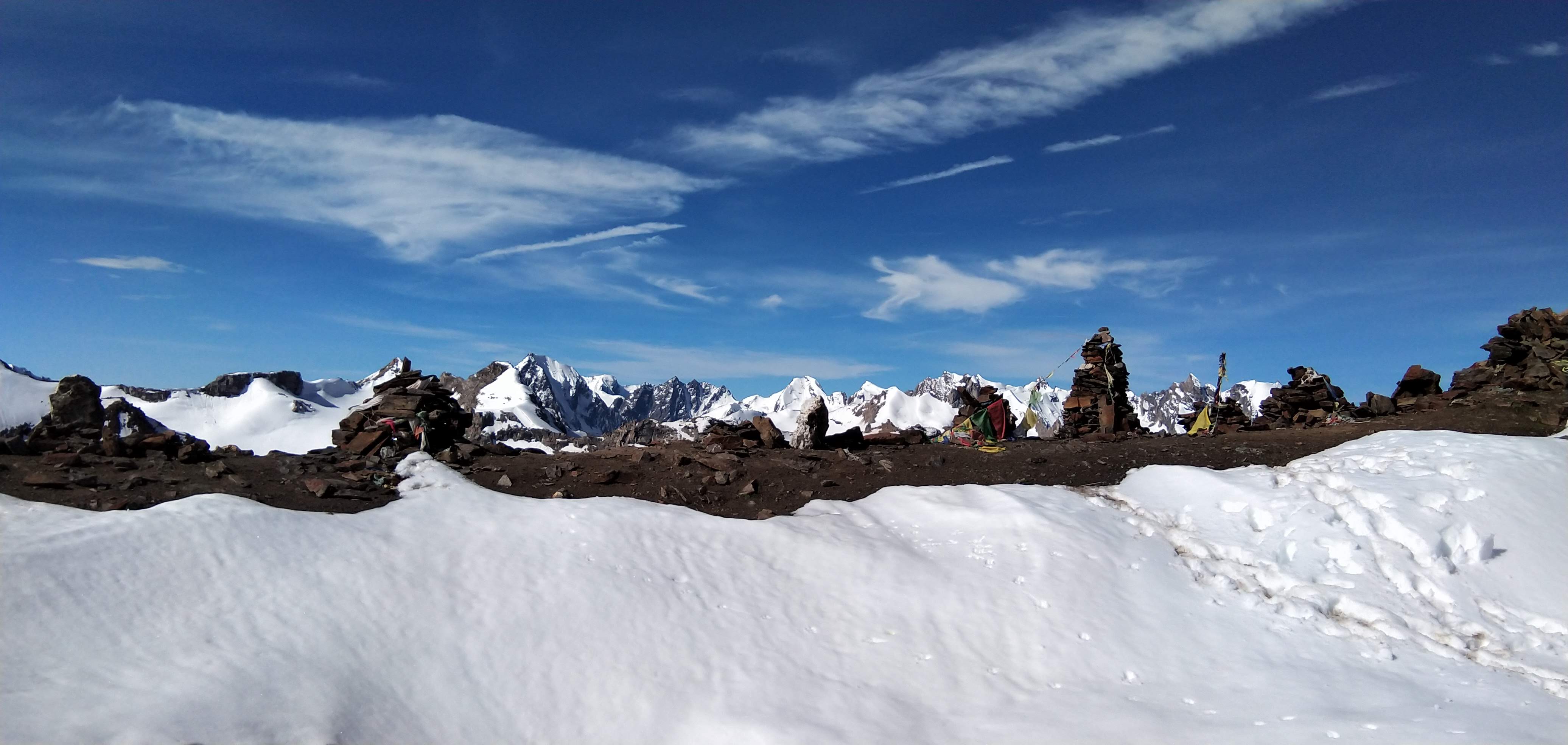
✅Borasu Pass was historically used as a trans-Himalayan trade route linking the Har Ki Dun valley (Garhwal) with Baspa valley (Kinnaur), long before modern borders restricted movement.
✅The entire approach until Har Ki Dun falls inside Govind Pashu Vihar National Park — a protected ecosystem known for species like Himalayan black bear, musk deer, and monal.
✅Beyond Har Ki Dun, the trail enters a rarely traversed glacial basin where route marking is minimal and navigation relies heavily on experience and terrain reading.
✅Borasu Pass (~17,880 ft) involves real high-altitude mountaineering elements — including steep snow slopes, potential rope sections, glacier crossings, and crevasse-prone zones.
✅The climb to the pass is often safer in early morning hours due to firmer snow conditions, reducing risk of slips, rockfall, and snow instability.
✅The crossover marks a dramatic ecological shift — from the lush Tons valley of Uttarakhand to the drier, more rugged Baspa valley of Himachal Pradesh.
✅Upper Lamjung, the basecamp for the pass, is located in an active rockfall zone, which is why campsite selection and timing are critical for safety.
✅The descent from the pass is considered more demanding than the ascent, involving steep snow slopes followed by long stretches of unstable moraine and boulder fields.
✅No Inner Line Permit (ILP) is typically required for this trek, but forest permits from Uttarakhand and local permissions are mandatory and managed by the organising team.
✅Chitkul, the trek’s endpoint, lies close to the Indo-Tibet border and remains one of the last motorable inhabited villages in India.
Route Map
How to reach
✈️ Air: • Nearest Airport: Jolly Grant Airport, Dehradun (DED) • Regular flights available from Delhi, Mumbai, Bangalore, and other major cities.Regular flights available from Delhi, Mumbai, Bangalore, and other major cities. • From the airport, you can hire a taxi to Dehradun ISBT or directly to Sankri.
🚆 Train: • Nearest Railway Station: Dehradun Railway Station • Well connected with major cities like Delhi, Haridwar, Rishikesh, and Lucknow.
🛣️ Road:Dehradun to Sankri (190 km | 8–9 hours)
🗺️ Travel Tip: • Private Cab: Can be booked in advance. Costlier but comfortable. • Local Bus: From Dehradun ISBT to Sankri via Purola (limited availability, leaves early morning).
Gallery
TrekFAQs
Borasu Pass is strictly meant for experienced trekkers. You should have completed at least one or two high-altitude treks (14,000 ft+) before attempting this. This trek involves long days, steep ascents, glacier travel, and exposure to harsh weather conditions. Beginners are not recommended unless they are exceptionally fit and well-prepared.
This is a difficult to expedition-grade trek. It includes high altitude (17,880 ft), long trekking days (8–10 hours), glacier crossings, moraine, boulder sections, and steep snow slopes. The pass day itself is physically and mentally demanding and requires endurance, balance, and acclimatization.
The trek offers extreme terrain variation — starting from forest trails and river valleys, moving into alpine meadows, and then transitioning into rocky moraine, glacier sections, and steep snow slopes near the pass. The descent includes loose scree, glacier streams, and exposed ridgelines.
Yes, it involves moderate technical elements. The pass crossing may require use of microspikes/crampons, gaiters, and sometimes rope support depending on snow conditions. Knowledge of basic trekking techniques like walking on snow, maintaining balance on loose rocks, and controlled descent is important.
The key risks include Acute Mountain Sickness (AMS), sudden weather changes, snowstorms, slips on snow slopes, and fatigue due to long trekking hours. Remote terrain also means limited evacuation options, which is why proper planning and experienced leadership are critical.
Acute Mountain Sickness (AMS) occurs due to rapid gain in altitude and reduced oxygen levels. Since Borasu reaches nearly 18,000 ft, AMS risk is high if not managed properly. Symptoms include headache, nausea, dizziness, fatigue, and loss of appetite. Severe cases can lead to HAPE/HACE, which are life-threatening.
We follow a strict acclimatization schedule with gradual altitude gain, include buffer days, monitor oxygen saturation levels regularly, and ensure hydration and nutrition. Our leaders are trained to identify early AMS symptoms and take immediate action, including descent if required.
Trekkers should maintain a steady pace, stay hydrated (3–4 litres daily), avoid alcohol/smoking, eat properly, and never ignore symptoms like headache or nausea. Proper acclimatization and listening to your trek leader are crucial.
Weather varies drastically. Lower camps (Sankri to Har Ki Dun) are pleasant (10–15°C daytime), while higher camps drop to -5°C to -10°C at night. At the pass, temperatures can fall further with strong winds. Sudden snowfall is common even in summer.
Yes, travel insurance is mandatory. This trek involves remote high-altitude terrain where evacuation (if required) can be expensive and logistically complex. Insurance ensures financial protection in case of medical emergencies, evacuation, or trip disruptions.
You must carry a valid government-issued ID (Aadhar/Passport), a medical fitness certificate, and a signed liability waiver form. These are mandatory for permits and safety compliance.
No ILP is required for this trek. However, forest permits are mandatory as the trek passes through Govind Pashu Vihar National Park. These permits are arranged by the organizing team.
You should be able to run 5 km in 30–35 minutes comfortably and carry a backpack for long durations. Good cardiovascular endurance, leg strength, and stamina are essential. Preparation should begin at least 6–8 weeks before the trek.
Focus on cardio (running, cycling), strength training (legs and core), and endurance (long walks with backpack). Stair climbing and hiking practice significantly help. Mental preparedness is equally important due to long and demanding days.
Yes, strongly recommended. Trekkers without prior experience above 12,000–14,000 ft may struggle with acclimatization and terrain challenges.
Network is available till Sankri (limited). Beyond that, there is no reliable connectivity. This is a remote expedition with complete digital disconnection.
Nutritious vegetarian meals are provided throughout the trek. Meals are designed to support high-energy output. Safe drinking water is provided at camps and refilled during the trek.
We operate with certified trek leaders, trained support staff, medical kits, oxygen cylinders, and planned evacuation protocols. Campsites are chosen carefully, and group size is controlled to ensure safety and personal attention.
You need proper trekking gear including layered clothing, down jacket, waterproof jacket, trekking shoes, gloves, cap, sunglasses, and personal medical kit. A detailed packing list is provided after booking.
Yes, offloading is available at additional cost. However, trekkers are encouraged to carry their own essential daypack for better mobility and safety.
A buffer day is included in the itinerary to handle weather delays. If conditions become unsafe, the trek leader may modify or cancel the pass attempt prioritizing safety.
Unlike regular treks, Borasu is a true crossover expedition connecting two distinct Himalayan regions. It offers a complete transition — forests, valleys, glaciers, and high-altitude pass crossing — making it one of the most raw and less-commercialized experiences in India.
Even with training, beginners are not advised unless they have prior trekking exposure. The risk level, terrain, and altitude make it unsuitable as a first high-altitude experience.
The trek leader is responsible for navigation, safety decisions, pace management, health monitoring, and emergency handling. Their instructions must be followed at all times for a safe and successful trek.
Every journey with us is carefully crafted for a deeply personal mountain experience.
Not Just a Trek — A Journey That Stays With You
Every trail we walk is a carefully chosen path into the heart of the Himalayas — not just to witness their grandeur, but to feel them under your skin and soul. Our treks are designed not as bucket list checkmarks, but as life-affirming journeys. At Planethimalayas, we believe a mountain journey is deeply personal — and that belief runs through everything we do.
Individual Care, Every Step of the Way
We keep our groups small and intimate so we can focus on you — your pace, your concerns, your joy. From pre-trek guidance to trail-side support, our leaders walk with intention, offering safety and attention without intrusion. It’s this deep care that turns strangers into friends and walks into memories.
Built on Genuine Love for the Himalayas
We don’t just operate in the Himalayas — we live and breathe them. From respecting mountain communities to following Leave No Trace ethics, our treks are shaped by humility and care. With Planethimalayas, your trek becomes a way of giving back to the mountains that give us so much.
Why Choose Us
Experience the difference of trekking with genuine mountain experts who truly care.
Trek Leader & Guide
Led by certified mountaineers with wilderness first aid training, ensuring your safety and confidence at every step.
Cook & Support Staff
Our mountain crew comprises local experts who bring unmatched experience, warmth, and deep knowledge of the region.
Small Group Size
We cap our group departures at just 8 trekkers — ensuring individual attention, deeper connections, and better trail discipline.
Safety Standards
From personal well-being to technical preparedness, we maintain the highest safety standards — using certified high-altitude gear and comprehensive safety protocols to ensure a secure and reliable Himalayan experience.
24×7 Online Support
We're always available — before, during, or after your trek. Reach out anytime, and you'll always hear back from a real human.
We Care for the Mountains
We strictly follow Leave No Trace ethics. Limited group sizes and mindful practices help protect the fragile Himalayan ecosystem.