WhatsApp FAQs
×


PriceNote – Listed Price & Customisation Rules:
The listed trek price applies to our fixed departures for the specified itinerary. Trek fees including any add-ons for customized groups may vary based on your preferences, ensuring every adventure is tailored to your needs.

Group Booking Offer:
For groups of 8 or more booking together, the trek fee for 1 participant will be waived as a token to encourage shared adventures.

Scholarship for Kids:
Children under 15 years receive a 30% discount on the trek price, making it easier for families to explore the Himalayas together.

×


Transport Price Note:
The transport price mentioned is only an current indicative estimate per person, assuming a Non-AC vehicle like Bolero shared by at least 4 participants.
Fewer participants → cost rises;
More participants → cost decreases.

Transport Selection During Booking:
Selecting transport during booking informs us of your preference. No payment is collected at booking.

Final Cost & Payment:
Final transport cost will be communicated before departure and to be paid directly to the cab driver.

×

Itinerary Note:
This itinerary represents the most updated plan, but minor adjustments may occur due to operational needs or mountain conditions.

Kalihani Pass Trek

An Offbeat Gateway to Bara Bhangal

Gallery

Trek Overview

  • Trek Duration: 7 Nights / 8 Days
  • Trek Grade: Moderate / Difficult
  • 🏔️ Max Altitude: 15,850 ft (Kalihani Pass)
  • Trek Distance: ~45 Km
  • 🌤️ Best Time: June-July & September-October
  • 🗺️ Region: Kullu Valley, Himachal Pradesh
  • 📍 Start Point: Manali
  • 🏁 End Point: Manali
  • 🧥 Cloakroom facility: Not Available

Price starting from ?

INR 18,900 * Manali to Manali

*Price inclusive of all applicable taxes (GST included).

Small group sizes • High guide-to-trekker ratio • No hidden costs

Addons (Optional)

  • Offloading-Bags – INR 4,000 (* Maximum weight 9kg/bag)

Need help or want a custom plan?

Walking The Trail

Beyond the familiar trails around Manali lies a quieter side of the Himalayas—one that doesn’t reveal itself all at once, but unfolds gradually as you move deeper into it. The Kalihani Pass Trek follows this shift, starting in the comfort of forested paths and slowly leading into landscapes that feel increasingly distant, raw, and untouched.
What makes this journey stand apart is its direction. The route moves toward the remote expanse of the Bara Bhangal side, a region known more by reputation than by footfall. It’s not about reaching a crowded summit or ticking off a viewpoint, but about walking into terrain that feels less traveled, where every day carries you further from the familiar rhythm of the valley.
The early stages pass through dense forests, grazing clearings, and water-fed camps like Jammu Pani, where the trail feels grounded and steady. There is a sense of progression, but not urgency—the mountains remain partially hidden, revealing themselves in fragments rather than all at once.
As altitude builds, the landscape begins to open out. Meadows like Riyali Thatch stretch wide under shifting light, and camps like Shagor sit at the edge of where vegetation starts to thin. The trail becomes less about walking through and more about moving across—across slopes, across ridgelines, across a terrain that feels increasingly exposed.
The approach to Kalihani Pass marks a clear transition. Grass gives way to rock, and rock to snow. The environment grows quieter, sharper, and more defined by altitude. The final stretch is not just a climb, but an entry into a glacial world where the scale of the mountains feels immediate and absolute.
At the pass, the landscape opens toward the wild, lesser-seen side of the range. It’s a moment that doesn’t demand celebration, but holds a quiet intensity—of having reached a place that feels both distant and deeply rooted in the geography of the Himalayas.
The return carries a different rhythm. As the trail loops back toward Rani Sui Lake and descends through ridgelines like Khanpari Tibba, the terrain softens once again. The same mountains remain, but the experience begins to settle, moving from effort into reflection.
By the time you reach back toward Manali, what stays is not just the memory of the pass, but the gradual shift you moved through—forests to meadows, meadows to glacier, and isolation back to familiarity. Kalihani is less about a single highlight, and more about the feeling of having walked into a quieter, less-seen side of the Himalayas—and back.
Read More

Highlights

✅ Move through a rich mix of dense Himalayan forests and vast alpine meadows, where the landscape gradually opens with altitude and changes character every day

✅ Experience diverse flora and fauna along the trail, with vibrant wildflowers in the meadows and varied vegetation across different altitude zones

✅ Camp at some of the most beautiful high-altitude sites like Riyali Thatch and Shagor, set in wide open spaces with uninterrupted mountain surroundings

✅ Take in expansive ridge-top views from Shagor and higher sections, overlooking both the Dhauladhar and Pir Panjal ranges with the Kullu Valley far below

✅ Reach Kalihani Pass (~15,800 ft), the highest point of the trek, marking a dramatic transition into a stark, glacial landscape near the edge of the remote Bara Bhangal region

✅ Visit the serene Rani Sui Lake, set quietly within a vast meadow, known for its calm setting and local significance

✅ Climb to Khanpari Tibba, a natural viewpoint offering sweeping bird’s-eye views of the Dhauladhar range ovverlooking the Kullu valley

Itinerary

?
The journey begins with a short drive from Manali toward the lesser-explored side of the valley, gradually leaving behind the busier routes. The road climbs toward Sangchar, a quiet roadhead where the trek officially begins, marking the shift from vehicle access to foot trails. The initial trail enters dense forests, where pine, oak, and deodar dominate the landscape. The ascent is steady but shaded, with the sound of water streams accompanying the route. The terrain feels grounded and enclosed, offering little in terms of long views but a strong sense of being within the mountains. As the climb continues, the forest begins to break into occasional clearings, hinting at the higher terrain ahead. Jammu Pani, the campsite, is set near a reliable water source, surrounded by forest and open patches. It serves as a calm first halt, easing the body into the rhythm of a longer and more demanding trek ahead.
The day begins with a continued ascent through forested terrain, gradually gaining altitude along well-defined trails used historically by locals and shepherds. The forest remains dense for most of the climb, with occasional breaks offering glimpses of the valley below. As you move higher, the vegetation begins to change subtly. The trees grow thinner, and the trail starts opening into wider sections where the surroundings feel less enclosed. The gradient remains consistent, making it a steady and sustained climb rather than a steep push. Pani Dhar sits at a transitional point—where the forest starts giving way to more open terrain. The campsite offers a mix of tree cover and clearings, setting the stage for the more expansive landscapes that begin to unfold from the next day onward.
This day marks a clear shift in the character of the trek. The dense forest gradually recedes, opening into vast alpine meadows that stretch across the slopes. The transition is noticeable—not just visually, but in the feel of the trail, as the surroundings begin to expand in every direction. Riyali Thatch is one of the defining landscapes of this trek—wide, rolling grasslands dotted with seasonal wildflowers during the summer months. The sense of openness replaces the earlier enclosure of the forest, and views begin to extend toward distant ridgelines. The campsite here is expansive and exposed, offering uninterrupted views of the surrounding terrain. The evening light across the meadows, combined with the growing sense of altitude, creates a shift in atmosphere—from sheltered to open, from grounded to elevated.
The trail continues its gradual climb, now fully within open alpine terrain. The path moves across wide slopes and ridgelines, with very little tree cover remaining. The sense of elevation becomes more constant, and the surroundings feel increasingly expansive. As you approach Shagor, the landscape becomes more dramatic. The campsite sits in a high-altitude basin, surrounded by ridges that offer sweeping views of both the Dhauladhar and Pir Panjal ranges. Valleys stretch out below, giving a strong sense of scale and distance. Shagor is one of the most scenic camps on the trek—not just for its location, but for the perspective it offers. It feels like a threshold, where the softer alpine terrain begins to give way to the harsher, more rugged world higher up.
This is the most demanding and defining day of the trek. The route ascends steadily from Shagor, leaving behind the grassy slopes and moving into rockier, more rugged terrain. As altitude increases, the environment becomes more stark, with patches of snow and moraine appearing closer to the pass. The climb to Kalihani Pass is gradual but sustained, requiring steady pacing. The transition from meadow to glacial terrain is clear, marking a shift in both landscape and effort. The final approach opens into a high, exposed section where the scale of the mountains feels immediate and unfiltered. At the pass, the terrain drops away toward the remote Bara Bhangal side—a region known for its isolation and minimal access. The moment here is defined less by celebration and more by the starkness of the surroundings. After spending time at the pass, the descent follows the same route back to Shagor. The return feels different, with the harshness of the upper terrain giving way once again to the relative softness of the alpine slopes.
The trail descends gradually from Shagor, moving away from the harsher upper terrain into softer alpine landscapes. The route traverses across open slopes and meadows, maintaining wide views of the surrounding ranges. Rani Sui Lake appears quietly within a vast meadow, without a dramatic reveal. Surrounded by open grasslands, it carries a calm, grounded presence that contrasts with the starkness of the previous day. The campsite near the lake offers a more sheltered and peaceful environment. The setting feels less exposed, with the focus shifting from scale to stillness—marking a gentle transition in the overall journey.
The day begins with a climb toward Khanpari Tibba, a prominent high point along the route. From here, the views open once again—this time overlooking the Manali valley, with the Dhauladhar range stretching across the horizon. The trail then descends gradually toward Lamadugh, re-entering forested sections after days spent in open terrain. The transition is noticeable, as the path moves back under tree cover, bringing shade and a sense of enclosure once again. Lamadugh serves as the final campsite, offering a comfortable and relatively lower-altitude halt after the high-altitude sections of the trek.
The final day is a steady descent from Lamadugh back to Manali. The trail moves entirely through forested terrain, gradually losing altitude as the sounds and signs of civilization begin to return. The path is well-defined and easier on the body, allowing for a more relaxed pace. As you approach Manali, the shift from quiet mountain trails to the liveliness of the town becomes clear. The trek concludes with a strong sense of completion—not defined by a single point, but by the progression through forests, meadows, ridgelines, and high-altitude terrain. Kalihani leaves behind not just views, but the memory of having moved steadily into a more remote and less-traveled side of the Himalayas, and back.

Packing list

For a comprehensive packing list, download the PDF below: Download Packing List

Did you know?

The route toward Kalihani Pass has long been used by local shepherds moving between grazing grounds, and even today, sections of the trail follow these traditional high-altitude migration paths.
Bara Bhangal, the remote valley beyond the pass, is one of the most isolated inhabited regions in Himachal—cut off for most of the year, with access routes that are long, demanding, and rarely used by regular trekkers.
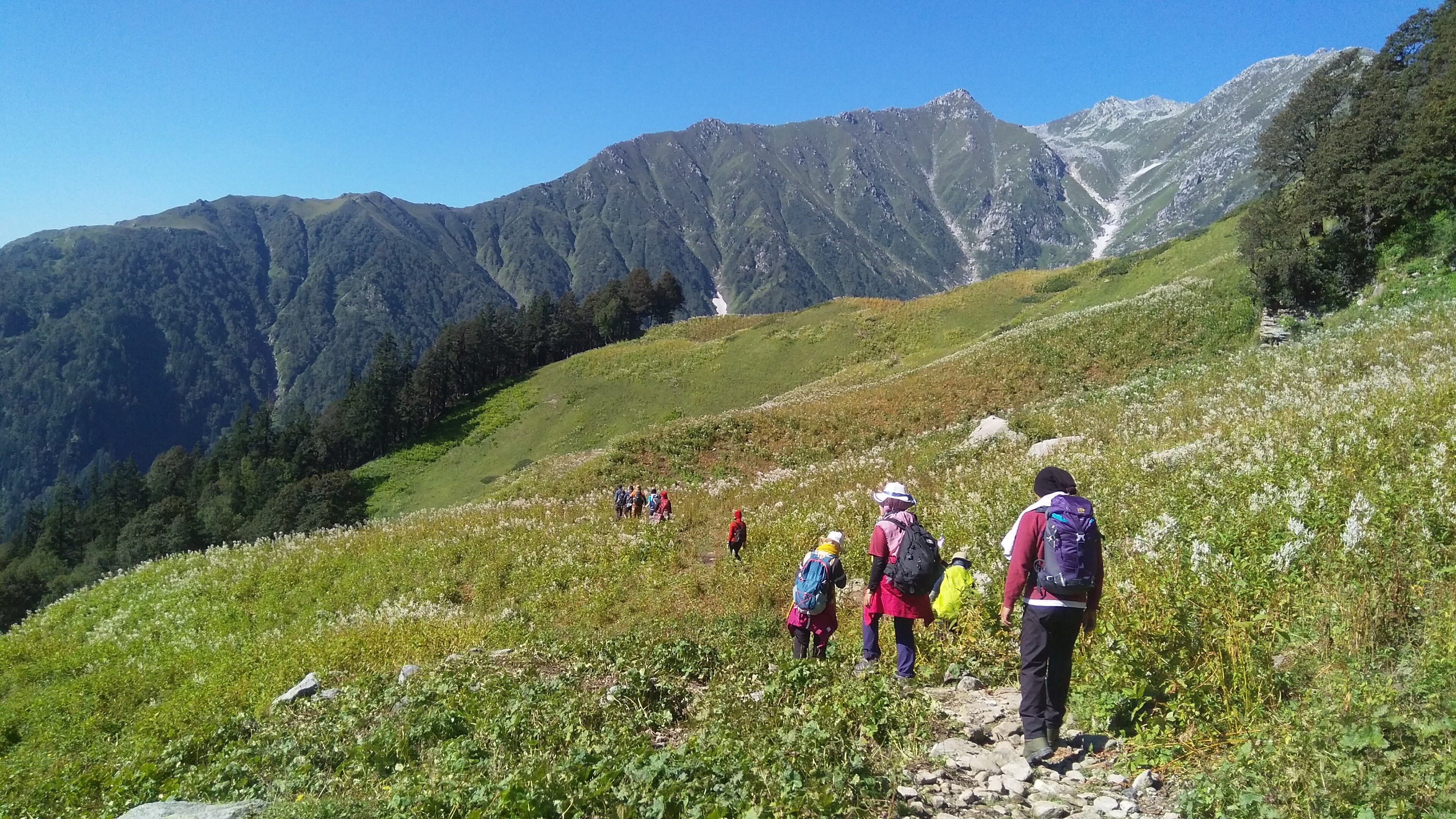
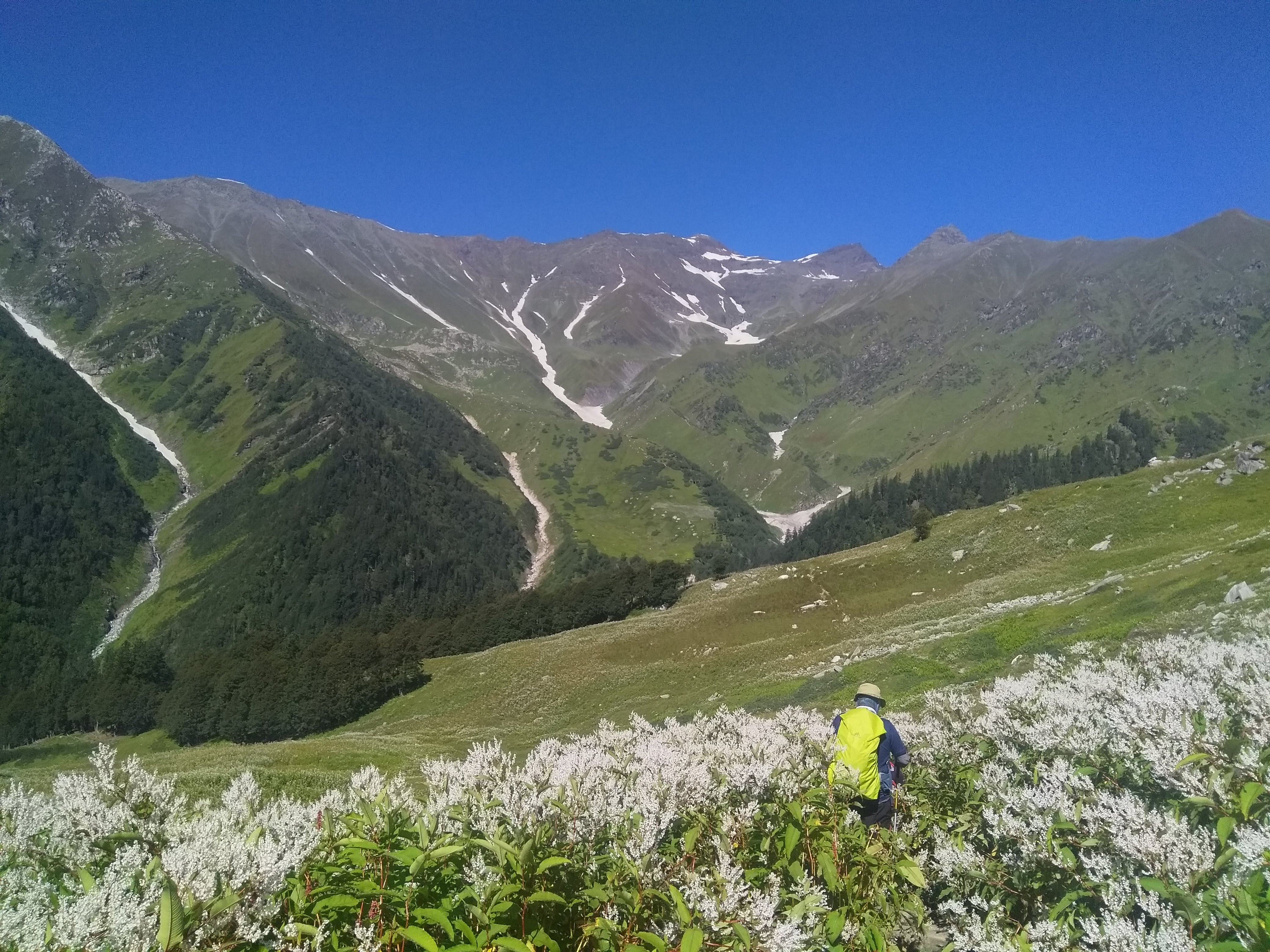
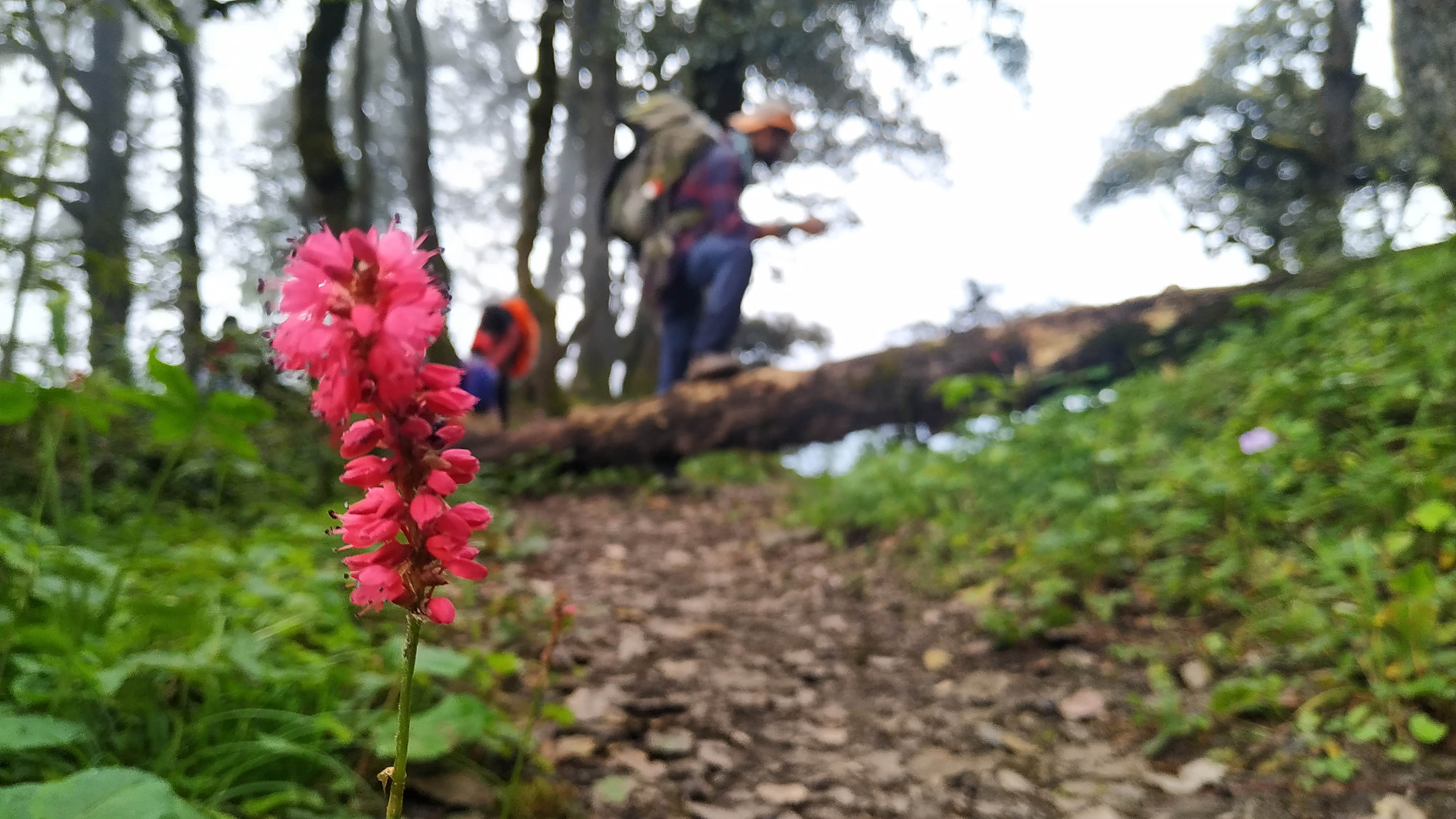
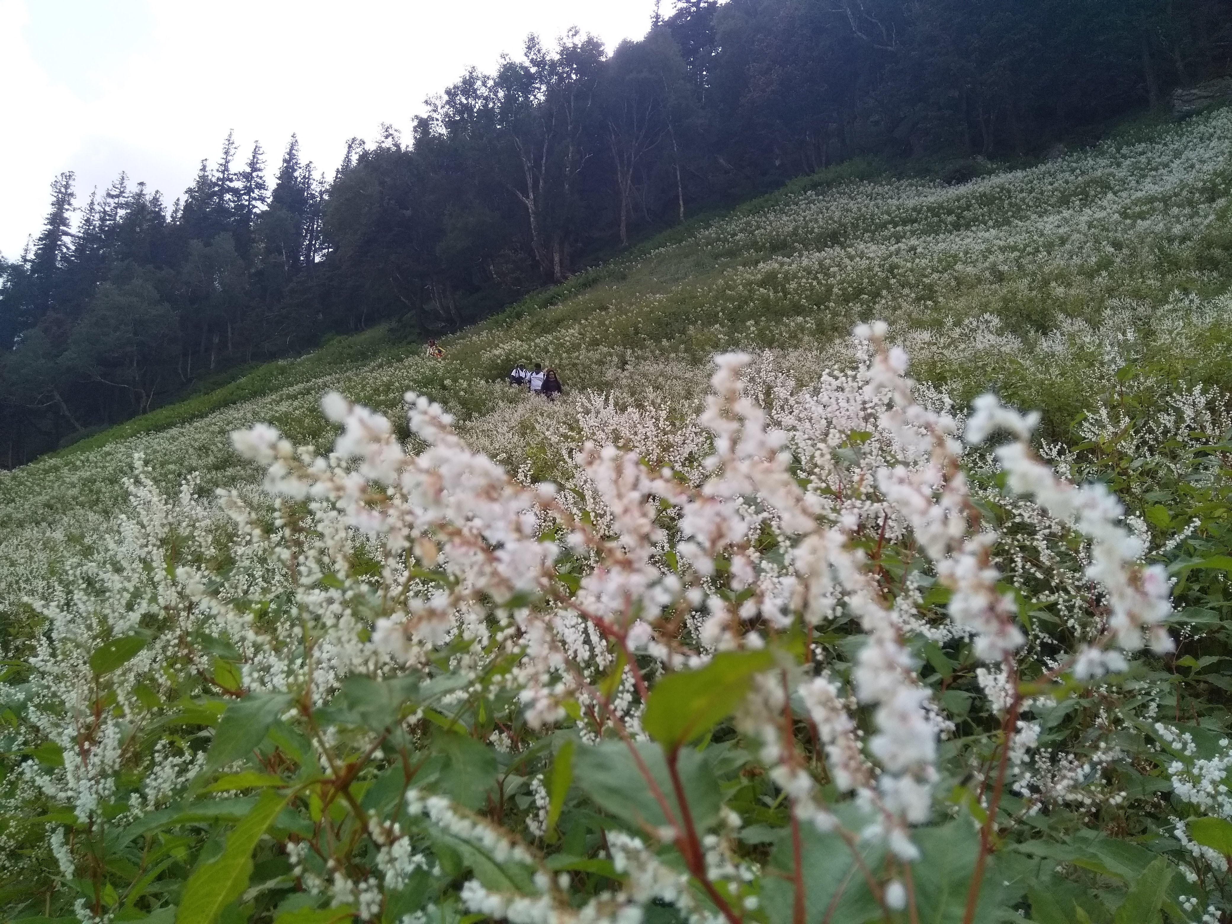
Riyali Thatch isn’t just a scenic meadow—it’s part of a larger alpine ecosystem that bursts into life during summer, with a wide variety of wildflowers that change color and pattern within weeks.
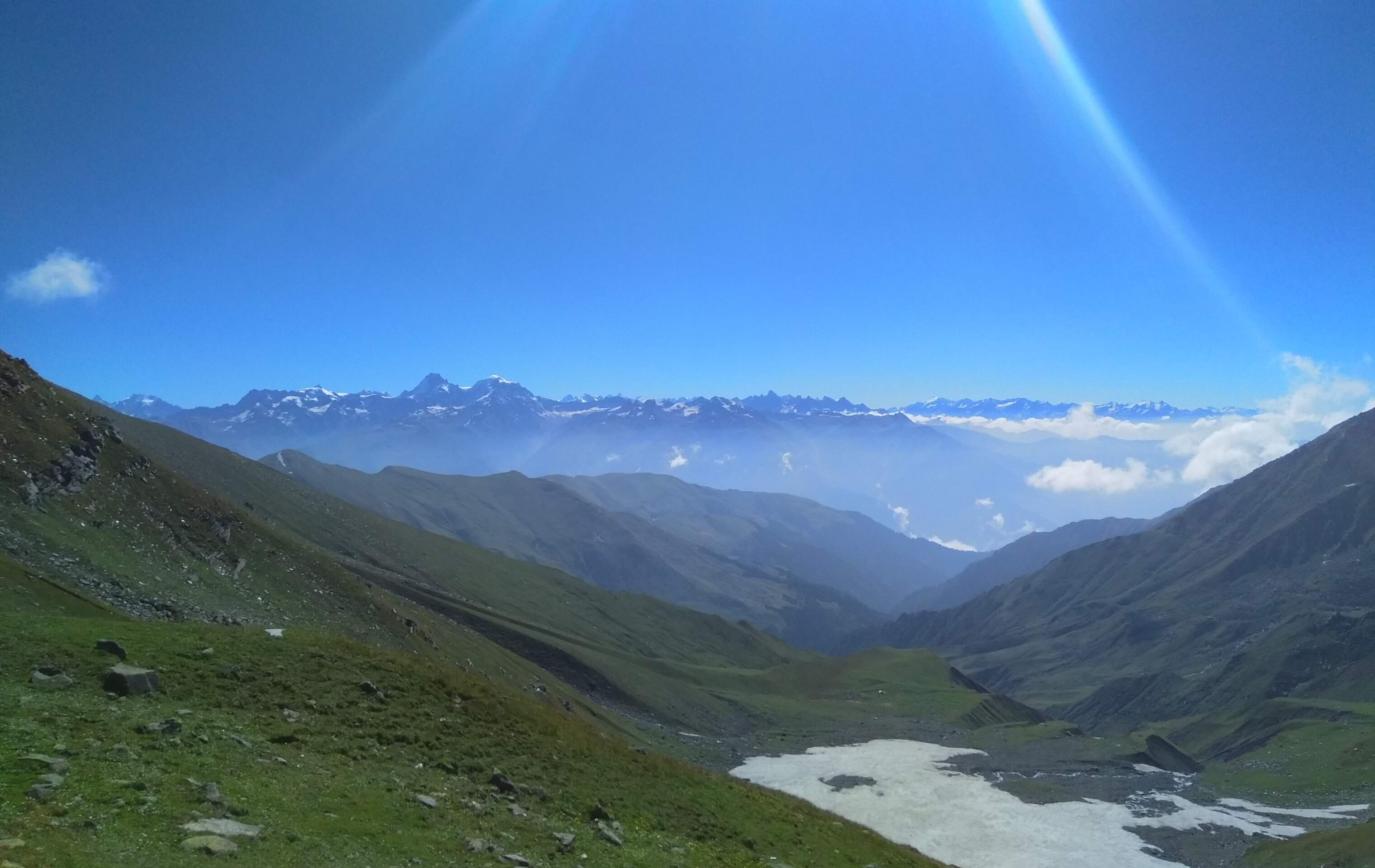
Shagor sits at a unique vantage point where you can simultaneously observe the transition between two major Himalayan systems—the Dhauladhar and the Pir Panjal—something rarely visible from a single campsite.
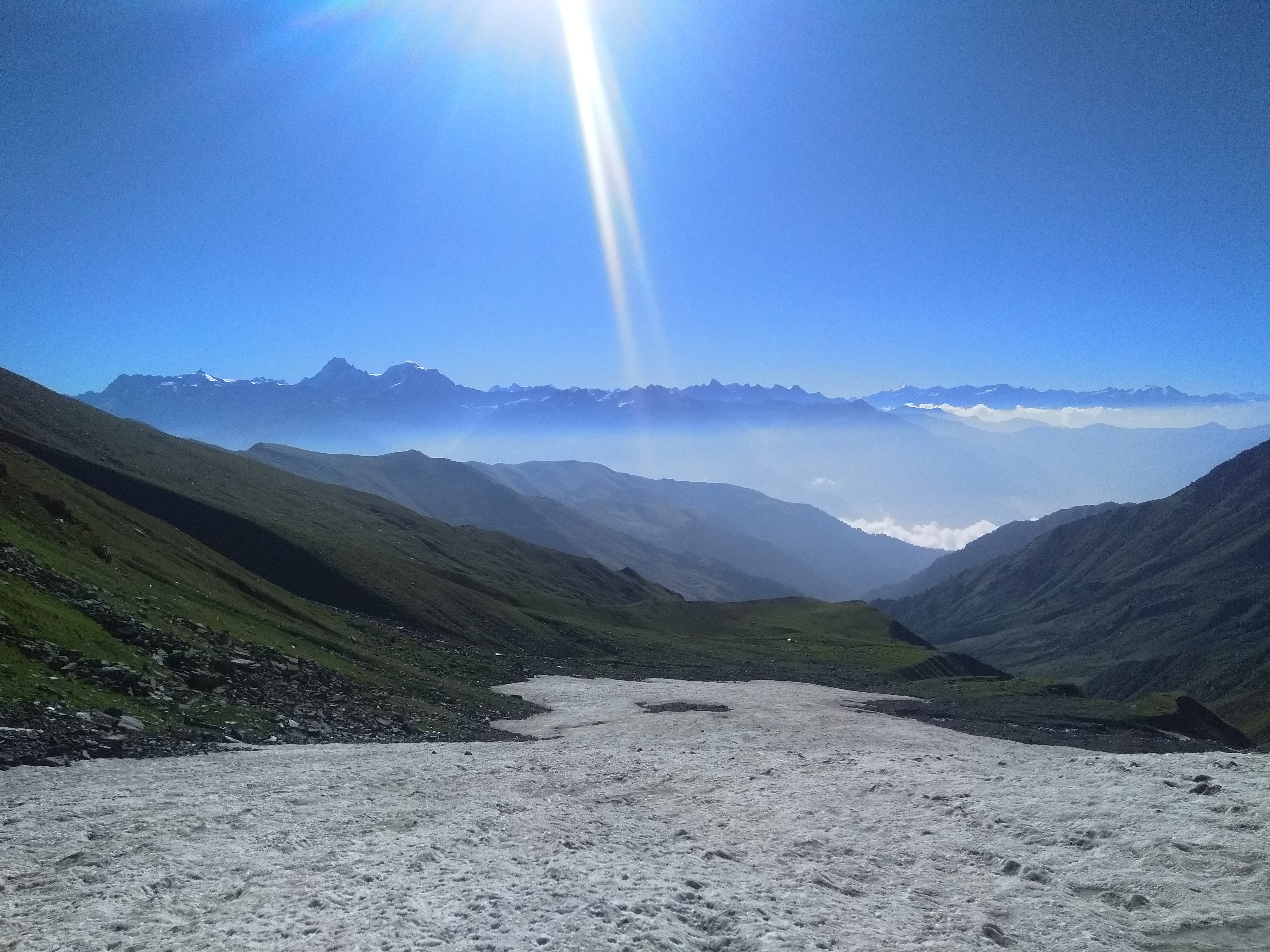
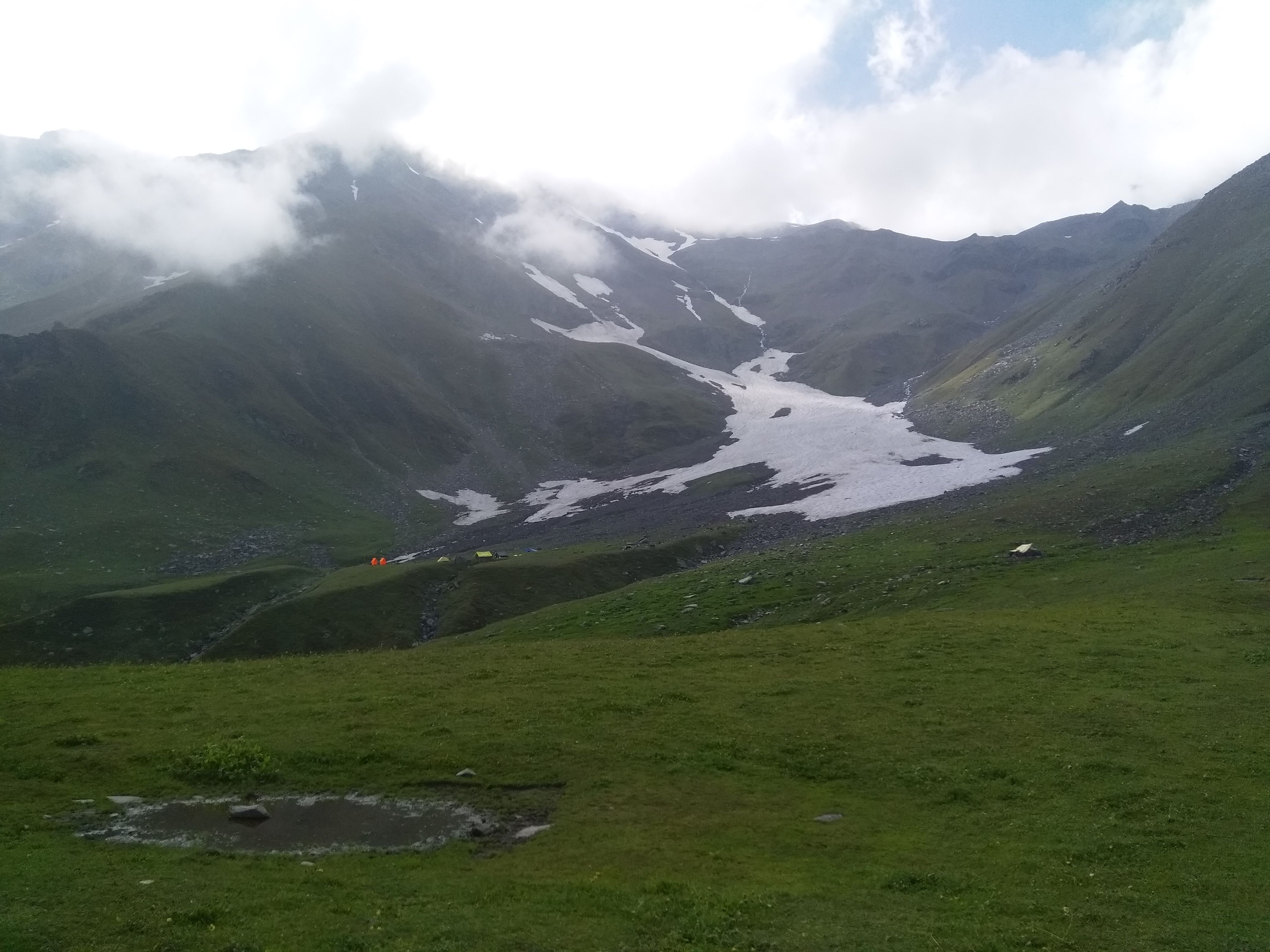
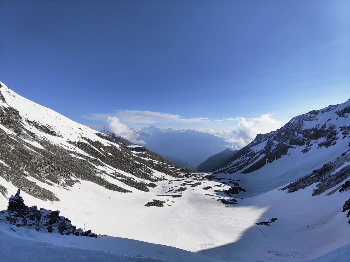
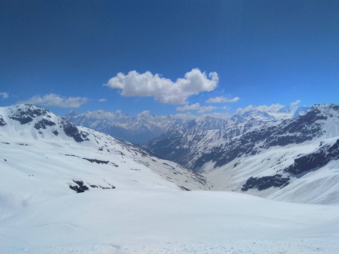
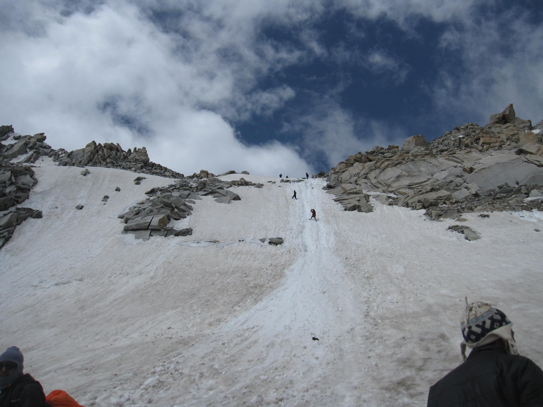
The approach to Kalihani Pass often involves crossing old snow bridges and glacial patches, depending on the season—remnants of winter that linger well into summer at higher altitudes.
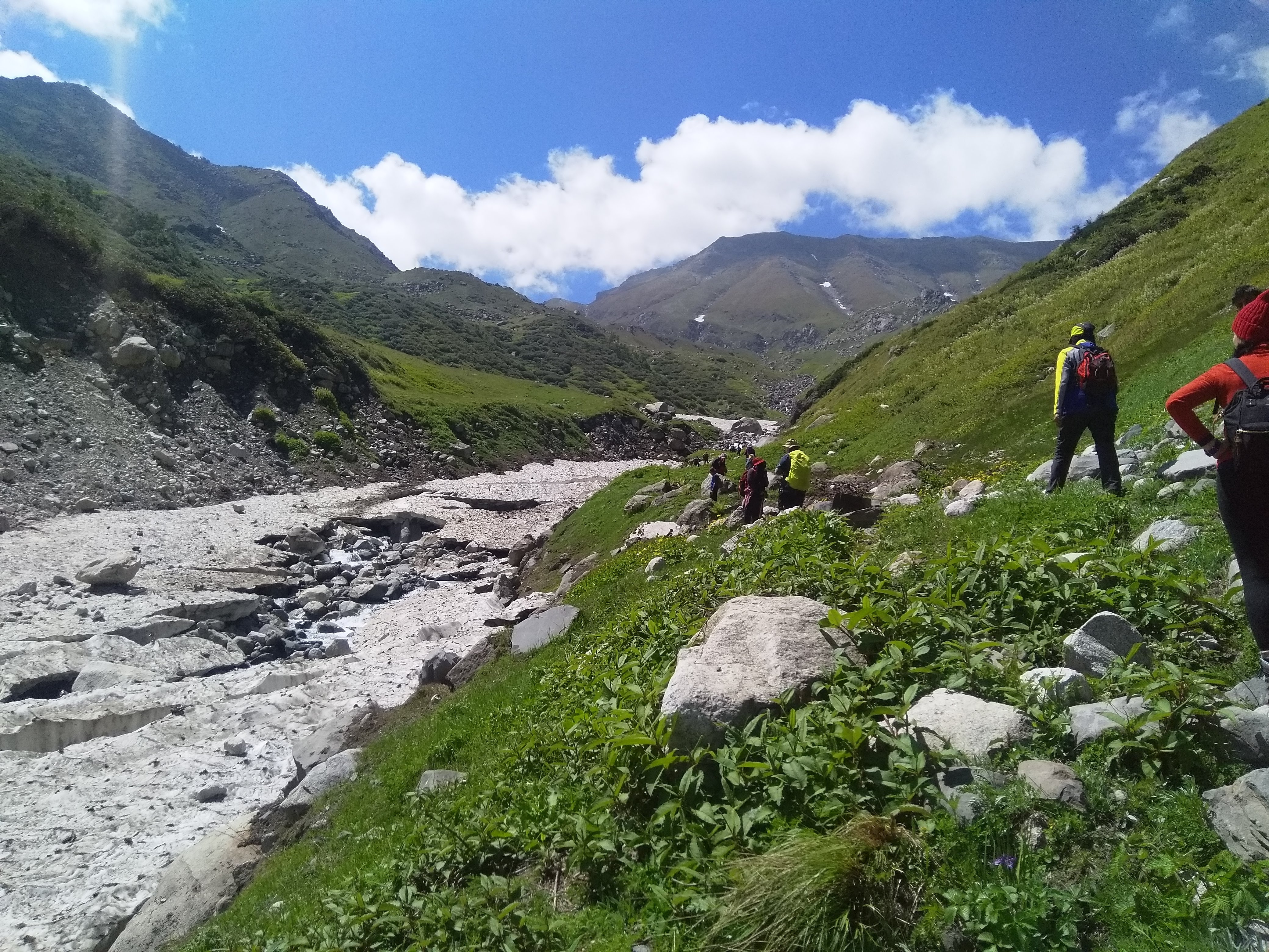
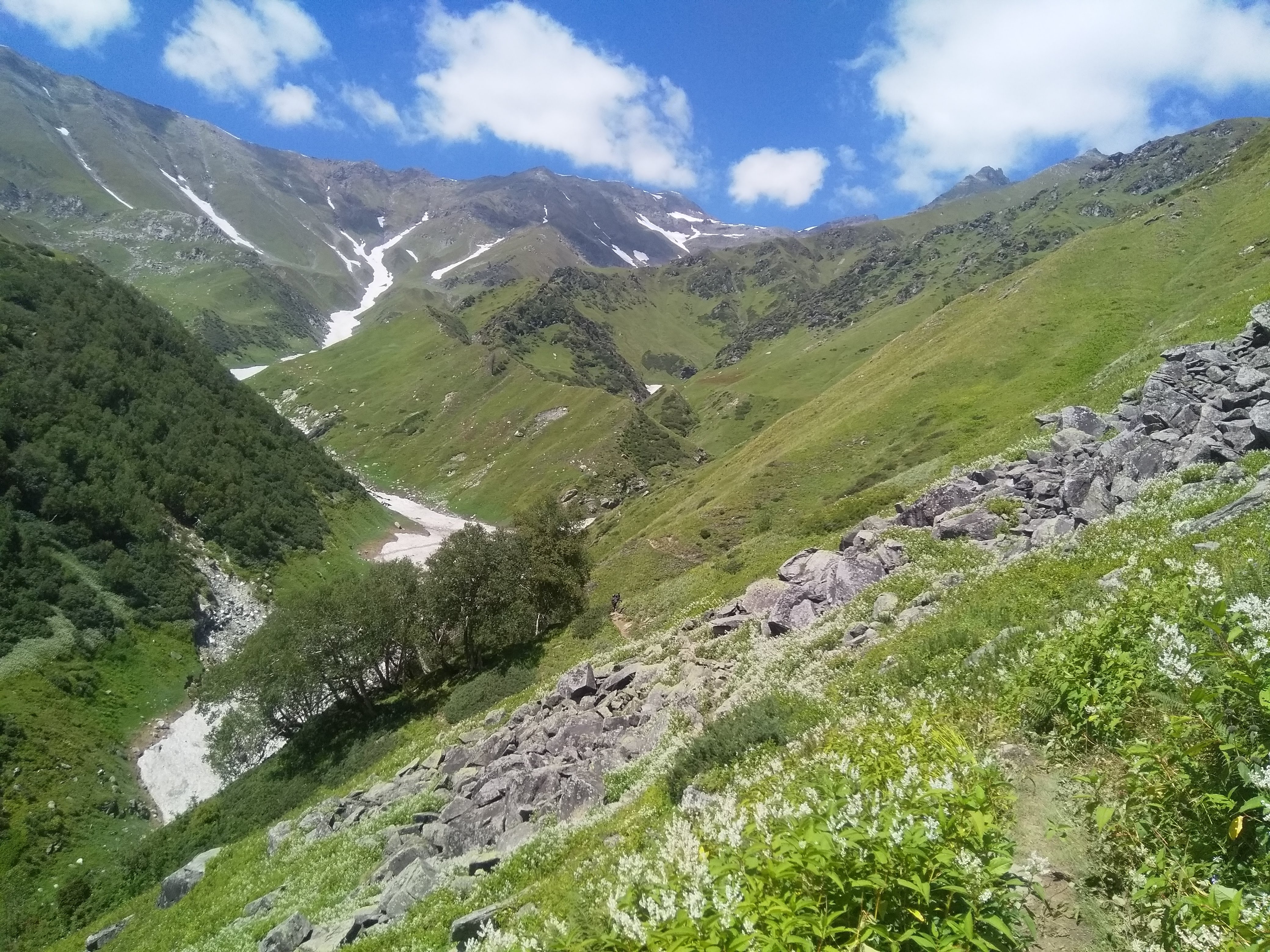
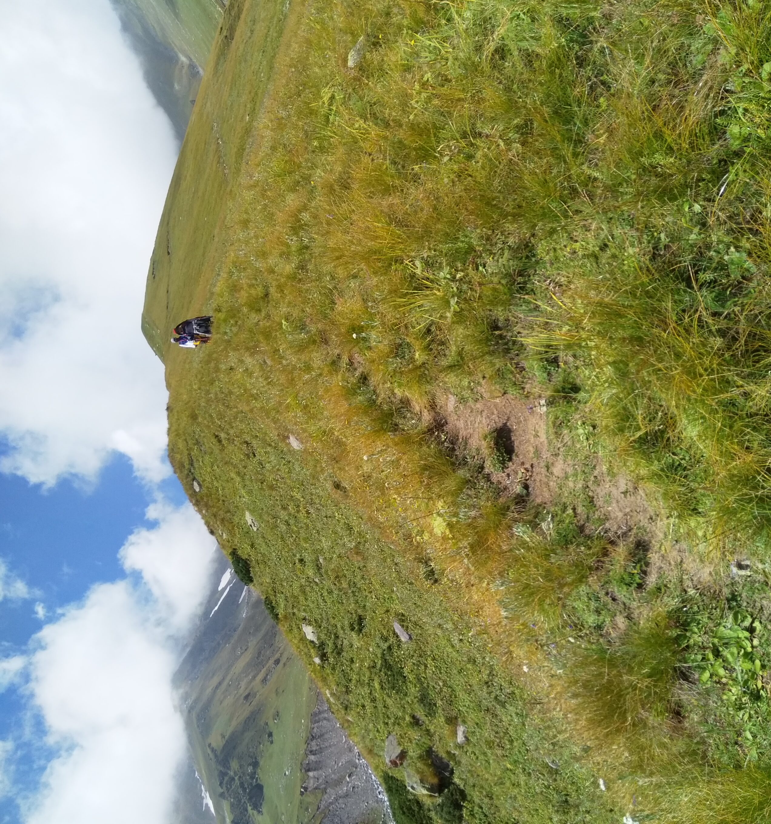
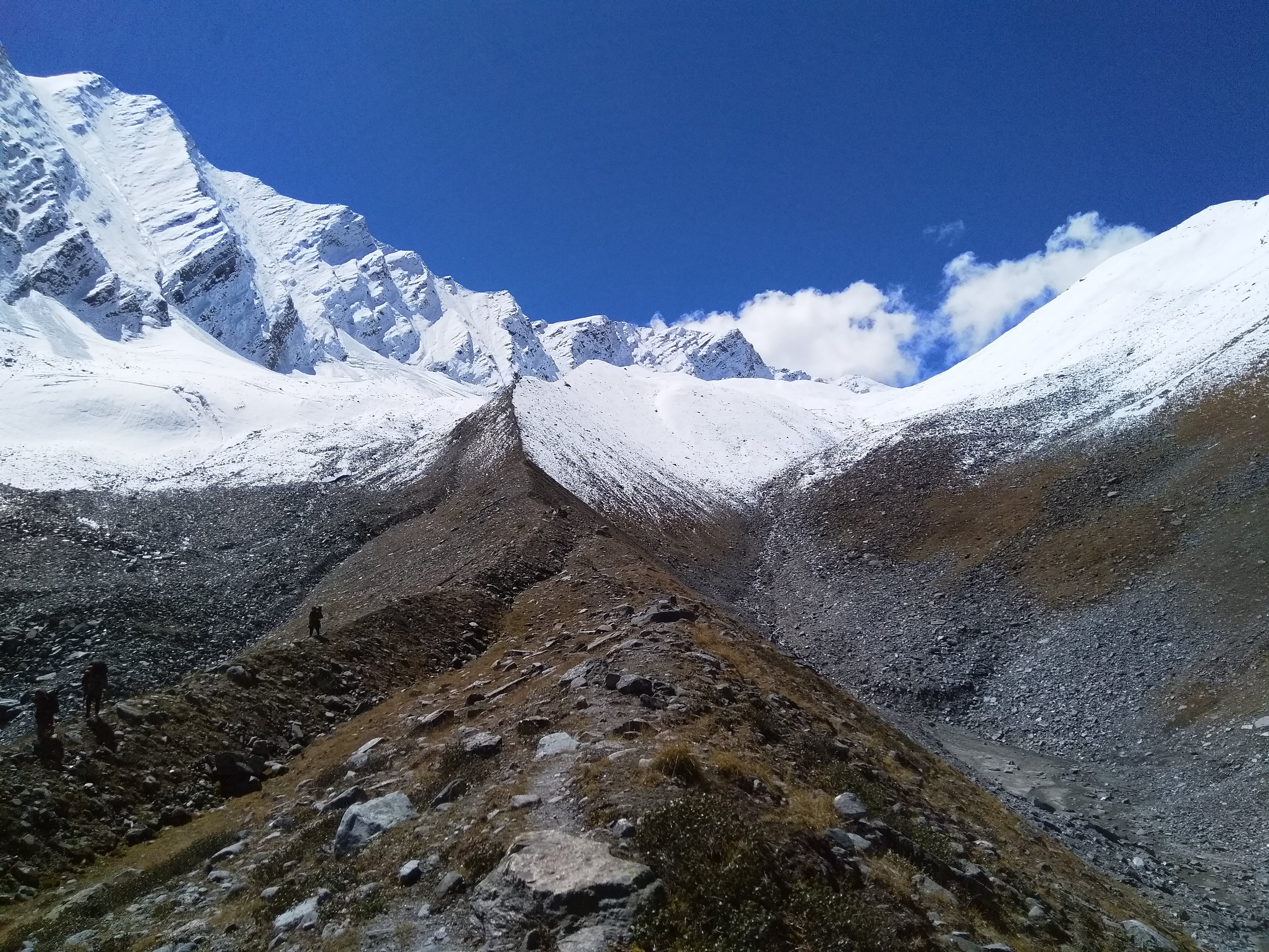
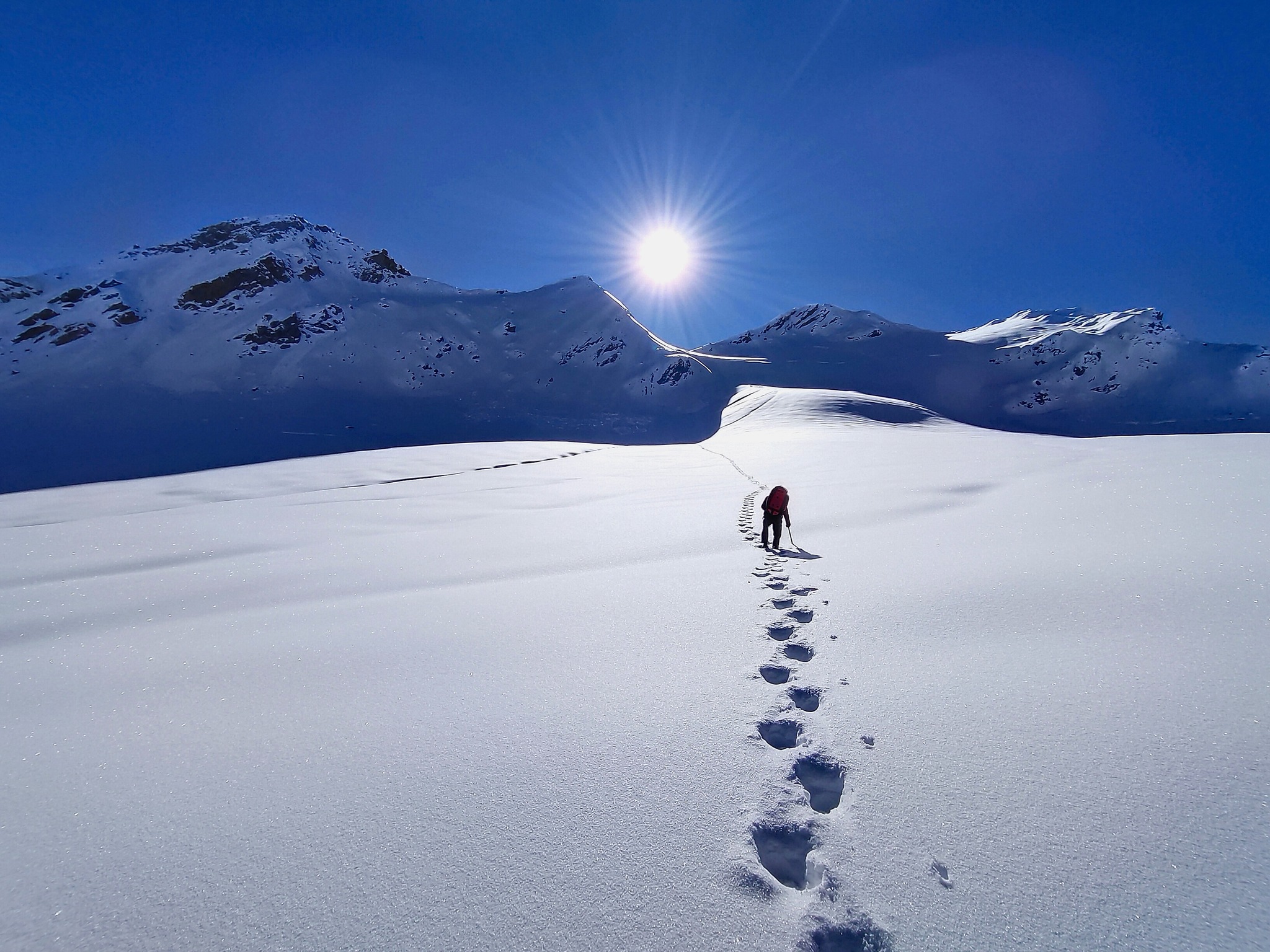
Unlike many popular treks, large sections of this route don’t have a clearly defined trail, especially in the upper regions—navigation often depends on terrain reading and local knowledge rather than marked paths.
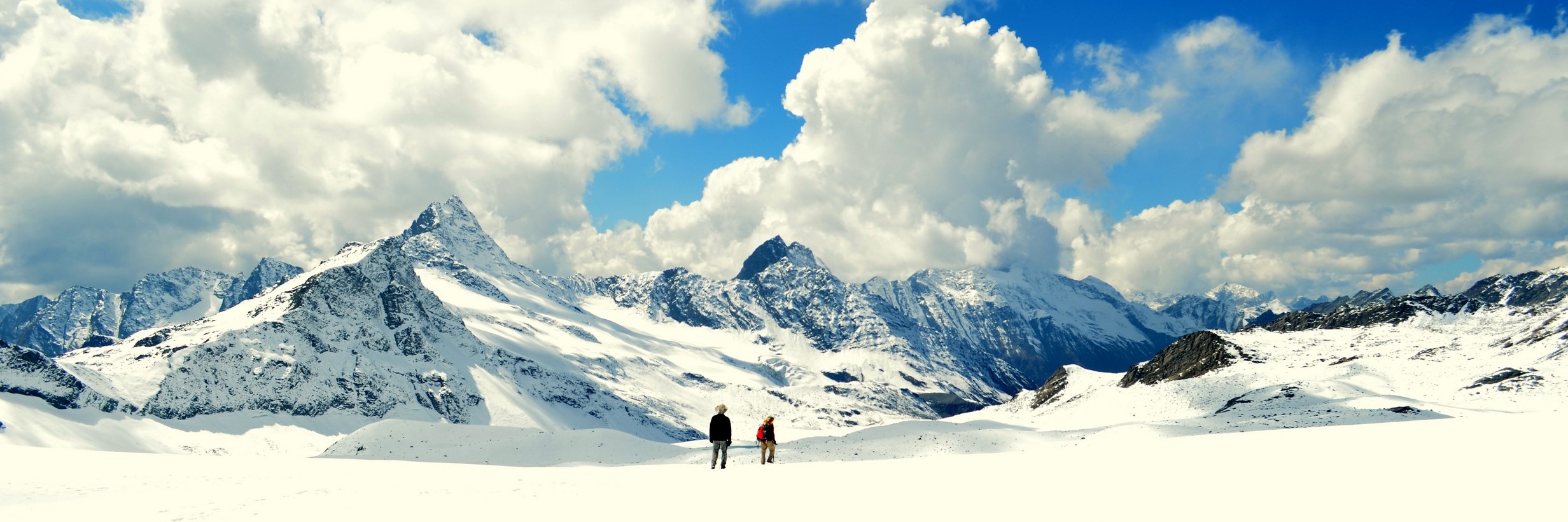
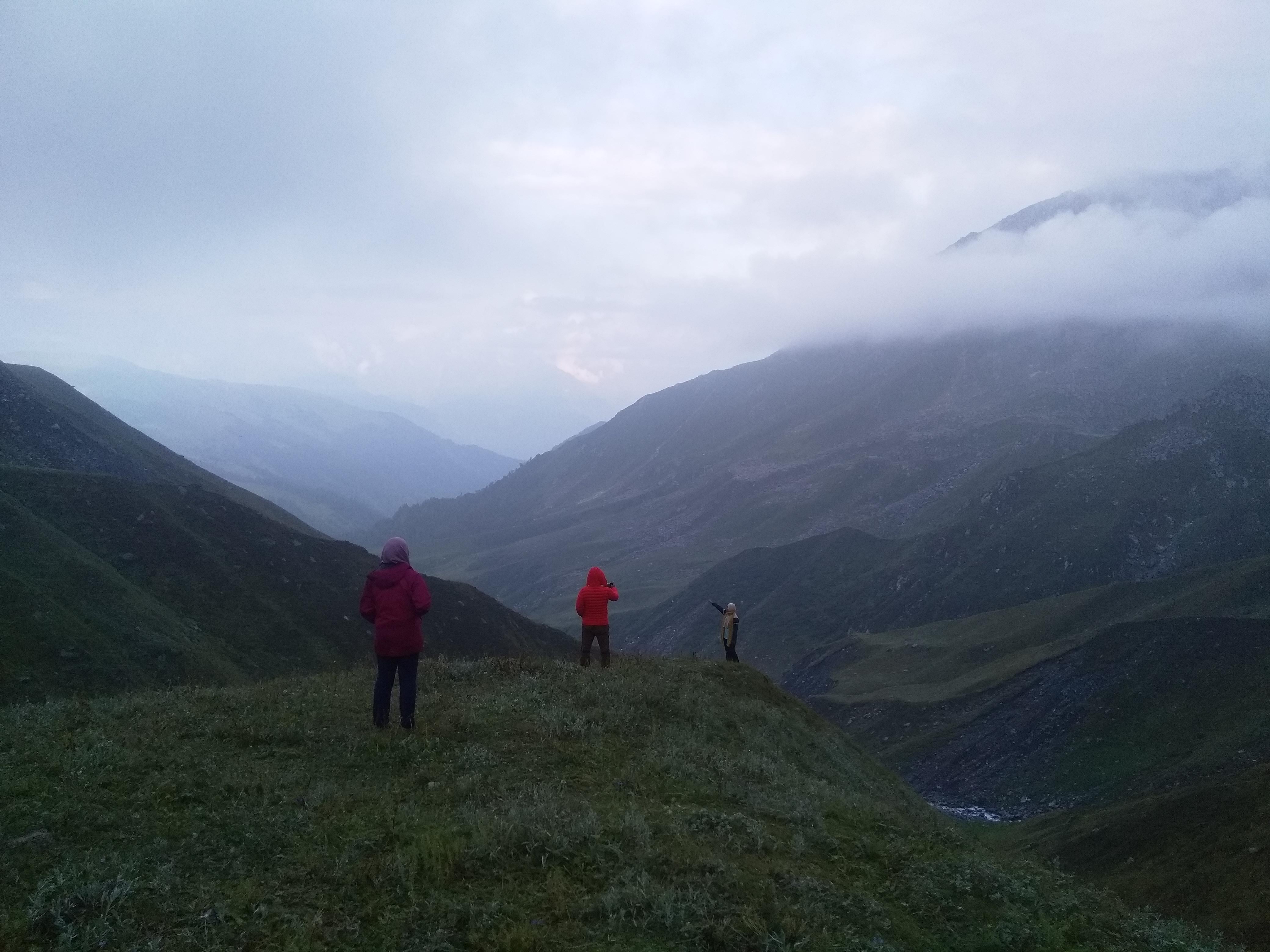
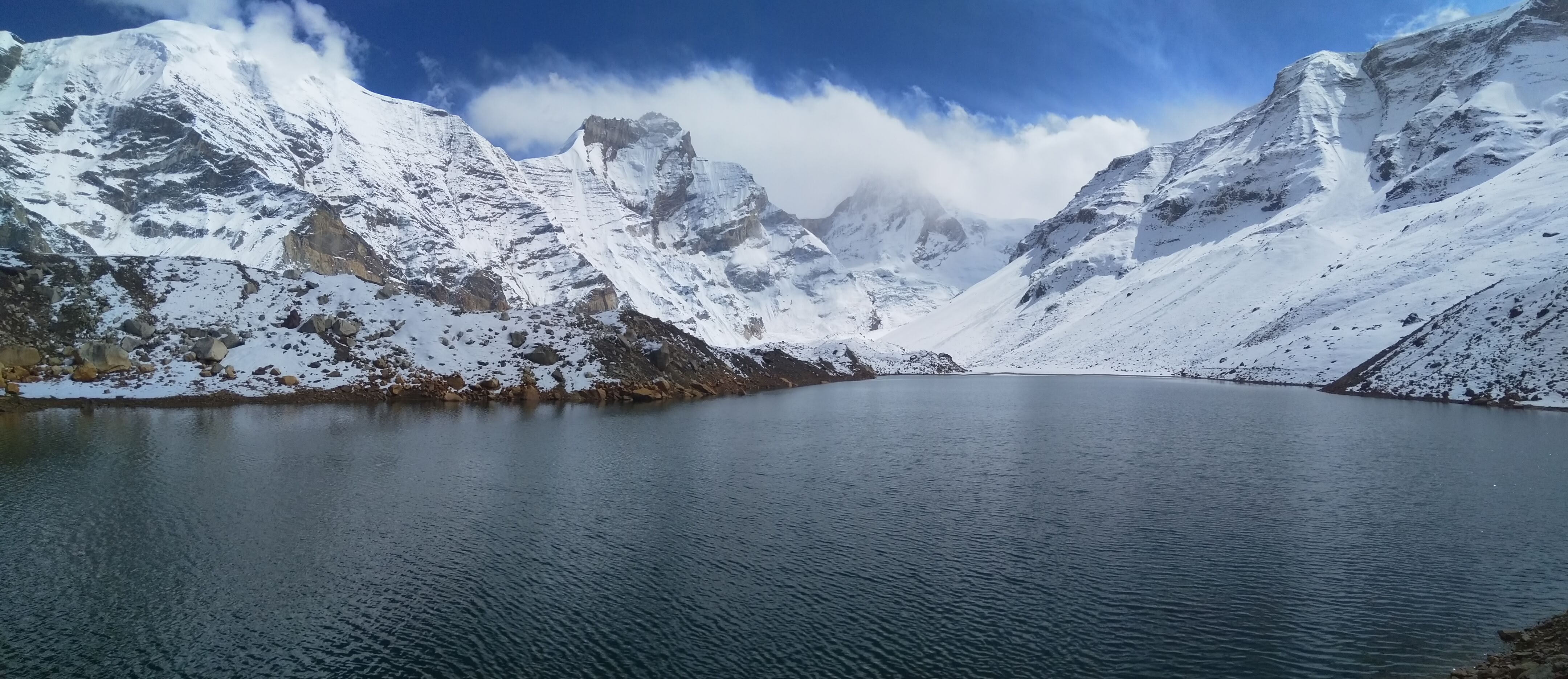
Weather near Kalihani Pass can change rapidly due to its exposure—clear skies can turn into whiteouts within hours, especially when clouds move in from the Bara Bhangal side.
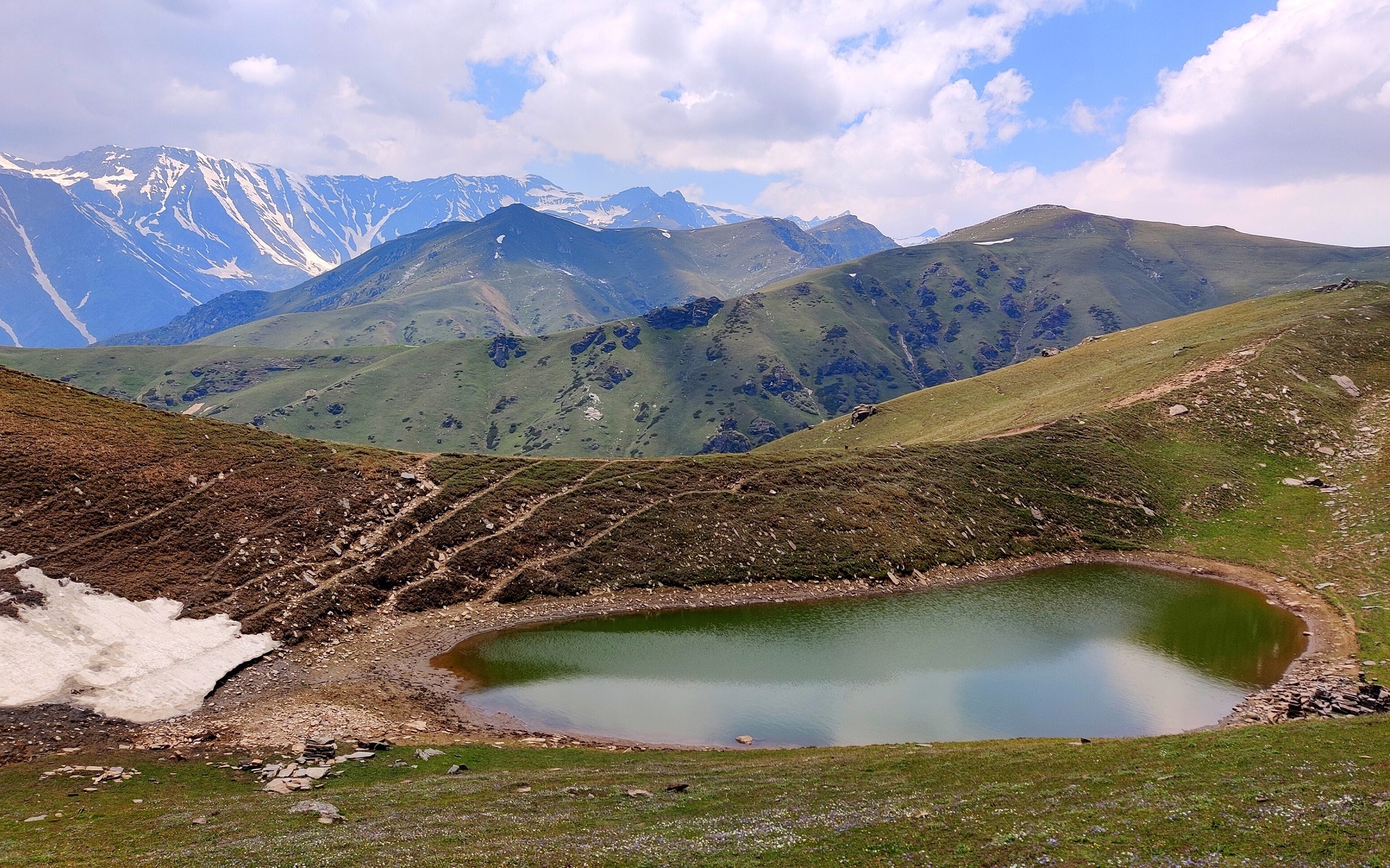
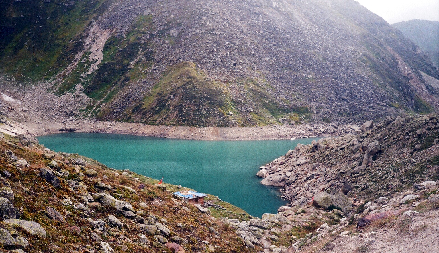
Rani Sui Lake is deeply tied to local folklore and is considered sacred, but unlike more popular lakes, it remains quiet and relatively untouched, even during peak trekking seasons.
Khanpari Tibba acts as a natural viewpoint over the Manali valley, but historically, it was also used as a lookout point by locals moving across ridgelines to assess weather and terrain conditions ahead.
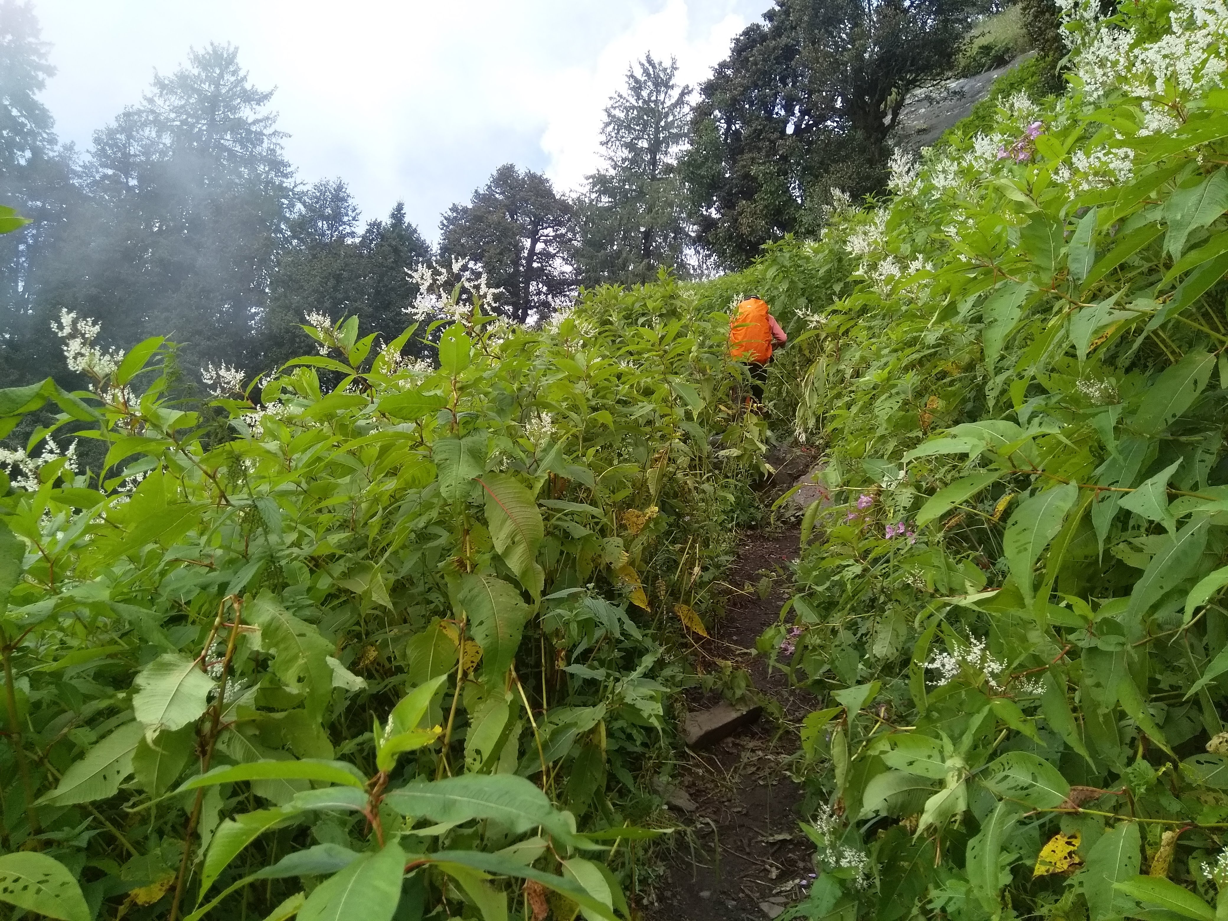
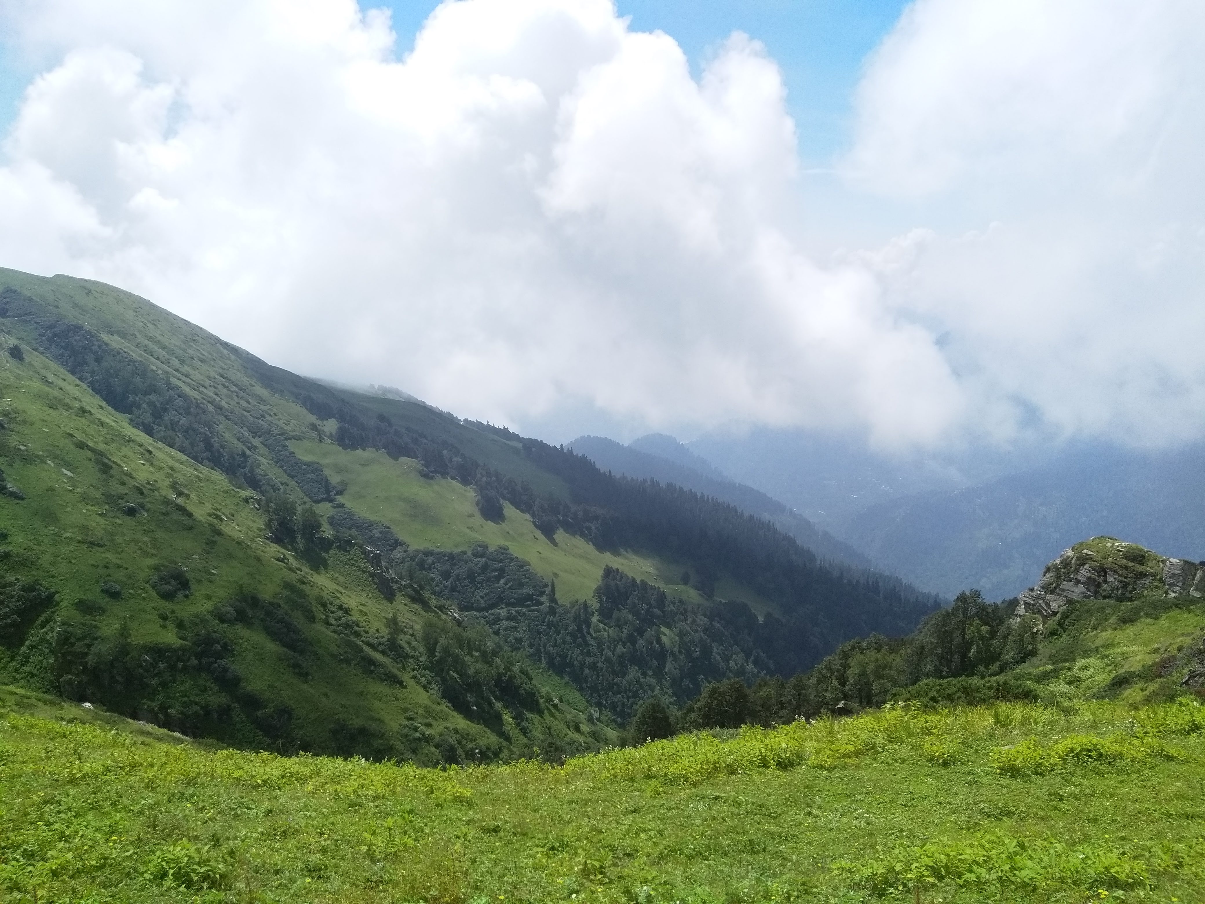
The descent from high-altitude terrain back into forests around Lamadugh often feels more dramatic than expected—not because of difficulty, but because of how suddenly the landscape changes after days in open meadows.
Wildlife signs are often more common than sightings—especially in the lower forest sections, where Himalayan species move quietly, leaving behind tracks and subtle traces along the trail.
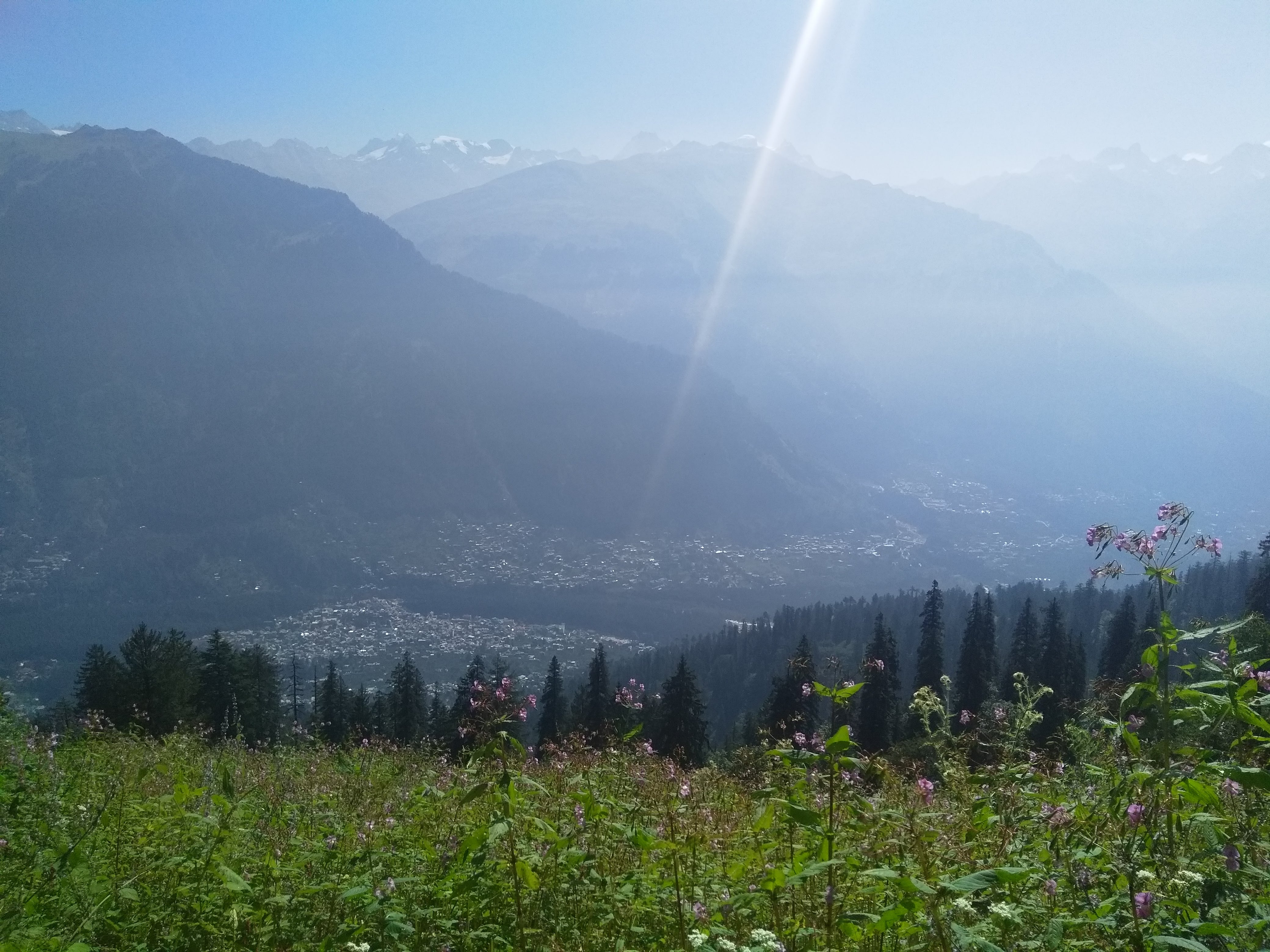
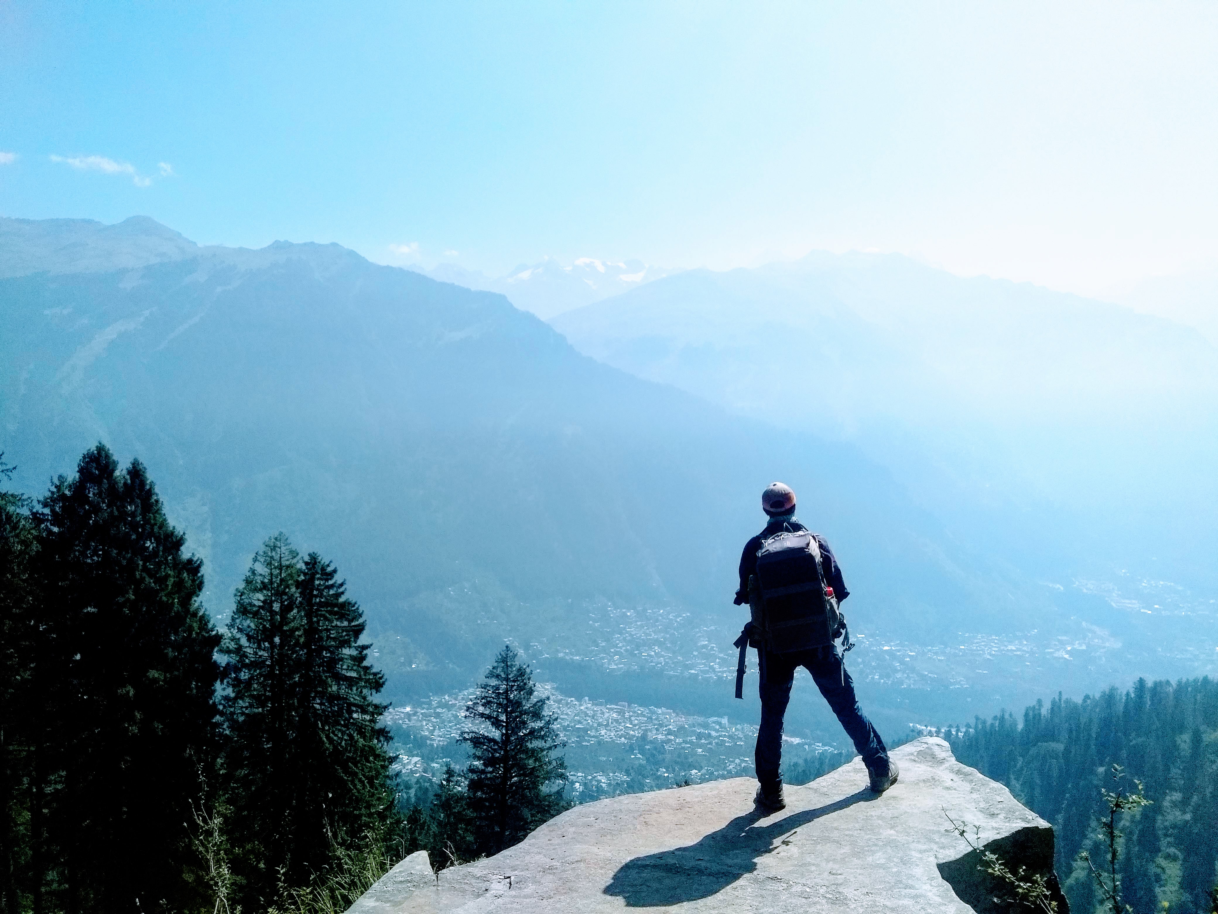
Despite being close to Manali in terms of starting point, the trek quickly loses any sense of proximity—by the time you reach Shagor, the landscape feels far more remote than its map location suggests.
The Kalihani route is often underestimated—not for its technical difficulty, but for the way it builds gradually, demanding consistency over multiple days rather than a single challenging push.
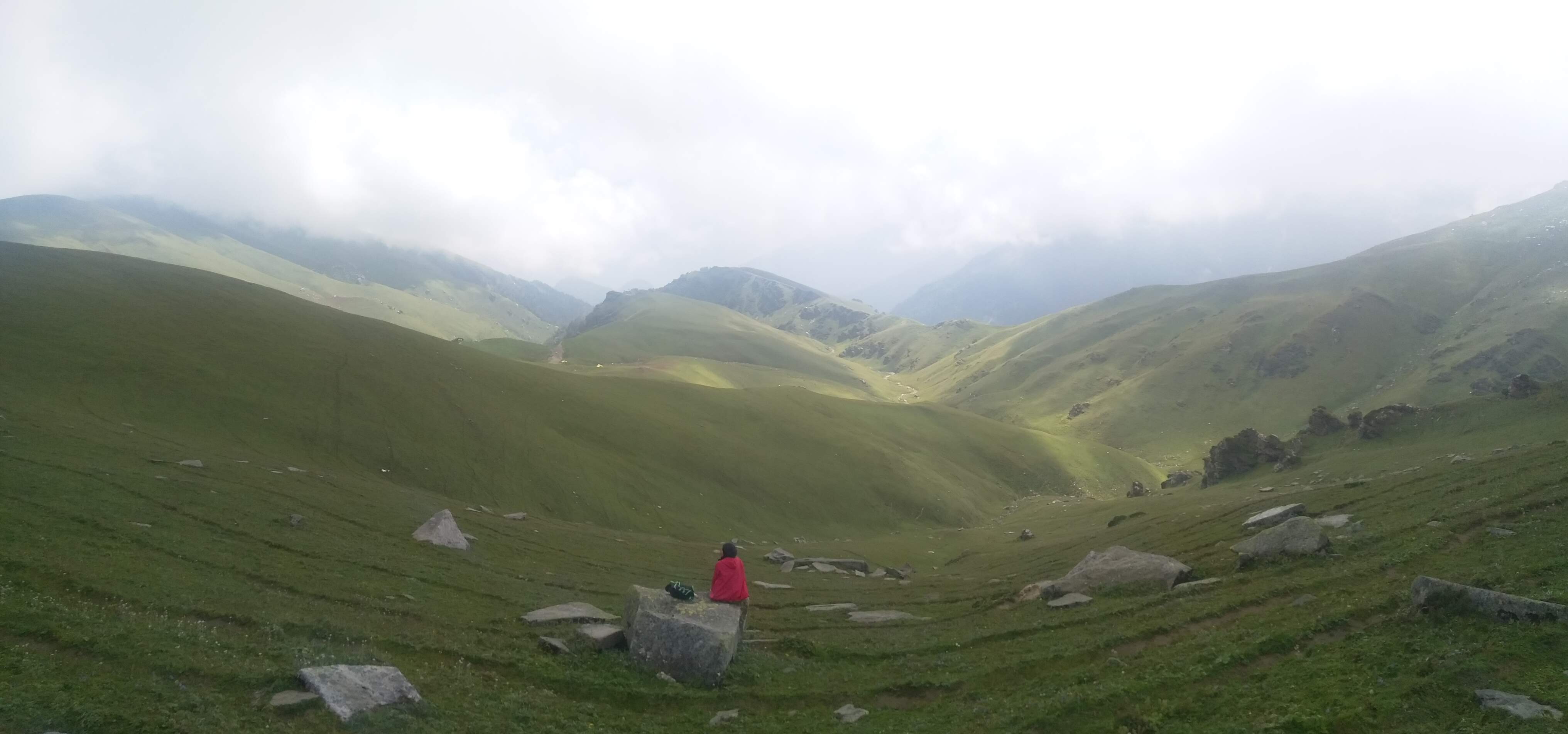
What most trekkers remember isn’t just the pass, but the progression—the slow shift from enclosed forest trails to open meadows, and finally into a stark, high-altitude environment that feels almost untouched.

Route Map

How to reach

✈️ Air: Nearest airport: Bhuntar Airport (Kullu) – 50 km from Manali. Take a cab or bus to reach Manali.

🚆 Train: Nearest major railway station: Chandigarh Railway Station. From Chandigarh, take a Volvo bus or private cab to Manali (~8–10 hrs).

🛣️ Road: From Delhi: Overnight Volvo buses (12–14 hrs) regularly ply to Manali. From Chandigarh: 8–10 hrs by cab or bus. Manali is well-connected and has frequent bus services.

🗺️ Travel Tip: Arrive in Manali a day before the trek for acclimatization and avoid delays.

TrekFAQs

  • This trek is best suited for trekkers with good fitness and preferably some prior trekking experience. While it is not technical, the long duration (7–8 days), continuous altitude gain, and high camps make it more demanding than beginner treks.
  • It is not ideal for complete beginners or families with young kids. The trek involves multiple long walking days, remote camps, and high-altitude exposure above 15,000 ft. Fit beginners with strong preparation may attempt it, but it is better suited for those who have done at least one trek before.
  • It is a moderate to difficult trek. The challenge comes from its length, back-to-back trekking days, and high-altitude summit push toward Kalihani Pass. The terrain itself is varied but mostly non-technical, requiring endurance more than technical skills.
  • No, this itinerary goes up to Kalihani Pass (~15,800 ft) and returns from there. The pass itself leads toward the remote Bara Bhangal region, which requires a separate, longer, and more committing expedition.
  • This trek stands out for its diversity — dense forests, vast meadows, high-altitude camps like Riyali and Shagor, and a summit approach that feels raw and untouched. The views of both the Dhauladhar and Pir Panjal ranges, along with the connection toward the remote Bara Bhangal valley, give it a unique offbeat character.
  • Yes, AMS is a real concern as the trek goes above 15,000 ft. The itinerary is designed for gradual acclimatization, but staying hydrated, maintaining a steady pace, and reporting symptoms early are crucial for a safe experience.
  • You should be able to walk 6–8 hours a day for multiple consecutive days. A preparation routine of 4–6 weeks including cardio (running, brisk walking), leg strength, and endurance training is strongly recommended.
  • The trek moves through dense pine and oak forests, wide alpine meadows, ridge walks, and high-altitude rocky terrain near the pass. Each day brings a noticeable shift in landscape, which is one of the defining features of this trek.
  • The best months are June to September. Early summer brings lingering snow near the pass, while late season offers clearer views and more stable weather. Monsoon can bring lush meadows but also occasional rain.
  • Network is available in Manali and partially in the lower villages like Rumsu. Beyond that, there is no reliable connectivity throughout the trek, especially from Chaklani onwards.
  • Accommodation is in tents at all campsites such as Chaklani, Riyali Thatch, Shagor, and Rani Sui. These are remote alpine camps with basic but well-managed trekking facilities.
  • Yes, permits are required as the route passes through forest and high-altitude grazing regions. These are arranged as part of the trek logistics.
  • Maintain a steady pace, stay hydrated, layer properly for changing weather, and follow the trek leader’s instructions at all times. Avoid rushing on ascent days, especially toward higher camps and the pass.
  • Days are usually pleasant, but weather can change quickly at higher altitudes. Evenings and nights can get cold, especially at camps like Shagor. Sudden cloud build-up, wind, and occasional rain are common.
  • While the trek starts close to Manali, it quickly moves into less-traveled regions. By the time you reach Riyali and Shagor, the landscape feels remote and untouched, with very limited human presence.
  • Kalihani Pass offers a complete Himalayan journey — forests, meadows, high-altitude camps, and a powerful summit approach. It’s less about reaching a point and more about experiencing the gradual transition into a raw, offbeat mountain landscape that stays with you long after the trek ends.

Similar Treks

View of Buran Ghati Trek trek moderate, difficult

Buran Ghati Trek

6 Nights / 7 Days
himachal pradesh
View of Hampta Pass Trek trek moderate

Hampta Pass Trek

4 Nights / 5 Days
himachal pradesh
View of Rupin Pass Trek trek difficult

Rupin Pass Trek

6 Nights / 7 Days
himachal pradesh
View of Gaumukh Tapovan Trek trek moderate, difficult

Gaumukh Tapovan Trek

6 Nights / 6 Days
uttarakhand-garhwal
View of Kedartal Trek trek moderate, difficult

Kedartal Trek

6 Nights / 6 Days
uttarakhand-garhwal
View of Satopanth Lake Trek trek moderate

Satopanth Lake Trek

5 Nights / 5 Days
uttarakhand-garhwal
View of Bali Pass Trek trek difficult

Bali Pass Trek

7 Nights / 8 Days
uttarakhand-garhwal
View of Borasu Pass Trek trek difficult

Borasu Pass Trek

8 Nights / 8 Days + 1 Buffer Day
uttarakhand-garhwalhimachal pradesh

How Our Treks Are More Than Just a Trek

Every journey with us is carefully crafted for a deeply personal mountain experience.

Not Just a Trek — A Journey That Stays With You

Every trail we walk is a carefully chosen path into the heart of the Himalayas — not just to witness their grandeur, but to feel them under your skin and soul. Our treks are designed not as bucket list checkmarks, but as life-affirming journeys. At Planethimalayas, we believe a mountain journey is deeply personal — and that belief runs through everything we do.

Individual Care, Every Step of the Way

We keep our groups small and intimate so we can focus on you — your pace, your concerns, your joy. From pre-trek guidance to trail-side support, our leaders walk with intention, offering safety and attention without intrusion. It’s this deep care that turns strangers into friends and walks into memories.

Built on Genuine Love for the Himalayas

We don’t just operate in the Himalayas — we live and breathe them. From respecting mountain communities to following Leave No Trace ethics, our treks are shaped by humility and care. With Planethimalayas, your trek becomes a way of giving back to the mountains that give us so much.

Why Choose Us

Experience the difference of trekking with genuine mountain experts who truly care.

Trek Leader & Guide

Led by certified mountaineers with wilderness first aid training, ensuring your safety and confidence at every step.

Cook & Support Staff

Our mountain crew comprises local experts who bring unmatched experience, warmth, and deep knowledge of the region.

Small Group Size

We cap our group departures at just 8 trekkers — ensuring individual attention, deeper connections, and better trail discipline.

Safety Standards

From personal well-being to technical preparedness, we maintain the highest safety standards — using certified high-altitude gear and comprehensive safety protocols to ensure a secure and reliable Himalayan experience.

24×7 Online Support

We're always available — before, during, or after your trek. Reach out anytime, and you'll always hear back from a real human.

We Care for the Mountains

We strictly follow Leave No Trace ethics. Limited group sizes and mindful practices help protect the fragile Himalayan ecosystem.